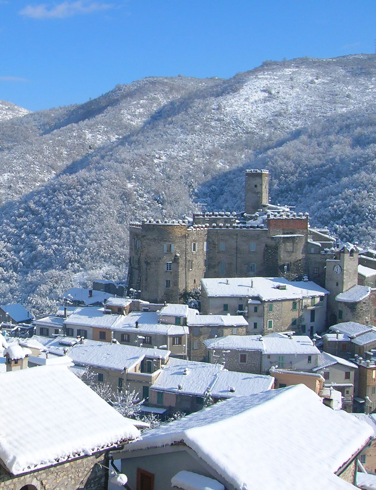
Riofreddo (Riofreddo)
.svg)
- Italian comune
 Hiking in Riofreddo
Riofreddo is a picturesque village located in the province of Rome, Italy, surrounded by the stunning landscapes of the Apennine Mountains. It's a great destination for hiking enthusiasts, offering various trails that cater to different skill levels. Here are some highlights for hiking in the Riofreddo area:
Trails and Terrain
- Variety of Trails: The region boasts a mix of easy walks and more challenging hikes suitable for experienced hikers. You can find routes that take you through lush forests, rocky paths, and scenic overlooks.
- Natural Beauty: The lush landscapes feature a mix of oak and beech forests, meadows, and stunning views of the surrounding mountains. Wildlife sightings are common, including various bird species and local fauna.
Popular Hiking Areas
- Monte Scalambra: Nearby Monte Scalambra offers a rewarding hike with panoramic views from the summit. It's well-marked and provides a fairly straightforward path.
- The Aniene Valley: Hikes along the Aniene River showcase the beauty of the valley, with options to explore different paths along the riverbanks.
Recommendations
- Best Time to Hike: The best time for hiking in Riofreddo is during the spring (April to June) and fall (September to October) when temperatures are mild, and the scenery is vibrant.
- Preparation: Ensure you wear appropriate footwear, carry enough water, and pack snacks. It’s also advisable to have a map or GPS device, as some trails can be less marked.
- Local Resources: Check in with local hiking clubs or tourist information centers for guided hikes or more detailed maps of the area.
Cultural Aspects
- Historic Sites: Incorporate some cultural exploration into your hiking plans by visiting some of the ancient churches and ruins in and around Riofreddo.
- Local Cuisine: After a day of hiking, enjoy traditional Italian cuisine at local restaurants, which will help you recharge for your next adventure.
Overall, hiking in Riofreddo offers a blend of natural beauty, outdoor adventure, and cultural discovery, making it a great spot for both novice and experienced hikers alike.
- Country:

- Postal Code: 00020
- Local Dialing Code: 0774
- Licence Plate Code: ROMA
- Coordinates: 42° 3' 32" N, 12° 59' 48" E


- GPS tracks (wikiloc): [Link]
- AboveSeaLevel: 705 м m
- Area: 12.38 sq km
- Population: 749
- Web site: http://www.comunediriofreddo.it
- Wikipedia en: wiki(en)
- Wikipedia: wiki(it)
- Wikidata storage: Wikidata: Q243199
- Wikipedia Commons Category: [Link]
- Freebase ID: [/m/0gm81x]
- GeoNames ID: Alt: [6541132]
- VIAF ID: Alt: [72144814257607715981]
- OSM relation ID: [41743]
- ISTAT ID: 058083
- Italian cadastre code: H300
Shares border with regions:

Cineto Romano
- Italian comune
Hiking in Cineto Romano
Cineto Romano is a charming village located in the Lazio region of Italy, not far from Rome. Nestled in the Sabine Hills, it's an excellent destination for hiking enthusiasts, offering a blend of natural beauty, historical sites, and cultural experiences....
- Country:
- Postal Code: 00020
- Local Dialing Code: 0774
- Licence Plate Code: RM
- Coordinates: 42° 3' 1" N, 12° 57' 54" E
- GPS tracks (wikiloc): [Link]
- AboveSeaLevel: 519 м m
- Area: 10.37 sq km
- Population: 586
- Web site: [Link]


Arsoli
- Italian comune
Hiking in Arsoli
Arsoli is a charming village located in the province of Rome, Italy, and is surrounded by beautiful natural landscapes that offer fantastic hiking opportunities. Nestled in the Simbruini Mountains, the area is characterized by its rugged terrain, lush forests, and stunning views, making it an excellent destination for outdoor enthusiasts....
- Country:
- Postal Code: 00023
- Local Dialing Code: 0774
- Licence Plate Code: RM
- Coordinates: 42° 2' 26" N, 13° 1' 4" E
- GPS tracks (wikiloc): [Link]
- AboveSeaLevel: 470 м m
- Area: 12.2 sq km
- Population: 1534
- Web site: [Link]


Roviano
- Italian comune
Hiking in Roviano
Roviano, located in the province of Rome, Italy, is a picturesque town surrounded by the Monti Lucretili regional park. This area offers various hiking opportunities for outdoor enthusiasts, with trails that showcase the natural beauty of the region, including lush forests, stunning views, and charming rural landscapes....
- Country:
- Postal Code: 00027
- Local Dialing Code: 0774
- Licence Plate Code: ROMA
- Coordinates: 42° 1' 33" N, 12° 59' 40" E
- GPS tracks (wikiloc): [Link]
- AboveSeaLevel: 523 м m
- Area: 8.5 sq km
- Population: 1341
- Web site: [Link]
Vallinfreda
- Italian comune
Hiking in Vallinfreda
Vallinfreda is a picturesque village located in the Lazio region of Italy, nestled in the Monti Simbruini National Park. This area is known for its beautiful landscapes, rich biodiversity, and a variety of hiking trails suitable for different skill levels. Here are some key points about hiking in Vallinfreda:...
- Country:
- Postal Code: 00020
- Local Dialing Code: 0774
- Licence Plate Code: RM
- Coordinates: 42° 5' 0" N, 12° 58' 0" E
- GPS tracks (wikiloc): [Link]
- AboveSeaLevel: 870 м m
- Area: 16.72 sq km
- Population: 291
- Web site: [Link]


Vivaro Romano
- Italian comune
Hiking in Vivaro Romano
Vivaro Romano is a charming town located in the province of Rome, Italy, surrounded by stunning landscapes and natural beauty, making it a fantastic destination for hiking enthusiasts....
- Country:
- Postal Code: 00020
- Local Dialing Code: 0774
- Licence Plate Code: RM
- Coordinates: 42° 6' 2" N, 13° 0' 27" E
- GPS tracks (wikiloc): [Link]
- AboveSeaLevel: 756 м m
- Area: 12.54 sq km
- Population: 158
- Web site: [Link]


Oricola
- Italian comune
Hiking in Oricola
Oricola is a charming town located in the province of L'Aquila, in the Abruzzo region of Italy. It is known for its stunning natural landscapes, making it an excellent destination for hiking enthusiasts. Here are some key points to consider when hiking in Oricola:...
- Country:
- Postal Code: 67063
- Local Dialing Code: 0863
- Licence Plate Code: AQ
- Coordinates: 42° 3' 1" N, 13° 2' 22" E
- GPS tracks (wikiloc): [Link]
- AboveSeaLevel: 810 м m
- Area: 18.36 sq km
- Population: 1251
- Web site: [Link]