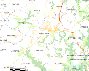
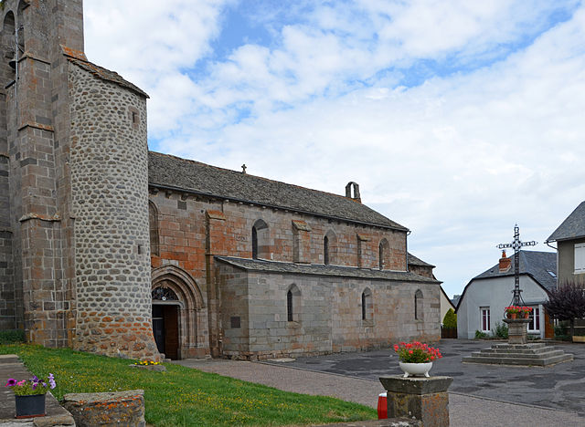
Roffiac (Roffiac)

- commune in Cantal, France
- Country:

- Postal Code: 15100
- Coordinates: 45° 3' 9" N, 3° 2' 17" E


- GPS tracks (wikiloc): [Link]
- Area: 21.26 sq km
- Population: 610
- Wikipedia en: wiki(en)
- Wikipedia: wiki(fr)
- Wikidata storage: Wikidata: Q628356
- Wikipedia Commons Category: [Link]
- Freebase ID: [/m/03mb9mg]
- GeoNames ID: Alt: [6427616]
- SIREN number: [211501648]
- BnF ID: [152483343]
- VIAF ID: Alt: [248626111]
- INSEE municipality code: 15164
Shares border with regions:

Saint-Flour
- commune in Cantal, France
- Country:
- Postal Code: 15100
- Coordinates: 45° 2' 1" N, 3° 5' 34" E
- GPS tracks (wikiloc): [Link]
- Area: 27.14 sq km
- Population: 6630
- Web site: [Link]


Villedieu
- commune in Cantal, France
- Country:
- Postal Code: 15100
- Coordinates: 44° 59' 56" N, 3° 3' 51" E
- GPS tracks (wikiloc): [Link]
- Area: 18.99 sq km
- Population: 542


Coltines
- commune in Cantal, France
- Country:
- Postal Code: 15170
- Coordinates: 45° 5' 36" N, 2° 59' 16" E
- GPS tracks (wikiloc): [Link]
- Area: 19.02 sq km
- Population: 457

Valuéjols
- commune in Cantal, France
- Country:
- Postal Code: 15300
- Coordinates: 45° 3' 11" N, 2° 56' 2" E
- GPS tracks (wikiloc): [Link]
- Area: 38.51 sq km
- Population: 563
- Web site: [Link]


Tanavelle
- commune in Cantal, France
- Country:
- Postal Code: 15100
- Coordinates: 45° 1' 22" N, 2° 59' 54" E
- GPS tracks (wikiloc): [Link]
- Area: 13.58 sq km
- Population: 242
- Web site: [Link]


Andelat
- commune in Cantal, France
- Country:
- Postal Code: 15100
- Coordinates: 45° 3' 38" N, 3° 3' 41" E
- GPS tracks (wikiloc): [Link]
- Area: 21.05 sq km
- Population: 463


Ussel
- commune in Cantal, France
- Country:
- Postal Code: 15300
- Coordinates: 45° 4' 52" N, 2° 56' 8" E
- GPS tracks (wikiloc): [Link]
- Area: 10.34 sq km
- Population: 478