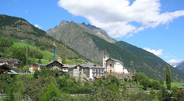
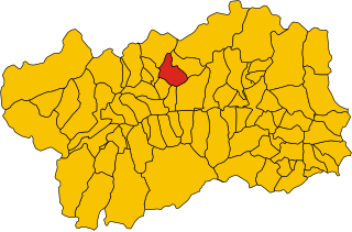
Roisan (Roisan)
.svg)
- Italian comune
 Hiking in Roisan
Roisan is a charming commune in the Aosta Valley region of Italy, known for its beautiful natural landscapes, historical sites, and cultural heritage. Hiking in Roisan offers access to stunning views of the surrounding mountains, valleys, and forests.
Popular Hiking Trails:
-
Trail to the Fort of Fenis: This hike leads you to the nearby Fort of Fenis, combining history with nature. The trail is moderately easy and can be suited for families.
-
Valle d'Aosta Trails: The area offers numerous trails that connect to larger routes in the Aosta Valley, where you can explore alpine meadows, old growth forests, and breathtaking mountain views.
-
Monte Emilius: For more experienced hikers, there are trails leading towards Monte Emilius, a well-known peak in the region. The ascent provides spectacular panoramas of the Aosta Valley.
Best Time to Hike:
- Spring (April to June): Great for wildflowers and mild weather, but check for lingering snow at higher elevations.
- Summer (July to September): The most popular time for hiking, with warm temperatures and dry trails.
- Fall (October): It brings beautiful autumn colors, making the scenery spectacular, though trails may be muddy.
Tips for Hiking in Roisan:
- Gear Up: Wear sturdy hiking boots, and dress in layers to adapt to changing weather.
- Hydration: Carry enough water, especially on longer hikes.
- Map and Navigation: Use detailed maps and be aware of the trail markings. Local information centers can provide maps and advice.
- Respect Nature: Follow Leave No Trace principles to preserve the natural beauty of the area.
Local Culture:
Experiencing Roisan isn't just about the hikes; it's also about the local culture, including traditional cuisine and gatherings. After a day on the trails, enjoy some local dishes, like polenta or Aosta Valley cheese, in one of the local restaurants.
Hiking in Roisan can be a rewarding experience for both novices and seasoned hikers, providing a perfect blend of physical activity and natural beauty.
- Country:

- Postal Code: 11010
- Local Dialing Code: 0165
- Licence Plate Code: AO
- Coordinates: 45° 47' 0" N, 7° 19' 0" E


- GPS tracks (wikiloc): [Link]
- AboveSeaLevel: 866 м m
- Area: 14.64 sq km
- Population: 1012
- Web site: http://www.comune.roisan.ao.it
- Wikipedia en: wiki(en)
- Wikipedia: wiki(it)
- Wikidata storage: Wikidata: Q35328
- Wikipedia Commons Category: [Link]
- Wikipedia Commons Maps Category: [Link]
- Freebase ID: [/m/0ft08l]
- GeoNames ID: Alt: [6541473]
- OSM relation ID: [46064]
- ISTAT ID: 007057
- Italian cadastre code: H497
Shares border with regions:

Aosta
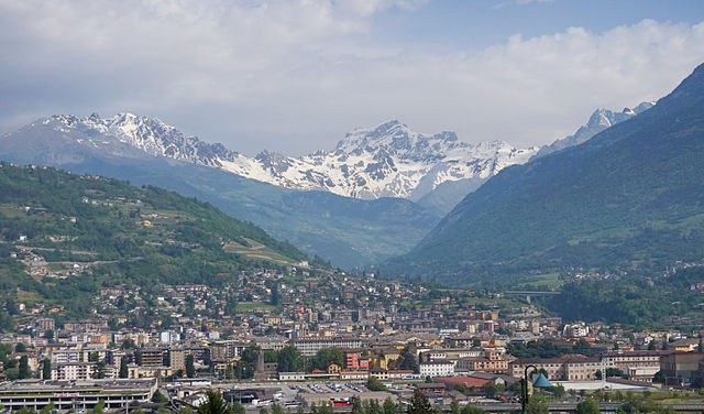
- Italian comune
Hiking in Aosta
Aosta, the capital of the Aosta Valley in Italy, is a fantastic destination for hiking enthusiasts. Nestled in the Italian Alps, the region offers stunning landscapes, charming villages, and a mix of both easy and challenging hiking trails. Here are some key points to consider for hiking in Aosta:...
- Country:
- Postal Code: 11100
- Local Dialing Code: 0165
- Licence Plate Code: AO
- Coordinates: 45° 44' 14" N, 7° 19' 14" E
- GPS tracks (wikiloc): [Link]
- AboveSeaLevel: 583 м m
- Area: 21 sq km
- Population: 34324
- Web site: [Link]

Doues
- Italian comune
Hiking in Doues
Doues is a small municipality located in the Aosta Valley region of Italy, surrounded by stunning mountainous landscapes that are perfect for hiking enthusiasts. The area offers a range of trails suitable for various skill levels, from easy walks to more challenging treks....
- Country:
- Postal Code: 11010
- Local Dialing Code: 0165
- Licence Plate Code: AO
- Coordinates: 45° 49' 0" N, 7° 18' 0" E
- GPS tracks (wikiloc): [Link]
- AboveSeaLevel: 1176 м m
- Area: 16.25 sq km
- Population: 506
- Web site: [Link]

Gignod
- Italian comune
Hiking in Gignod
Gignod is a small municipality located in the Aosta Valley region of Italy, surrounded by stunning alpine scenery. It's an excellent destination for hiking enthusiasts of all levels, offering a variety of trails that showcase the natural beauty of the region, its rugged mountains, picturesque valleys, and rich biodiversity. Here are some highlights for hiking in Gignod:...
- Country:
- Postal Code: 11010
- Local Dialing Code: 0165
- Licence Plate Code: AO
- Coordinates: 45° 47' 0" N, 7° 18' 0" E
- GPS tracks (wikiloc): [Link]
- AboveSeaLevel: 988 м m
- Area: 25.98 sq km
- Population: 1727
- Web site: [Link]


Saint-Christophe, Aosta Valley
- Italian comune
Hiking in Saint-Christophe, Aosta Valley
Saint-Christophe, located in the Aosta Valley region of northern Italy, is a wonderful destination for hiking enthusiasts. This charming village is surrounded by stunning alpine scenery and offers a variety of trails suitable for different skill levels. Here’s what you can expect when hiking in and around Saint-Christophe:...
- Country:
- Postal Code: 11020
- Local Dialing Code: 0165
- Licence Plate Code: AO
- Coordinates: 45° 45' 0" N, 7° 21' 0" E
- GPS tracks (wikiloc): [Link]
- AboveSeaLevel: 619 м m
- Area: 14.74 sq km
- Population: 3467
- Web site: [Link]
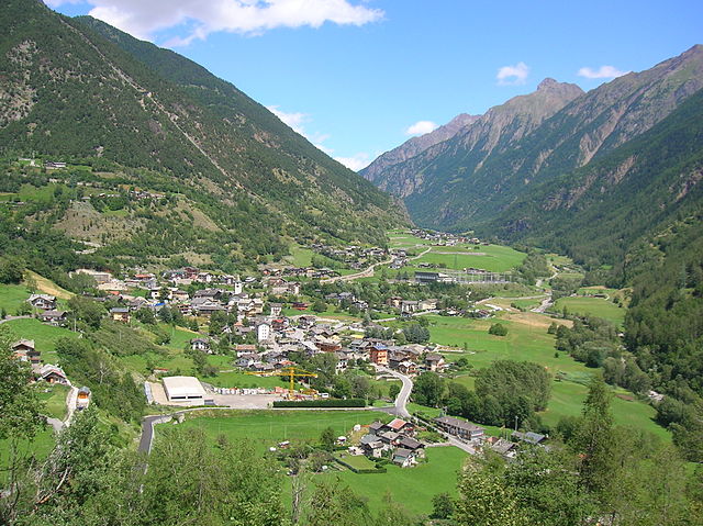
Valpelline, Aosta Valley
- Italian comune
Hiking in Valpelline, Aosta Valley
Valpelline, located in the Aosta Valley region of Italy, is an exceptional destination for hiking enthusiasts. This picturesque valley is surrounded by stunning alpine landscapes, rich biodiversity, and charming villages, providing a unique experience for both novice hikers and seasoned trekkers....
- Country:
- Postal Code: 11010
- Local Dialing Code: 0165
- Licence Plate Code: AO
- Coordinates: 45° 50' 0" N, 7° 20' 0" E
- GPS tracks (wikiloc): [Link]
- AboveSeaLevel: 964 м m
- Area: 31.45 sq km
- Population: 625
- Web site: [Link]