
Aosta (Aosta)
.svg)
- Italian comune
 Hiking in Aosta
Aosta, the capital of the Aosta Valley in Italy, is a fantastic destination for hiking enthusiasts. Nestled in the Italian Alps, the region offers stunning landscapes, charming villages, and a mix of both easy and challenging hiking trails. Here are some key points to consider for hiking in Aosta:
Routes and Trails
-
Gran Paradiso National Park: This is one of the most famous hiking areas, known for its diverse wildlife, breathtaking Alpine scenery, and well-marked trails. The park offers various routes, from easy walks to more challenging hikes, such as the ascent to Gran Paradiso peak.
-
Mont Avic Regional Park: Offers a variety of trails that showcase the beautiful lakes, waterfalls, and waterfalls of the region. The area is less crowded than Gran Paradiso but equally scenic.
-
The Alta Via 1: This long-distance trail is part of the "Alta Via" network which traverses the Aosta Valley. It is known for its stunning panoramas and takes several days to complete, ideal for experienced hikers.
Difficulty Levels
- Easy Hikes: Trails like the one around the Val Ferret or near the towns of Courmayeur and La Thuile are suitable for beginners and families.
- Moderate Hikes: Routes that lead to the various mountain huts (rifugi) offer a mix of challenges and rewards, like the hike to the Refuge Bonatti.
- Difficult Hikes: For seasoned hikers, challenging routes such as the ascent to the Breithorn or the hike up to La Belle Étoile offer incredible views and a more rigorous experience.
Best Times to Hike
- Summer (June to September): The warmest and most popular time for hiking. The trails are generally clear of snow and the weather is pleasant.
- Autumn (October): Offers stunning fall foliage and fewer crowds, though some higher trails may be snow-covered.
- Spring (May): The trails start to open up, but snow can linger at higher elevations.
Preparation
- Gear: Plan to bring good hiking boots, weather-appropriate clothing, water, snacks, and a map or GPS device.
- Weather: The weather can change rapidly in the Alps, so always check forecasts and be prepared for sudden changes.
- Accommodations: There are many rifugi (mountain huts) and local accommodations for overnight stays, making it feasible for multi-day treks.
Local Culture
Take some time to explore the rich history and culture of the Aosta Valley. The region is known for its Roman ruins, medieval castles, and delightful local cuisine, including specialties like Fontina cheese and Valdostana-style dishes.
Overall, Aosta is a hiking paradise that caters to all levels of hikers. Whether you're looking for a leisurely stroll through nature or an intense adventure in the mountains, you'll find something to enjoy.
- Country:

- Postal Code: 11100
- Local Dialing Code: 0165
- Licence Plate Code: AO
- Coordinates: 45° 44' 14" N, 7° 19' 14" E


- GPS tracks (wikiloc): [Link]
- AboveSeaLevel: 583 м m
- Area: 21 sq km
- Population: 34324
- Web site: http://www.comune.aosta.it
- Wikipedia en: wiki(en)
- Wikipedia: wiki(it)
- Wikidata storage: Wikidata: Q3367
- Wikipedia Commons Gallery: [Link]
- Wikipedia Commons Category: [Link]
- Wikipedia Commons Maps Category: [Link]
- Freebase ID: [/m/01x0my]
- GeoNames ID: Alt: [6541471]
- VIAF ID: Alt: [179144783069493379908]
- OSM relation ID: [45916]
- GND ID: Alt: [4079805-7]
- Library of Congress authority ID: Alt: [n80040687]
- MusicBrainz area ID: [0201ae42-b477-42d5-9490-6bc83a1c22c5]
- UN/LOCODE: [ITAOT]
- Facebook Places ID: [114657708546101]
- Great Russian Encyclopedia Online ID: [1824010]
- Digital Atlas of the Roman Empire ID: [104]
- ISNI: Alt: [0000 0001 2242 5737]
- DMOZ ID: Alt: [Regional/Europe/Italy/Regions/Valle_d'Aosta/Localities/Aosta/]
- National Library of Israel ID: [000978969]
- ISTAT ID: 007003
- Italian cadastre code: A326
- US National Archives Identifier: 10044715
Shares border with regions:
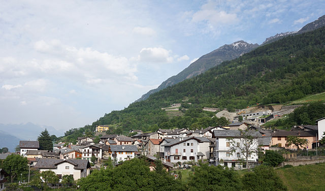

Charvensod
- Italian comune
Hiking in Charvensod
Charvensod, a charming commune located in the Aosta Valley region of Italy, offers a variety of hiking opportunities that cater to all levels of hikers. Nestled at the foot of the impressive Mont Emilius, Charvensod is surrounded by stunning alpine scenery, making it an ideal base for outdoor activities....
- Country:
- Postal Code: 11020
- Local Dialing Code: 0165
- Licence Plate Code: AO
- Coordinates: 45° 43' 0" N, 7° 19' 0" E
- GPS tracks (wikiloc): [Link]
- AboveSeaLevel: 749 м m
- Area: 25.86 sq km
- Population: 2428
- Web site: [Link]

Gignod
- Italian comune
Hiking in Gignod
Gignod is a small municipality located in the Aosta Valley region of Italy, surrounded by stunning alpine scenery. It's an excellent destination for hiking enthusiasts of all levels, offering a variety of trails that showcase the natural beauty of the region, its rugged mountains, picturesque valleys, and rich biodiversity. Here are some highlights for hiking in Gignod:...
- Country:
- Postal Code: 11010
- Local Dialing Code: 0165
- Licence Plate Code: AO
- Coordinates: 45° 47' 0" N, 7° 18' 0" E
- GPS tracks (wikiloc): [Link]
- AboveSeaLevel: 988 м m
- Area: 25.98 sq km
- Population: 1727
- Web site: [Link]


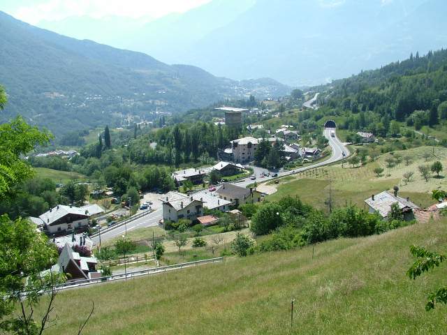
Gressan
- town and comune in Aosta Valley, Italy
Hiking in Gressan
Gressan is a beautiful municipality in the Aosta Valley region of Italy. Located near the town of Aosta, it's an excellent destination for hiking enthusiasts, offering a variety of trails suitable for different skill levels. Here are some highlights about hiking in Gressan:...
- Country:
- Postal Code: 11020
- Local Dialing Code: 0165
- Licence Plate Code: AO
- Coordinates: 45° 43' 0" N, 7° 17' 0" E
- GPS tracks (wikiloc): [Link]
- AboveSeaLevel: 626 м m
- Area: 25.3 sq km
- Population: 3378
- Web site: [Link]

Pollein
- Italian comune
Hiking in Pollein
Pollein is a charming municipality located in the Aosta Valley region of Italy, surrounded by stunning Alpine scenery. It's known for its picturesque landscapes and offers various hiking opportunities suitable for different skill levels. Here’s an overview of what you can expect when hiking in and around Pollein:...
- Country:
- Postal Code: 11020
- Local Dialing Code: 0165
- Licence Plate Code: AO
- Coordinates: 45° 43' 41" N, 7° 21' 25" E
- GPS tracks (wikiloc): [Link]
- AboveSeaLevel: 551 м m
- Area: 15.33 sq km
- Population: 1527
- Web site: [Link]


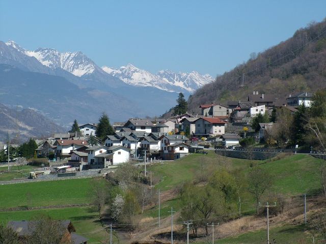
Roisan
- Italian comune
Hiking in Roisan
Roisan is a charming commune in the Aosta Valley region of Italy, known for its beautiful natural landscapes, historical sites, and cultural heritage. Hiking in Roisan offers access to stunning views of the surrounding mountains, valleys, and forests....
- Country:
- Postal Code: 11010
- Local Dialing Code: 0165
- Licence Plate Code: AO
- Coordinates: 45° 47' 0" N, 7° 19' 0" E
- GPS tracks (wikiloc): [Link]
- AboveSeaLevel: 866 м m
- Area: 14.64 sq km
- Population: 1012
- Web site: [Link]


Saint-Christophe, Aosta Valley
- Italian comune
Hiking in Saint-Christophe, Aosta Valley
Saint-Christophe, located in the Aosta Valley region of northern Italy, is a wonderful destination for hiking enthusiasts. This charming village is surrounded by stunning alpine scenery and offers a variety of trails suitable for different skill levels. Here’s what you can expect when hiking in and around Saint-Christophe:...
- Country:
- Postal Code: 11020
- Local Dialing Code: 0165
- Licence Plate Code: AO
- Coordinates: 45° 45' 0" N, 7° 21' 0" E
- GPS tracks (wikiloc): [Link]
- AboveSeaLevel: 619 м m
- Area: 14.74 sq km
- Population: 3467
- Web site: [Link]

Sarre, Aosta Valley
- Italian comune
Hiking in Sarre, Aosta Valley
Hiking in Sarre, located in the Aosta Valley of northern Italy, offers a fantastic outdoor experience surrounded by stunning mountain scenery. The Aosta Valley is known for its breathtaking landscapes, rich history, and numerous hiking trails suitable for all levels of experience....
- Country:
- Postal Code: 11010
- Local Dialing Code: 0165
- Licence Plate Code: AO
- Coordinates: 45° 43' 4" N, 7° 15' 27" E
- GPS tracks (wikiloc): [Link]
- AboveSeaLevel: 631 м m
- Area: 28.28 sq km
- Population: 4878
- Web site: [Link]