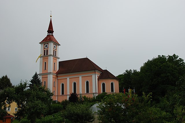
Südoststeiermark District (Bezirk Südoststeiermark)
.svg)
- district of Austria
 Hiking in Südoststeiermark District
Südoststeiermark District, located in the southern part of Austria, is known for its scenic landscapes, rolling hills, vineyards, and charming villages. Hiking in this region offers a variety of experiences for outdoor enthusiasts, whether you're looking for leisurely walks or more challenging trails.
Key Highlights for Hiking in Südoststeiermark:
-
Diverse Trails: The district has a network of well-marked hiking trails ranging from easy to moderate levels. You can find trails that meander through vineyards, forests, and meadows, providing an opportunity to experience the natural beauty of the region.
-
Vineyard Trails: One of the notable features of hiking in this area is the opportunity to hike through vineyards. There are specific routes that take you through picturesque vineyards where you can enjoy stunning views of the countryside as well as sample local wines.
-
Scenic Views: The region boasts several lookout points that offer panoramic views of the surrounding hills and valleys. For example, the trails around the Lafnitztal or the hills near Riegersburg Castle provide beautiful vistas.
-
Cultural Sites: Some trails connect to cultural and historical sites, such as the Riegersburg Castle, which is perched on a hill and offers both a fascinating history and impressive views. Visiting these sites can enhance your hiking experience.
-
Natural Attractions: The area is home to beautiful natural features such as the Styrian Thermal Baths, which can provide a perfect spot to relax after a day of hiking. Additionally, the diverse flora and fauna in the region adds to the charm of your hikes.
-
Transport and Accessibility: Many trails are easily accessible, and the region has good public transport links, making it convenient for hikers. You may also find accommodations in local villages that cater to tourists.
-
Seasonal Hiking: Each season offers a different experience. Spring and summer bring lush greenery and wildflowers, while autumn showcases the stunning colors of fall foliage. Winter hikes can also be magical, especially if you're interested in snowshoeing.
Tips for Hiking in Südoststeiermark:
- Check Weather Conditions: Always check the local weather before heading out, as conditions can change quickly in the mountains.
- Stay Hydrated: Bring sufficient water, especially during warmer months.
- Appropriate Gear: Wear sturdy hiking boots and dress in layers to adjust to changing temperatures.
- Local Maps: Consider obtaining a local hiking map or using an app to help navigate the trails.
- Respect Wildlife: Keep to marked paths to minimize your impact on the environment and respect local wildlife.
Whether you're a beginner or an experienced hiker, Südoststeiermark offers a delightful mix of nature, culture, and scenic beauty that makes it a great destination for hiking.
- Country:

- Capital: Feldbach
- Licence Plate Code: FB
- Coordinates: 46° 57' 0" N, 15° 53' 0" E


- GPS tracks (wikiloc): [Link]
- AboveSeaLevel: 344 м m
- Area: 1009 sq km
- Web site: http://www.bh-suedoststeiermark.steiermark.at/
- Wikipedia en: wiki(en)
- Wikipedia: wiki(de)
- Wikidata storage: Wikidata: Q854043
- Wikipedia Commons Category: [Link]
- Wikipedia Commons Maps Category: [Link]
- GeoNames ID: Alt: [8604689]
- VIAF ID: Alt: [315523994]
- archINFORM location ID: [14699]
Includes regions:

Mureck
- municipality in Austria
Hiking in Mureck
Mureck, located in the southern part of Austria near the border with Slovenia, offers a charming backdrop for hiking enthusiasts. The region is characterized by its lush landscapes, rolling hills, and scenic views. Here are some important aspects to consider when hiking in and around Mureck:...
- Country:
- Postal Code: 8480
- Local Dialing Code: 03472
- Licence Plate Code: SO
- Coordinates: 46° 42' 31" N, 15° 46' 22" E
- GPS tracks (wikiloc): [Link]
- AboveSeaLevel: 237 м m
- Area: 38.72 sq km
- Population: 3551
- Web site: [Link]
Straden
- municipality in Austria
Hiking in Straden
Straden is a picturesque village located in the Styria region of Austria, known for its rolling hills, vineyards, and beautiful landscapes, making it an excellent destination for hiking enthusiasts. Here are some highlights and tips for hiking in and around Straden:...
- Country:
- Local Dialing Code: 03473
- Licence Plate Code: RA
- Coordinates: 46° 48' 21" N, 15° 52' 16" E
- GPS tracks (wikiloc): [Link]
- AboveSeaLevel: 351 м m
- Area: 19.44 sq km
- Population: 3601
- Web site: [Link]
Kirchbach-Zerlach
- municipality in Austria
Hiking in Kirchbach-Zerlach
Kirchbach-Zerlach is a picturesque area located in the southern part of Austria, known for its stunning landscapes, rolling hills, and diverse hiking opportunities. As a hiking instructor, I can highlight some key features and tips for hiking in this region....
- Country:
- Postal Code: 8081–8083
- Local Dialing Code: 03116
- Licence Plate Code: SO
- Coordinates: 46° 56' 0" N, 15° 40' 0" E
- GPS tracks (wikiloc): [Link]
- AboveSeaLevel: 334 м m
- Area: 123.45 sq km
- Population: 3264
- Web site: [Link]

Zerlach
- former municipality in Austria
Hiking in Zerlach
Zerlach is a beautiful region in Austria, known for its picturesque landscapes and outdoor recreational opportunities. While specific hiking trails and conditions can vary seasonally and may be best checked locally, here are some general tips and highlights for hiking in Zerlach and its surroundings:...
- Country:
- Postal Code: 8082
- Local Dialing Code: 03116
- Licence Plate Code: FB
- Coordinates: 46° 57' 25" N, 15° 39' 50" E
- GPS tracks (wikiloc): [Link]
- AboveSeaLevel: 337 м m
- Area: 23.78 sq km
- Population: 1690

Gniebing-Weißenbach
- former municipality in Austria
Hiking in Gniebing-Weißenbach
Gniebing-Weißenbach, located in Styria, Austria, is a charming area that offers beautiful hiking opportunities amidst picturesque landscapes. The region features rolling hills, lush forests, and stunning views of the surrounding countryside. Here are some key points to consider when planning a hike in Gniebing-Weißenbach:...
- Country:
- Local Dialing Code: 03152
- Licence Plate Code: FB
- Coordinates: 46° 58' 0" N, 15° 51' 0" E
- GPS tracks (wikiloc): [Link]
- AboveSeaLevel: 288 м m
- Area: 15.36 sq km
- Population: 2204
Frannach
- former municipality in Austria
Hiking in Frannach
Frannach, a serene area located in Austria, offers a range of beautiful hiking opportunities that cater to different skill levels and preferences. The region is characterized by lush landscapes, scenic trails, and picturesque views, making it an excellent destination for outdoor enthusiasts....
- Country:
- Postal Code: 8081
- Local Dialing Code: 03116
- Licence Plate Code: FB
- Coordinates: 46° 54' 49" N, 15° 38' 1" E
- GPS tracks (wikiloc): [Link]
- AboveSeaLevel: 316 м m
- Area: 8.04 sq km
- Population: 548
Baumgarten bei Gnas
- former municipality in Austria
Hiking in Baumgarten bei Gnas
Baumgarten bei Gnas is a charming village in Austria, located in the Styria region. It offers a variety of hiking opportunities for outdoor enthusiasts, showcasing beautiful landscapes, local flora, and stunning views of the surrounding countryside....
- Country:
- Local Dialing Code: 03151
- Licence Plate Code: SO
- Coordinates: 46° 54' 0" N, 15° 46' 0" E
- GPS tracks (wikiloc): [Link]
- AboveSeaLevel: 330 м m
- Area: 8.97 sq km
- Population: 541
Pertlstein
- former municipality in Austria
Hiking in Pertlstein
Pertlstein, located in Austria, is a beautiful area for hiking enthusiasts, offering a variety of trails with stunning scenery. It is situated near the Styrian region, known for its picturesque landscapes, rolling hills, and wooded areas. Here are some key points to consider when planning a hiking trip in Pertlstein:...
- Country:
- Local Dialing Code: 03155
- Licence Plate Code: FB
- Coordinates: 46° 56' 3" N, 15° 57' 41" E
- GPS tracks (wikiloc): [Link]
- AboveSeaLevel: 274 м m
- Area: 9.29 sq km
- Population: 811

Edelsbach bei Feldbach
- municipality in Austria
Hiking in Edelsbach bei Feldbach
Edelsbach bei Feldbach, located in Styria, Austria, is surrounded by beautiful landscapes that are ideal for hiking enthusiasts. The region features a mix of rolling hills, lush forests, and picturesque valleys, offering a variety of trails suitable for different skill levels....
- Country:
- Local Dialing Code: 03152
- Licence Plate Code: FB
- Coordinates: 46° 59' 21" N, 15° 50' 10" E
- GPS tracks (wikiloc): [Link]
- AboveSeaLevel: 328 м m
- Area: 16.05 sq km
- Population: 1342
- Web site: [Link]
Mitterlabill
- former municipality in Austria
Hiking in Mitterlabill
Mitterlabill is a beautiful hiking destination located in the Austrian Alps, known for its stunning landscapes, diverse flora, and fauna, as well as its various hiking trails suitable for different skill levels. Here are some key aspects to consider when hiking in Mitterlabill:...
- Country:
- Postal Code: 8413
- Local Dialing Code: 03184
- Licence Plate Code: FB
- Coordinates: 46° 53' 0" N, 15° 38' 0" E
- GPS tracks (wikiloc): [Link]
- AboveSeaLevel: 309 м m
- Area: 7.88 sq km
Klöch
- municipality in Austria
Hiking in Klöch
Klöch, located in southeastern Styria, Austria, is a wonderful destination for hiking enthusiasts. Nestled in the picturesque landscape of the Styrian wine country, it offers a range of trails that showcase stunning vistas, lush vineyards, and rolling hills. Here are some highlights for hiking in Klöch:...
- Country:
- Postal Code: 8493
- Local Dialing Code: 03475
- Licence Plate Code: RA
- Coordinates: 46° 45' 53" N, 15° 57' 58" E
- GPS tracks (wikiloc): [Link]
- AboveSeaLevel: 290 м m
- Area: 16.39 sq km
- Population: 1192
- Web site: [Link]

Sankt Peter am Ottersbach
- municipality in Austria
Hiking in Sankt Peter am Ottersbach
Sankt Peter am Ottersbach is a charming village located in the Styria region of Austria. It's a fantastic destination for those interested in hiking, as the surrounding landscape is characterized by rolling hills, lush forests, and scenic countryside....
- Country:
- Postal Code: 8093
- Local Dialing Code: 03477
- Licence Plate Code: RA
- Coordinates: 46° 47' 52" N, 15° 45' 33" E
- GPS tracks (wikiloc): [Link]
- AboveSeaLevel: 380 м m
- Area: 35.48 sq km
- Population: 2950
- Web site: [Link]

Paldau
- municipality in Austria
Hiking in Paldau
Paldau, located in the southeastern part of Austria, is a charming area known for its picturesque landscapes and natural beauty, making it an excellent destination for hiking enthusiasts. While it may not be as widely recognized as some of the larger national parks in Austria, it offers a variety of trails that cater to different skill levels....
- Country:
- Local Dialing Code: 03150
- Licence Plate Code: FB
- Coordinates: 46° 56' 26" N, 15° 47' 34" E
- GPS tracks (wikiloc): [Link]
- AboveSeaLevel: 309 м m
- Area: 23.67 sq km
- Population: 3130
- Web site: [Link]

Fehring
- municipality in Austria
Hiking in Fehring
Fehring is a charming town located in the southern part of Austria, near the border with Slovenia. It's surrounded by beautiful landscapes that are ideal for hiking. The area features rolling hills, scenic vineyards, and lush woods, making it perfect for nature enthusiasts....
- Country:
- Local Dialing Code: 03155
- Licence Plate Code: FB
- Coordinates: 46° 56' 11" N, 16° 0' 38" E
- GPS tracks (wikiloc): [Link]
- AboveSeaLevel: 272 м m
- Area: 29.61 sq km
- Population: 7284
- Web site: [Link]

Halbenrain
- municipality in Austria
Hiking in Halbenrain
Halbenrain is a small town located in the Styria region of Austria, known for its picturesque landscapes and welcoming atmosphere. Hiking in and around Halbenrain offers a variety of trails that cater to different skill levels, from gentle walks to more challenging hikes....
- Country:
- Postal Code: 8492
- Local Dialing Code: 03476
- Licence Plate Code: RA
- Coordinates: 46° 43' 19" N, 15° 56' 48" E
- GPS tracks (wikiloc): [Link]
- AboveSeaLevel: 223 м m
- Area: 38.66 sq km
- Population: 1747
- Web site: [Link]


Feldbach
- municipality in Austria
Hiking in Feldbach
Feldbach, located in Styria, Austria, is a beautiful region that offers a variety of hiking opportunities amidst stunning landscapes. Here are some key points about hiking in Feldbach:...
- Country:
- Local Dialing Code: 03152
- Licence Plate Code: SO
- Coordinates: 46° 57' 18" N, 15° 53' 18" E
- GPS tracks (wikiloc): [Link]
- AboveSeaLevel: 282 м m
- Area: 67.3 sq km
- Population: 13369
- Web site: [Link]
Eichfeld
- former municipality in Austria
Hiking in Eichfeld
Eichfeld is a beautiful area that offers a range of hiking opportunities, often characterized by its picturesque landscapes, diverse ecosystems, and scenic trails. Although it may not be as well-known as some larger hiking destinations, it provides an excellent opportunity for those looking to explore nature, enjoy peaceful walks, or embark on more strenuous hikes....
- Country:
- Local Dialing Code: 03472
- Licence Plate Code: RA
- Coordinates: 46° 43' 30" N, 15° 46' 6" E
- GPS tracks (wikiloc): [Link]
- AboveSeaLevel: 238 м m
- Area: 17.98 sq km
- Population: 863
- Web site: [Link]

Riegersburg
- municipality in Austria
Hiking in Riegersburg
Riegersburg, located in Styria, Austria, is known for its stunning landscapes, cultural heritage, and the impressive Riegersburg Castle which overlooks the surrounding countryside. Hiking in this area offers a blend of natural beauty and historical exploration....
- Country:
- Local Dialing Code: 03153
- Licence Plate Code: FB
- Coordinates: 47° 0' 0" N, 15° 56' 0" E
- GPS tracks (wikiloc): [Link]
- AboveSeaLevel: 377 м m
- Area: 32.12 sq km
- Population: 4922
- Web site: [Link]
Gosdorf
- former municipality in Austria
Hiking in Gosdorf
Gosdorf is a charming village located in the eastern part of Austria, surrounded by beautiful landscapes that are perfect for hiking enthusiasts. The region offers various trails that cater to different skill levels, ranging from easy walks to more challenging hikes that can lead you to stunning viewpoints and natural attractions....
- Country:
- Postal Code: 8482
- Local Dialing Code: 03472
- Licence Plate Code: RA
- Coordinates: 46° 43' 33" N, 15° 47' 41" E
- GPS tracks (wikiloc): [Link]
- AboveSeaLevel: 234 м m
- Area: 15.64 sq km
- Population: 1152
Sankt Stefan im Rosental
- municipality in Austria
Hiking in Sankt Stefan im Rosental
Sankt Stefan im Rosental is a charming village located in the scenic Styria region of Austria. It offers a variety of hiking opportunities for outdoor enthusiasts, ranging from leisurely walks to more challenging trails. Here are some highlights and tips for hiking in the area:...
- Country:
- Postal Code: 8082, 8083, 8091, 8324, 8341, 8421
- Local Dialing Code: 03116
- Licence Plate Code: SO
- Coordinates: 46° 54' 8" N, 15° 42' 42" E
- GPS tracks (wikiloc): [Link]
- AboveSeaLevel: 330 м m
- Area: 43.02 sq km
- Population: 3947
- Web site: [Link]
Glojach
- former municipality in Austria
Hiking in Glojach
Glojach is a picturesque area located in Slovenia, known for its beautiful landscapes, hiking trails, and natural scenery. While it might not be as widely recognized as other hiking destinations in Slovenia, it can offer a tranquil experience for hikers looking to explore less crowded paths....
- Country:
- Postal Code: 8421
- Local Dialing Code: 03184
- Licence Plate Code: FB
- Coordinates: 46° 52' 23" N, 15° 40' 59" E
- GPS tracks (wikiloc): [Link]
- AboveSeaLevel: 410 м m
- Area: 3.38 sq km
- Population: 244
Tieschen
- municipality in Austria
Hiking in Tieschen
Tieschen is a small village located in the southern part of Austria, near the border with Slovenia. The region offers beautiful landscapes, and hiking around Tieschen can be a rewarding experience for outdoor enthusiasts....
- Country:
- Postal Code: 8355
- Local Dialing Code: 03475
- Licence Plate Code: RA
- Coordinates: 46° 47' 11" N, 15° 56' 41" E
- GPS tracks (wikiloc): [Link]
- AboveSeaLevel: 260 м m
- Area: 18 sq km
- Population: 1260
- Web site: [Link]
Bierbaum am Auersbach
- former municipality in Austria
Hiking in Bierbaum am Auersbach
Bierbaum am Auersbach is a picturesque village located in Styria, Austria, surrounded by beautiful landscapes that are perfect for hiking enthusiasts. The area is characterized by rolling hills, dense forests, and more tranquil pathways that offer a variety of terrain options for hikers of all skill levels....
- Country:
- Local Dialing Code: 03477
- Licence Plate Code: RA
- Coordinates: 46° 49' 46" N, 15° 47' 34" E
- GPS tracks (wikiloc): [Link]
- AboveSeaLevel: 296 м m
- Area: 5.18 sq km
Deutsch Goritz
- municipality in Austria
Hiking in Deutsch Goritz
Deutsch Goritz is a small village located in the southern part of Austria, not far from the border with Slovenia. The region surrounding Deutsch Goritz is characterized by beautiful landscapes, rich biodiversity, and a variety of hiking trails suitable for different skill levels....
- Country:
- Postal Code: 8483
- Local Dialing Code: 03474
- Licence Plate Code: RA
- Coordinates: 46° 45' 0" N, 15° 49' 48" E
- GPS tracks (wikiloc): [Link]
- AboveSeaLevel: 244 м m
- Area: 23.26 sq km
- Population: 1816
- Web site: [Link]
Trössing
- former municipality in Austria
Hiking in Trössing
Hiking in Trössing, a scenic area in Austria, offers fantastic opportunities for outdoor enthusiasts of all levels. The region is characterized by its picturesque landscapes, lush forests, and a variety of trails that cater to both casual walkers and experienced hikers....
- Country:
- Postal Code: 8342, 8345
- Local Dialing Code: 03477
- Licence Plate Code: SO
- Coordinates: 46° 49' 36" N, 15° 49' 11" E
- GPS tracks (wikiloc): [Link]
- AboveSeaLevel: 260 м m
- Area: 4.16 sq km
- Population: 270
Weinburg am Saßbach
- former municipality in Austria
Hiking in Weinburg am Saßbach
Weinburg am Saßbach is a picturesque destination for hiking enthusiasts, located in the beautiful surroundings of Austria. Here are some key points to consider if you’re planning to hike in this area:...
- Country:
- Postal Code: 8481
- Local Dialing Code: 03472
- Licence Plate Code: RA
- Coordinates: 46° 45' 15" N, 15° 43' 19" E
- GPS tracks (wikiloc): [Link]
- AboveSeaLevel: 276 м m
- Area: 25 sq km

Dietersdorf am Gnasbach
- former municipality in Austria
Hiking in Dietersdorf am Gnasbach
Dietersdorf am Gnasbach is a charming village in Austria that offers a range of picturesque hiking opportunities, set against the backdrop of the beautiful Styrian countryside. Here are some aspects to consider for a hiking experience in and around Dietersdorf am Gnasbach:...
- Country:
- Local Dialing Code: 03477
- Licence Plate Code: RA
- Coordinates: 46° 48' 36" N, 15° 48' 36" E
- GPS tracks (wikiloc): [Link]
- AboveSeaLevel: 273 м m
- Area: 6.56 sq km
Radkersburg Umgebung
- former municipality in Austria
Hiking in Radkersburg Umgebung
Radkersburg Umgebung, located in the southern part of Styria in Austria, is a beautiful area for hiking, surrounded by lush landscapes, vineyards, and charming villages. The region is known for its gentle rolling hills, rich agricultural land, and the renowned Sulm Valley, making it a great destination for outdoor enthusiasts....
- Country:
- Local Dialing Code: 03474
- Licence Plate Code: RA
- Coordinates: 46° 42' 10" N, 15° 59' 52" E
- GPS tracks (wikiloc): [Link]
- AboveSeaLevel: 210 м m
- Area: 27.76 sq km
- Population: 1734
Ratschendorf
- former municipality in Austria
Hiking in Ratschendorf
Ratschendorf, known for its picturesque landscapes, offers some lovely hiking opportunities, especially for those who enjoy nature and tranquility. While specific trails may vary based on local maps and conditions, here are some general points to consider when hiking in the area:...
- Country:
- Local Dialing Code: 03474
- Licence Plate Code: RA
- Coordinates: 46° 44' 40" N, 15° 49' 0" E
- GPS tracks (wikiloc): [Link]
- AboveSeaLevel: 240 м m
- Area: 10.39 sq km
- Population: 603
Breitenfeld an der Rittschein
- former municipality in Austria
Hiking in Breitenfeld an der Rittschein
Breitenfeld an der Rittschein is a picturesque village in the Austrian state of Styria, known for its scenic landscapes and outdoor recreational opportunities, including hiking. The region offers various trails suitable for different skill levels, making it an attractive destination for hikers....
- Country:
- Local Dialing Code: 03387
- Licence Plate Code: FB
- Coordinates: 47° 1' 47" N, 15° 57' 28" E
- GPS tracks (wikiloc): [Link]
- AboveSeaLevel: 281 м m
- Area: 13.22 sq km
- Population: 788

Gnas
- municipality in Austria
Hiking in Gnas
Gnas, located in the Styria region of Austria, is a fantastic area for hiking enthusiasts, offering a mix of lush landscapes, rolling hills, and scenic trails. Here are some highlights and tips for hiking in Gnas and its surroundings:...
- Country:
- Local Dialing Code: 03151
- Licence Plate Code: FB
- Coordinates: 46° 52' 30" N, 15° 49' 35" E
- GPS tracks (wikiloc): [Link]
- AboveSeaLevel: 300 м m
- Area: 15.84 sq km
- Population: 6046
- Web site: [Link]
Unterlamm
- municipality in Austria
Hiking in Unterlamm
Unterlamm is a picturesque area located in the Styria region of Austria, known for its beautiful landscapes and outdoor activities, including hiking. Here are some aspects to consider when hiking in Unterlamm:...
- Country:
- Local Dialing Code: 03155
- Licence Plate Code: FB
- Coordinates: 46° 58' 40" N, 16° 3' 31" E
- GPS tracks (wikiloc): [Link]
- AboveSeaLevel: 285 м m
- Area: 16.65 sq km
- Population: 1264
- Web site: [Link]
Raabau
- former municipality in Austria
Hiking in Raabau
Raabau, located near Graz in Austria, offers beautiful hiking opportunities surrounded by nature. The region is characterized by its lush forests, rolling hills, and scenic views, making it an excellent destination for outdoor enthusiasts....
- Country:
- Postal Code: 8330
- Local Dialing Code: 03152
- Licence Plate Code: FB
- Coordinates: 46° 57' 44" N, 15° 54' 49" E
- GPS tracks (wikiloc): [Link]
- AboveSeaLevel: 282 м m
- Area: 4 sq km
- Population: 572

Trautmannsdorf in Oststeiermark
- former municipality in Austria
Hiking in Trautmannsdorf in Oststeiermark
Trautmannsdorf is a charming village in the region of Oststeiermark (Eastern Styria) in Austria, surrounded by picturesque landscapes that are perfect for hiking. The area is known for its rolling hills, lush meadows, and beautiful woodlands, making it an attractive destination for nature lovers and hiking enthusiasts alike....
- Country:
- Local Dialing Code: 03159
- Licence Plate Code: FB
- Coordinates: 46° 52' 24" N, 15° 53' 2" E
- GPS tracks (wikiloc): [Link]
- AboveSeaLevel: 326 м m
- Area: 7.29 sq km
- Population: 877
Edelstauden
- former municipality in Austria
Hiking in Edelstauden
Edelstauden is a small area located in Austria, often surrounded by beautiful natural landscapes. While it may not be as widely recognized as some of the larger hiking destinations, there are still some charming trails and outdoor activities that can be enjoyed in the region. Here are some points to consider when hiking in and around Edelstauden:...
- Country:
- Postal Code: 8081
- Local Dialing Code: 03134
- Licence Plate Code: FB
- Coordinates: 46° 58' 56" N, 15° 37' 35" E
- GPS tracks (wikiloc): [Link]
- AboveSeaLevel: 367 м m
- Area: 6.75 sq km
Studenzen
- former municipality in Austria
Hiking in Studenzen
Studenzen, located in Styria, Austria, is a charming destination for hiking enthusiasts. Nestled amidst picturesque landscapes, it offers a variety of trails suitable for different skill levels, ranging from leisurely walks to more challenging hikes....
- Country:
- Postal Code: 8322
- Local Dialing Code: 03115
- Licence Plate Code: FB
- Coordinates: 47° 0' 20" N, 15° 45' 14" E
- GPS tracks (wikiloc): [Link]
- AboveSeaLevel: 310 м m
- Area: 5.92 sq km
- Population: 686
Stainz bei Straden
- former municipality in Austria
Hiking in Stainz bei Straden
Stainz bei Straden is a picturesque area located in the Styria region of Austria, known for its rolling hills, scenic landscapes, and charming vineyards. It's an excellent destination for hiking enthusiasts who enjoy combining outdoor activities with cultural experiences....
- Country:
- Local Dialing Code: 03473
- Licence Plate Code: FB
- Coordinates: 46° 49' 17" N, 15° 53' 41" E
- GPS tracks (wikiloc): [Link]
- AboveSeaLevel: 251 м m
- Area: 13.68 sq km
Fladnitz im Raabtal
- former municipality in Austria
Hiking in Fladnitz im Raabtal
Fladnitz im Raabtal is a picturesque area in Styria, Austria, known for its stunning landscapes and outdoor recreational opportunities. Hiking in this region provides access to beautiful trails that vary in difficulty, offering something for everyone from beginners to experienced hikers....
- Country:
- Local Dialing Code: 0 31 15
- Licence Plate Code: FB
- Coordinates: 46° 59' 29" N, 15° 47' 9" E
- GPS tracks (wikiloc): [Link]
- AboveSeaLevel: 310 м m
- Area: 6.32 sq km
Eichkögl
- municipality in Austria
Hiking in Eichkögl
Eichkögl is a beautiful hiking destination in Austria, located in the state of Styria. It is part of the Eastern Alps and offers various hiking opportunities with stunning views of the surrounding landscape, including mountains, forests, and meadows....
- Country:
- Local Dialing Code: 03115
- Licence Plate Code: FB
- Coordinates: 47° 1' 25" N, 15° 47' 28" E
- GPS tracks (wikiloc): [Link]
- AboveSeaLevel: 429 м m
- Area: 14.89 sq km
- Population: 1310
- Web site: [Link]
Raning
- former municipality in Austria
Hiking in Raning
It seems like there might be a typo in your question, as "Raning" isn't a recognized location for hiking. If you meant "Rangit," "Rancho," or perhaps "Raning," which could refer to a less-known area, please clarify....
- Country:
- Postal Code: 8342
- Local Dialing Code: 03151
- Licence Plate Code: SO
- Coordinates: 46° 51' 49" N, 15° 48' 32" E
- GPS tracks (wikiloc): [Link]
- AboveSeaLevel: 273 м m
- Area: 8.2 sq km
- Population: 797
Pirching am Traubenberg
- municipality in Austria
Hiking in Pirching am Traubenberg
Pirching am Traubenberg, a charming village in Austria, is located in the scenic region of Styria. It's surrounded by beautiful landscapes that offer a variety of hiking opportunities suitable for all skill levels. Here are some things to know about hiking in that area:...
- Country:
- Postal Code: 8081
- Local Dialing Code: 03134
- Licence Plate Code: FB
- Coordinates: 46° 57' 22" N, 15° 35' 48" E
- GPS tracks (wikiloc): [Link]
- AboveSeaLevel: 350 м m
- Area: 16.67 sq km
- Population: 2567
- Web site: [Link]
Schwarzau im Schwarzautal
- former municipality in Austria
Hiking in Schwarzau im Schwarzautal
Schwarzau im Schwarzautal is a picturesque area nestled in the beautiful landscapes of Styria, Austria. This region offers a variety of hiking options that appeal to both beginners and experienced hikers. Here are some details to consider when hiking in and around Schwarzau im Schwarzautal:...
- Country:
- Postal Code: 8421
- Local Dialing Code: 03184
- Licence Plate Code: FB
- Coordinates: 46° 52' 34" N, 15° 39' 53" E
- GPS tracks (wikiloc): [Link]
- AboveSeaLevel: 298 м m
- Area: 10.49 sq km
Unterauersbach
- former municipality in Austria
Hiking in Unterauersbach
Unterauersbach is a picturesque area located in Austria, known for its beautiful landscapes and outdoor activities, including hiking. Here are some highlights and tips for hiking in Unterauersbach:...
- Country:
- Postal Code: 8342
- Local Dialing Code: 03151
- Licence Plate Code: SO
- Coordinates: 46° 51' 58" N, 15° 46' 14" E
- GPS tracks (wikiloc): [Link]
- AboveSeaLevel: 330 м m
- Area: 7.89 sq km
- Population: 432
Aug-Radisch
- former municipality in Austria
Hiking in Aug-Radisch
Aug-Radisch is a beautiful area in Germany known for its picturesque landscapes and hiking opportunities. Located in the Bavarian region, it offers a range of trails that appeal to various skill levels, from beginners to experienced hikers....
- Country:
- Local Dialing Code: 03151
- Licence Plate Code: FB
- Coordinates: 46° 51' 0" N, 15° 47' 0" E
- GPS tracks (wikiloc): [Link]
- AboveSeaLevel: 300 м m
- Area: 4.48 sq km
- Population: 280

Frutten-Gießelsdorf
- former municipality in Austria
Hiking in Frutten-Gießelsdorf
Frutten-Gießelsdorf is a small area in Austria, located in Styria, known for its picturesque landscapes and natural beauty. It provides a variety of hiking opportunities for both beginners and experienced hikers. Here are some key points to consider for hiking in the Frutten-Gießelsdorf area:...
- Country:
- Local Dialing Code: 03158
- Licence Plate Code: FB
- Coordinates: 46° 49' 28" N, 15° 56' 6" E
- GPS tracks (wikiloc): [Link]
- AboveSeaLevel: 335 м m
- Area: 10.88 sq km
- Population: 625
Auersbach
- former municipality in Austria
Hiking in Auersbach
Auersbach is a picturesque area in Styria, Austria, known for its stunning landscapes and outdoor activities, including hiking. Here are some key points to consider if you're planning a hiking trip in this region:...
- Country:
- Local Dialing Code: 03152
- Licence Plate Code: FB
- Coordinates: 47° 1' 0" N, 15° 52' 0" E
- GPS tracks (wikiloc): [Link]
- AboveSeaLevel: 380 м m
- Area: 12.59 sq km
- Population: 880
Bad Gleichenberg
- municipality in Austria
Hiking in Bad Gleichenberg
Bad Gleichenberg, located in the southeastern part of Austria in Styria, is known for its beautiful landscapes, thermal spas, and a range of hiking opportunities suitable for various skill levels. The region combines natural beauty with cultural heritage, making it an excellent destination for outdoor enthusiasts....
- Country:
- Local Dialing Code: 03159
- Licence Plate Code: FB
- Coordinates: 46° 52' 13" N, 15° 54' 10" E
- GPS tracks (wikiloc): [Link]
- AboveSeaLevel: 317 м m
- Area: 13.7 sq km
- Population: 5314
- Web site: [Link]
Oberdorf am Hochegg
- former municipality in Austria
Hiking in Oberdorf am Hochegg
Oberdorf am Hochegg is a picturesque area in Austria known for its beautiful landscapes and great hiking opportunities. Nestled in the foothills of the Alps, it offers a mix of well-marked trails suitable for various skill levels, from leisurely strolls to more challenging hikes....
- Country:
- Local Dialing Code: 03115
- Licence Plate Code: FB
- Coordinates: 46° 59' 0" N, 15° 43' 0" E
- GPS tracks (wikiloc): [Link]
- AboveSeaLevel: 350 м m
- Area: 12.57 sq km
- Population: 727

Hof bei Straden
- former municipality in Austria
Hiking in Hof bei Straden
Hof bei Straden, located in Styria, Austria, is a scenic area that offers a variety of hiking opportunities amidst beautiful landscapes. The region is characterized by rolling hills, lush forests, vineyards, and picturesque rural scenery. Here are some highlights and tips for hiking in this area:...
- Country:
- Local Dialing Code: 03473
- Licence Plate Code: RA
- Coordinates: 46° 48' 2" N, 15° 53' 40" E
- GPS tracks (wikiloc): [Link]
- AboveSeaLevel: 250 м m
- Area: 17.18 sq km
- Population: 847
Mettersdorf am Saßbach
- municipality in Austria
Hiking in Mettersdorf am Saßbach
Mettersdorf am Saßbach is a charming village located in Austria, nestled in the picturesque region of Styria. This area offers a wonderful opportunity for hiking enthusiasts to explore the stunning landscapes, lush forests, and rolling hills typical of the Styrian countryside....
- Country:
- Postal Code: 8092
- Local Dialing Code: 03477
- Licence Plate Code: RA
- Coordinates: 46° 48' 17" N, 15° 42' 39" E
- GPS tracks (wikiloc): [Link]
- AboveSeaLevel: 281 м m
- Area: 22.72 sq km
- Population: 1282
- Web site: [Link]
Hohenbrugg-Weinberg
- former municipality in Austria
Hiking in Hohenbrugg-Weinberg
Hohenbrugg-Weinberg is a charming area in Austria, known for its picturesque landscapes and natural beauty, making it a wonderful destination for hiking enthusiasts. While it's a less-traveled region compared to some of the more famous alpine trekking spots, it offers a variety of trails suited for different skill levels....
- Country:
- Postal Code: 8350, 8352
- Local Dialing Code: 03155
- Licence Plate Code: SO
- Coordinates: 46° 56' 56" N, 16° 3' 18" E
- GPS tracks (wikiloc): [Link]
- AboveSeaLevel: 257 м m
- Area: 15.59 sq km
- Population: 970
Perlsdorf
- former municipality in Austria
Hiking in Perlsdorf
Perlsdorf, located in Austria, offers beautiful landscapes and a peaceful environment suitable for hiking. The region is characterized by rolling hills, lush green fields, and scenic views that make it ideal for nature lovers and outdoor enthusiasts....
- Country:
- Local Dialing Code: 03151
- Licence Plate Code: FB
- Coordinates: 46° 54' 56" N, 15° 48' 58" E
- GPS tracks (wikiloc): [Link]
- AboveSeaLevel: 299 м m
- Area: 5.62 sq km
- Population: 334
Petersdorf
- former municipality in Austria
Hiking in Petersdorf
Petersdorf, located in the scenic region of Styria in Austria, offers a beautiful backdrop for hiking enthusiasts. The area is known for its rolling hills, lush forests, and stunning views of the surrounding mountains. Here are some highlights and tips for hiking in Petersdorf:...
- Country:
- Postal Code: 8323
- Local Dialing Code: 03119
- Licence Plate Code: FB
- Coordinates: 46° 59' 46" N, 15° 40' 36" E
- GPS tracks (wikiloc): [Link]
- AboveSeaLevel: 362 м m
- Area: 15.09 sq km
- Population: 877

Mühldorf bei Feldbach
- former municipality in Austria
Hiking in Mühldorf bei Feldbach
Mühldorf bei Feldbach, located in the Styria region of Austria, offers a variety of hiking opportunities that showcase the stunning scenery of the area, including rolling hills, lush forests, and charming rural landscapes. Here are a few highlights for hikers in this picturesque area:...
- Country:
- Local Dialing Code: 03152
- Licence Plate Code: FB
- Coordinates: 46° 56' 0" N, 15° 54' 0" E
- GPS tracks (wikiloc): [Link]
- AboveSeaLevel: 290 м m
- Area: 17.61 sq km
- Population: 3125
Kohlberg
- former municipality in Austria
Hiking in Kohlberg
Kohlberg, located in the Styria region of Austria, offers a variety of hiking opportunities that cater to different skill levels and preferences. The region is known for its stunning natural beauty, rolling hills, and diverse landscapes, making it an appealing destination for outdoor enthusiasts....
- Country:
- Postal Code: 8342; 8341
- Local Dialing Code: 03151
- Licence Plate Code: FB
- Coordinates: 46° 54' 19" N, 15° 47' 51" E
- GPS tracks (wikiloc): [Link]
- AboveSeaLevel: 296 м m
- Area: 7.88 sq km
- Population: 565
- Web site: [Link]
Leitersdorf im Raabtal
- former municipality in Austria
Hiking in Leitersdorf im Raabtal
Leitersdorf im Raabtal is a beautiful area located in the Styria region of Austria, known for its lush landscapes and scenic trails. The region offers a great mix of hiking opportunities, suitable for various skill levels—from leisurely walks to more challenging hikes....
- Country:
- Local Dialing Code: 03152
- Licence Plate Code: FB
- Coordinates: 46° 56' 26" N, 15° 56' 1" E
- GPS tracks (wikiloc): [Link]
- AboveSeaLevel: 285 м m
- Area: 4.8 sq km
- Population: 675
Kornberg bei Riegersburg
- former municipality in Austria
Hiking in Kornberg bei Riegersburg
Kornberg bei Riegersburg is a beautiful area in Austria that offers a variety of hiking opportunities for outdoor enthusiasts. This region is characterized by stunning landscapes, including rolling hills, lush forests, and picturesque views of the surrounding countryside....
- Country:
- Postal Code: 8333
- Licence Plate Code: SO
- Coordinates: 46° 58' 54" N, 15° 54' 46" E
- GPS tracks (wikiloc): [Link]
- AboveSeaLevel: 360 м m
- Area: 15.97 sq km
- Population: 1132

Jagerberg
- municipality in Austria
Hiking in Jagerberg
Jagerberg, a picturesque area located in Austria, is known for its scenic landscapes and excellent hiking trails. The region offers a mix of terrain, from gentle hills to more challenging routes, making it suitable for hikers of all skill levels....
- Country:
- Local Dialing Code: 03184
- Licence Plate Code: FB
- Coordinates: 46° 51' 14" N, 15° 44' 17" E
- GPS tracks (wikiloc): [Link]
- AboveSeaLevel: 380 м m
- Area: 28.94 sq km
- Population: 1653
- Web site: [Link]

Lödersdorf
- former municipality in Austria
Hiking in Lödersdorf
Lödersdorf is a small municipality located in Styria, Austria. While it might not be as well-known as some major hiking destinations, the surrounding region offers beautiful landscapes and a variety of hiking opportunities for outdoor enthusiasts....
- Country:
- Postal Code: 8334
- Local Dialing Code: 03152
- Licence Plate Code: FB
- Coordinates: 46° 57' 0" N, 15° 57' 0" E
- GPS tracks (wikiloc): [Link]
- AboveSeaLevel: 280 м m
- Area: 9.81 sq km
- Population: 710
Krusdorf
- former municipality in Austria
Hiking in Krusdorf
Krusdorf is a picturesque area that offers a variety of hiking opportunities, particularly for those who enjoy natural landscapes and exploring tranquil settings. While detailed specifics might vary, here are some general aspects and tips for hiking in Krusdorf:...
- Country:
- Local Dialing Code: 03473
- Licence Plate Code: FB
- Coordinates: 46° 50' 0" N, 15° 52' 0" E
- GPS tracks (wikiloc): [Link]
- AboveSeaLevel: 270 м m
- Area: 5.95 sq km
- Population: 391
Johnsdorf-Brunn
- former municipality in Austria
Hiking in Johnsdorf-Brunn
Johnsdorf-Brunn, located in Austria, offers a variety of scenic hiking opportunities predominantly set in a picturesque landscape characterized by rolling hills and lush greenery. The region provides a mix of well-marked trails suitable for various skill levels, making it an excellent destination for both casual walkers and more experienced hikers....
- Country:
- Postal Code: 8350
- Local Dialing Code: 03155
- Licence Plate Code: FB
- Coordinates: 46° 57' 14" N, 15° 59' 13" E
- GPS tracks (wikiloc): [Link]
- AboveSeaLevel: 270 м m
- Area: 7.34 sq km
- Population: 804
- Web site: [Link]


Hatzendorf
- former municipality in Austria
Hiking in Hatzendorf
Hatzendorf is a picturesque village located in Styria, Austria, which provides beautiful landscapes and several opportunities for hiking. While it may not be as widely known for hiking as some other Austrian regions, it offers a serene environment with rolling hills, vineyards, and forests, making it a charming destination for nature lovers and outdoor enthusiasts....
- Country:
- Local Dialing Code: 03155
- Licence Plate Code: FB
- Coordinates: 46° 58' 41" N, 16° 0' 12" E
- GPS tracks (wikiloc): [Link]
- AboveSeaLevel: 289 м m
- Area: 24.97 sq km
- Population: 1751
Maierdorf
- former municipality in Austria
Hiking in Maierdorf
Maierdorf is a picturesque village located in the region of Lower Austria, Austria. This area is well known for its beautiful landscapes and hiking opportunities. Here are some key points to consider if you're planning to hike in Maierdorf:...
- Country:
- Postal Code: 8342
- Local Dialing Code: 03151
- Licence Plate Code: SO
- Coordinates: 46° 54' 0" N, 15° 51' 0" E
- GPS tracks (wikiloc): [Link]
- AboveSeaLevel: 294 м m
- Area: 9.3 sq km
- Population: 513

Bad Radkersburg
- municipality in Austria
Hiking in Bad Radkersburg
Bad Radkersburg, situated in the southeastern part of Austria near the border with Slovenia, is a charming town that offers a delightful experience for hikers and nature lovers. The region is known for its scenic landscapes, rich cultural heritage, and well-marked hiking trails that cater to various skill levels....
- Country:
- Postal Code: 8490
- Local Dialing Code: 03476
- Licence Plate Code: RA
- Coordinates: 46° 41' 23" N, 15° 59' 19" E
- GPS tracks (wikiloc): [Link]
- AboveSeaLevel: 209 м m
- Area: 2.17 sq km
- Population: 3156
- Web site: [Link]
Oberstorcha
- former municipality in Austria
Hiking in Oberstorcha
Oberstorcha is a beautiful destination for hiking enthusiasts, known for its stunning landscapes and diverse trails. While specific details about Oberstorcha may vary depending on the region and elevation, here are some general aspects to consider when planning a hiking trip there:...
- Country:
- Postal Code: 8341; 8324
- Local Dialing Code: 03115
- Licence Plate Code: FB
- Coordinates: 46° 58' 0" N, 15° 47' 0" E
- GPS tracks (wikiloc): [Link]
- AboveSeaLevel: 310 м m
- Area: 8.79 sq km
- Population: 617


Kapfenstein
- municipality in Austria
Hiking in Kapfenstein
Kapfenstein, located in Styria, Austria, is a unique destination for hiking enthusiasts. The area is known for its picturesque landscapes, rolling hills, and vineyards, making it an excellent spot for outdoor activities....
- Country:
- Local Dialing Code: 03157
- Licence Plate Code: FB
- Coordinates: 46° 53' 0" N, 15° 58' 0" E
- GPS tracks (wikiloc): [Link]
- AboveSeaLevel: 300 м m
- Area: 28.51 sq km
- Population: 1557
- Web site: [Link]
Kirchberg an der Raab
- municipality in Austria
Hiking in Kirchberg an der Raab
Kirchberg an der Raab is a picturesque municipality located in Styria, Austria, known for its beautiful natural landscapes and vibrant hiking trails. The area is characterized by rolling hills, lush forests, and the serene Raab River, making it a fantastic destination for both novice and experienced hikers....
- Country:
- Local Dialing Code: 03115
- Licence Plate Code: FB
- Coordinates: 46° 59' 14" N, 15° 45' 49" E
- GPS tracks (wikiloc): [Link]
- AboveSeaLevel: 370 м m
- Area: 16.71 sq km
- Population: 4488
- Web site: [Link]
Kirchbach in Steiermark
- former municipality in Austria
Hiking in Kirchbach in Steiermark
Kirchbach in Steiermark, located in the scenic Styria region of Austria, is a great destination for hiking enthusiasts. The area is characterized by its lush landscapes, rolling hills, and stunning mountain views, making it ideal for a variety of outdoor activities, including hiking....
- Country:
- Local Dialing Code: 03116
- Licence Plate Code: FB
- Coordinates: 46° 56' 0" N, 15° 40' 0" E
- GPS tracks (wikiloc): [Link]
- AboveSeaLevel: 334 м m
- Area: 15.19 sq km
- Population: 1547
Murfeld
- municipality in Austria
Hiking in Murfeld
Murfeld is a beautiful area in Austria, situated in Styria, known for its stunning landscapes and outdoor activities, including hiking. The region is characterized by its rolling hills, lush forests, and scenic views, making it an ideal destination for nature lovers and hiking enthusiasts....
- Country:
- Licence Plate Code: SO
- Coordinates: 46° 42' 45" N, 15° 41' 47" E
- GPS tracks (wikiloc): [Link]
- AboveSeaLevel: 244 м m
- Area: 24.22 sq km
- Population: 1645
- Web site: [Link]
Merkendorf
- former municipality in Austria
Hiking in Merkendorf
Merkendorf, located in the Styria region of Austria, is a beautiful area for hiking enthusiasts. The region is known for its stunning landscapes, rolling hills, and lush greenery, making it a lovely destination for both beginner and experienced hikers....
- Country:
- Postal Code: 8344
- Local Dialing Code: 03159
- Licence Plate Code: FB
- Coordinates: 46° 51' 0" N, 15° 54' 0" E
- GPS tracks (wikiloc): [Link]
- AboveSeaLevel: 273 м m
- Area: 11.21 sq km

Grabersdorf
- former municipality in Austria
Hiking in Grabersdorf
Grabersdorf, a small village located in the beautiful Austrian countryside, offers a variety of hiking opportunities suitable for different skill levels. The area is characterized by its picturesque landscapes, rolling hills, lush forests, and scenic views, making it an attractive destination for outdoor enthusiasts....
- Country:
- Postal Code: 8342
- Local Dialing Code: 03151
- Licence Plate Code: FB
- Coordinates: 46° 50' 36" N, 15° 49' 22" E
- GPS tracks (wikiloc): [Link]
- AboveSeaLevel: 267 м m
- Area: 6.37 sq km
- Population: 346
Poppendorf
- former municipality in Austria
Hiking in Poppendorf
Poppendorf is a charming area located in Styria, Austria, known for its beautiful landscapes and outdoor activities, including hiking. The region features rolling hills, lush forests, and picturesque valleys, making it a great destination for hikers of all skill levels....
- Country:
- Postal Code: 8342, 8343
- Local Dialing Code: 03151
- Licence Plate Code: SO
- Coordinates: 46° 51' 53" N, 15° 51' 21" E
- GPS tracks (wikiloc): [Link]
- AboveSeaLevel: 324 м m
- Area: 11.22 sq km
- Population: 689
Gossendorf
- former municipality in Austria
Hiking in Gossendorf
Gossendorf is a small village, and while it might not be widely recognized for hiking, it can offer a peaceful and scenic experience for outdoor enthusiasts. The surrounding natural landscapes typically feature rolling hills, forests, and maybe even some charming rural paths....
- Country:
- Licence Plate Code: FB
- Coordinates: 46° 54' 40" N, 15° 55' 47" E
- GPS tracks (wikiloc): [Link]
- AboveSeaLevel: 310 м m
- Area: 9.35 sq km
- Population: 884

Bairisch Kölldorf
- former municipality in Austria
Hiking in Bairisch Kölldorf
Bairisch Kölldorf, located in Styria, Austria, is a beautiful area known for its picturesque landscapes and opportunities for outdoor activities, including hiking. The region features a mix of rolling hills, lush forests, and scenic viewpoints, making it an appealing destination for hikers of all levels....
- Country:
- Local Dialing Code: 03159
- Licence Plate Code: FB
- Coordinates: 46° 52' 23" N, 15° 55' 42" E
- GPS tracks (wikiloc): [Link]
- AboveSeaLevel: 280 м m
- Area: 6.34 sq km

Sankt Anna am Aigen
- municipality in Austria
Hiking in Sankt Anna am Aigen
Sankt Anna am Aigen is a charming village located in the southern part of Austria, specifically in the state of Styria. It's known for its beautiful countryside and scenic landscapes, making it an excellent destination for hiking enthusiasts. Here are some highlights to consider when hiking in this region:...
- Country:
- Postal Code: 8354, 8355
- Local Dialing Code: 03158
- Licence Plate Code: SO
- Coordinates: 46° 50' 9" N, 15° 58' 32" E
- GPS tracks (wikiloc): [Link]
- AboveSeaLevel: 403 м m
- Area: 32.61 sq km
- Population: 2334
- Web site: [Link]
Shares border with regions:


Graz-Umgebung District
- district in Austria
Hiking in Graz-Umgebung District
Graz-Umgebung District, located around the city of Graz in Austria, offers a wide range of hiking opportunities, featuring scenic landscapes, lush forests, and picturesque hilltops. Here are some highlights and recommendations for hiking in this area:...
- Country:
- Capital: Graz
- Licence Plate Code: GU
- Coordinates: 47° 3' 43" N, 15° 24' 54" E
- GPS tracks (wikiloc): [Link]
- AboveSeaLevel: 522 м m
- Area: 1100.7 sq km
- Population: 148830
- Web site: [Link]