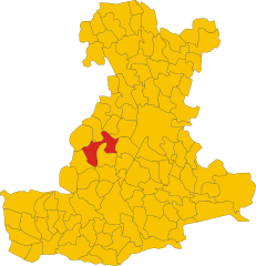
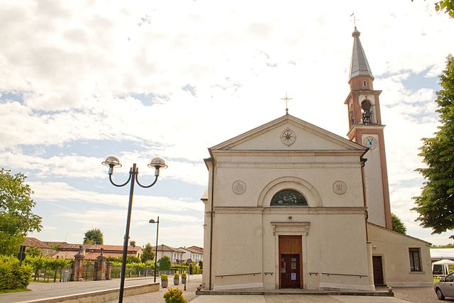
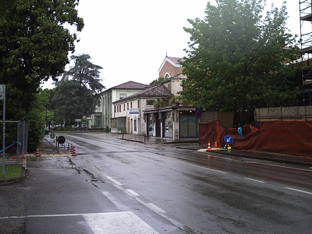
Saccolongo (Saccolongo)
- Italian comune
Saccolongo is a small town located in the Veneto region of Italy, known for its picturesque landscapes and proximity to the beautiful Euganean Hills (Colli Euganei). Hiking in and around Saccolongo can be a rewarding experience, offering a mix of gentle slopes, scenic views, and opportunities to explore the local flora and fauna.
Hiking Trails:
-
Euganean Hills Regional Park: This park offers several well-marked trails that vary in difficulty. You can find paths that lead you through forests, vineyards, and charming villages. Popular destinations include Monte Venda, the highest peak in the range, and the picturesque village of Arquà Petrarca.
-
Saccolongo to Monte di Rovolon: This hike offers moderate difficulty and provides stunning views of the surrounding hills. The trail takes you through lush vegetation and gives you a chance to experience the local wildlife.
-
Vigolana Trail: This trail connects Saccolongo to nearby towns and offers a combination of natural beauty and cultural sites. Along the way, you'll encounter vineyards and perhaps stop for a tasting at one of the local wineries.
What to Bring:
- Proper Footwear: Sturdy hiking shoes are essential as some trails can be rocky or uneven.
- Water and Snacks: Staying hydrated is crucial, especially during warmer months.
- Map or GPS: While trails are marked, a map or app can help keep you oriented.
- Sunscreen and Bug Spray: Depending on the season, you may want to protect yourself from sun exposure and insects.
Safety Tips:
- Check Weather Conditions: Be aware of the forecast and plan accordingly.
- Stay on Marked Trails: To preserve the natural environment and ensure personal safety, stick to designated paths.
- Hike in Groups: If possible, hike with others for safety and companionship.
Local Highlights:
While hiking, take the opportunity to enjoy local attractions such as:
- Historic Villages: Explore charming towns like Abano Terme and Montegrotto Terme, known for their thermal baths.
- Local Cuisine: Consider stopping at a trattoria to sample regional dishes and wines post-hike.
Hiking in Saccolongo and the surrounding Euganean Hills offers a unique blend of nature, culture, and adventure, making it a delightful destination for outdoor enthusiasts. Enjoy your hiking experience!
- Country:

- Postal Code: 35030
- Local Dialing Code: 049
- Licence Plate Code: PD
- Coordinates: 45° 24' 0" N, 11° 45' 0" E


- GPS tracks (wikiloc): [Link]
- AboveSeaLevel: 19 м m
- Area: 13.8 sq km
- Population: 4945
- Web site: http://www.comune.saccolongo.pd.it
- Wikipedia en: wiki(en)
- Wikipedia: wiki(it)
- Wikidata storage: Wikidata: Q34439
- Wikipedia Commons Category: [Link]
- Freebase ID: [/m/0gk56p]
- GeoNames ID: Alt: [6541009]
- VIAF ID: Alt: [240125613]
- OSM relation ID: [44911]
- GND ID: Alt: [7566421-5]
- MusicBrainz area ID: [68a88378-13c5-4fc3-b5e5-69744ce43ce5]
- UN/LOCODE: [ITSCQ]
- ISTAT ID: 028073
- Italian cadastre code: H655
Shares border with regions:
Rubano
- Italian comune
Rubano is a charming town located in the Veneto region of Italy, near the city of Padua. While it may not be widely recognized for its hiking trails, there are several beautiful opportunities for outdoor enthusiasts in the surrounding areas....
- Country:

- Postal Code: 35030
- Local Dialing Code: 049
- Licence Plate Code: PD
- Coordinates: 45° 26' 0" N, 11° 47' 0" E


- GPS tracks (wikiloc): [Link]
- AboveSeaLevel: 16 м m
- Area: 14.51 sq km
- Population: 16448
- Web site: [Link]
Cervarese Santa Croce
- Italian comune
 Hiking in Cervarese Santa Croce
Cervarese Santa Croce is a charming municipality in the province of Padua, Italy, nestled at the foot of the Euganean Hills. This area offers a variety of hiking opportunities, set against a backdrop of beautiful landscapes, rolling hills, and lush greenery....
- Country:

- Postal Code: 35030
- Local Dialing Code: 049
- Licence Plate Code: PD
- Coordinates: 45° 24' 11" N, 11° 41' 32" E


- GPS tracks (wikiloc): [Link]
- AboveSeaLevel: 30 м m
- Area: 17.71 sq km
- Population: 5779
- Web site: [Link]


Teolo
- Italian comune
Teolo is a charming town located in the Veneto region of Italy, situated near the Euganean Hills, which are known for their beautiful landscapes, rich history, and diverse flora and fauna. Hiking in Teolo offers a variety of trails and paths that cater to different skill levels and preferences....
- Country:

- Postal Code: 35037
- Local Dialing Code: 049
- Licence Plate Code: PD
- Coordinates: 45° 21' 0" N, 11° 40' 0" E


- GPS tracks (wikiloc): [Link]
- AboveSeaLevel: 175 м m
- Area: 31.2 sq km
- Population: 9014
- Web site: [Link]
Mestrino
- Italian comune
Mestrino, a charming town located in the Veneto region of Italy, offers several opportunities for hiking enthusiasts to explore the picturesque landscapes of the area. While Mestrino itself might not be known for extensive hiking trails, its proximity to various natural parks and the beautiful countryside makes it an excellent base for outdoor activities....
- Country:

- Postal Code: 35035
- Local Dialing Code: 049
- Licence Plate Code: PD
- Coordinates: 45° 27' 0" N, 11° 46' 0" E


- GPS tracks (wikiloc): [Link]
- AboveSeaLevel: 20 м m
- Area: 19.22 sq km
- Population: 11502
- Web site: [Link]


Veggiano
- Italian comune
Veggiano is a small town located in the Veneto region of Italy, not far from the city of Padua. While it may not be a famous hiking destination, the surrounding area offers several opportunities for outdoor activities, including hiking....
- Country:

- Postal Code: 35030
- Local Dialing Code: 049
- Licence Plate Code: PD
- Coordinates: 45° 27' 0" N, 11° 43' 0" E


- GPS tracks (wikiloc): [Link]
- AboveSeaLevel: 21 м m
- Area: 16.41 sq km
- Population: 4765
- Web site: [Link]


Selvazzano Dentro
- Italian comune
Selvazzano Dentro is located in the province of Padua in Italy, and while it may not be a well-known hiking destination compared to larger national parks or mountainous regions, there are opportunities for outdoor activities and hiking in the surrounding areas....
- Country:

- Postal Code: 35030
- Local Dialing Code: 049
- Licence Plate Code: PD
- Coordinates: 45° 23' 0" N, 11° 47' 0" E


- GPS tracks (wikiloc): [Link]
- AboveSeaLevel: 18 м m
- Area: 19.52 sq km
- Population: 22903
- Web site: [Link]
