Saint-Égrève (Saint-Égrève)
- commune in Isère, France
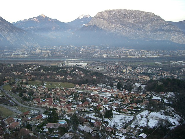
Saint-Égrève is a commune located in the Isère department in the Auvergne-Rhône-Alpes region of southeastern France, close to the city of Grenoble. It offers a variety of hiking opportunities for outdoor enthusiasts, particularly due to its proximity to the breathtaking Chartreuse and Vercors mountains.
Hiking Highlights in Saint-Égrève
-
Natural Surroundings: Saint-Égrève is surrounded by stunning mountain landscapes, forests, and rivers, making it an ideal location for hiking. The area is rich in biodiversity and offers picturesque views.
-
Trails: There are numerous trails suitable for all levels of hikers. From easy, family-friendly paths to more challenging routes for experienced hikers, you can find trails that cater to your level of fitness and experience. Many trails are well-marked and maintained.
-
Nearby Protected Areas: The nearby Regional Natural Park of Chartreuse offers even more extensive hiking options. You can explore various ecosystems, including limestone cliffs, dense forests, and alpine meadows, along with numerous trails that differ in difficulty.
-
Cultural and Historical Sites: The region is home to historical sites and monasteries, which can add an interesting cultural aspect to your hikes. Exploring these sites can provide insights into the local history and traditions.
-
Seasonal Hiking: The best time for hiking in the area typically spans from late spring to early fall, when the weather is milder, and the trails are more accessible. Winter hiking is also possible, but proper gear and experience in snow conditions will be necessary.
Tips for Hiking in Saint-Égrève
- Preparation: Always check the weather forecast before heading out and dress appropriately. Wear sturdy hiking boots and bring plenty of water and snacks.
- Map and Navigation: While many trails are marked, it's a good idea to carry a map or use a GPS device. Popular hiking apps can also help you stay oriented.
- Respect Nature: Follow Leave No Trace principles to minimize your impact on the environment. Stay on marked trails and respect wildlife.
- Safety: Inform someone of your hiking plans and expected return time. If you're hiking in more isolated areas, consider going with a partner or group.
Whether you're looking for a leisurely stroll or a vigorous hike, Saint-Égrève and its surroundings offer diverse options for enjoying the natural beauty of this region in France.
- Country:

- Postal Code: 38120
- Coordinates: 45° 13' 54" N, 5° 40' 59" E


- GPS tracks (wikiloc): [Link]
- AboveSeaLevel: 202 м m
- Area: 10.88 sq km
- Population: 15738
- Web site: http://www.saint-egreve.fr
- Wikipedia en: wiki(en)
- Wikipedia: wiki(fr)
- Wikidata storage: Wikidata: Q1069745
- Wikipedia Commons Category: [Link]
- Freebase ID: [/m/03g_55d]
- GeoNames ID: Alt: [6616671]
- SIREN number: [213803828]
- BnF ID: [15258192x]
- PACTOLS thesaurus ID: [pcrtZZPZKh7haj]
- INSEE municipality code: 38382
Shares border with regions:


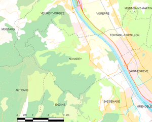
Noyarey
- commune in Isère, France
Noyarey is a charming commune located in the Auvergne-Rhône-Alpes region of France, near the city of Saint-Egrève and the beautiful landscape of the Chartreuse Mountains. Hiking in Noyarey and its surrounding areas offers a variety of trails with stunning views of the mountains and valleys. Here are some key points to consider when hiking in Noyarey:...
- Country:

- Postal Code: 38360
- Coordinates: 45° 14' 37" N, 5° 37' 53" E


- GPS tracks (wikiloc): [Link]
- Area: 16.86 sq km
- Population: 2257
- Web site: [Link]


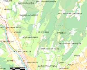
Quaix-en-Chartreuse
- commune in Isère, France
Hiking in Quaix-en-Chartreuse, located in the Chartreuse mountain range of France, offers stunning landscapes, diverse trails, and a rich natural heritage. Here are some key highlights for hikers in the area:...
- Country:

- Postal Code: 38950
- Coordinates: 45° 15' 10" N, 5° 43' 7" E


- GPS tracks (wikiloc): [Link]
- AboveSeaLevel: 525 м m
- Area: 18.09 sq km
- Population: 906
- Web site: [Link]


Grenoble
- commune in Isère, France
Grenoble, situated at the foot of the French Alps, is an excellent base for hiking enthusiasts. The surrounding mountains and natural landscapes offer a diverse range of trails suitable for all experience levels, from leisurely walks to challenging hikes. Here are some key highlights and recommendations for hiking in the Grenoble area:...
- Country:

- Postal Code: 38100; 38000
- Local Dialing Code: 476
- Coordinates: 45° 11' 13" N, 5° 43' 35" E


- GPS tracks (wikiloc): [Link]
- AboveSeaLevel: 212 м m
- Area: 18.13 sq km
- Population: 160649
- Web site: [Link]


Proveysieux
- commune in Isère, France
Proveysieux is a charming village located in the Grenoble area of the French Alps. It's a fantastic destination for hiking enthusiasts looking to explore the natural beauty of the region. Here are some key points about hiking in Proveysieux:...
- Country:

- Postal Code: 38120
- Coordinates: 45° 15' 46" N, 5° 41' 58" E


- GPS tracks (wikiloc): [Link]
- Area: 20.37 sq km
- Population: 503


Fontanil-Cornillon
- commune in Isère, France
Fontanil-Cornillon, located near Grenoble in the Auvergne-Rhône-Alpes region of France, offers a variety of hiking opportunities for outdoor enthusiasts. The area is characterized by its beautiful landscapes, charming villages, and proximity to the Chartreuse Mountains and the Vercors Regional Natural Park....
- Country:

- Postal Code: 38120
- Coordinates: 45° 15' 20" N, 5° 39' 55" E


- GPS tracks (wikiloc): [Link]
- Area: 5.5 sq km
- Population: 2735
- Web site: [Link]


Saint-Martin-le-Vinoux
- commune in Isère, France
 Hiking in Saint-Martin-le-Vinoux
Saint-Martin-le-Vinoux is a charming commune in the Isère department of southeastern France, located near Grenoble. It offers a variety of hiking opportunities, thanks to its proximity to the stunning Vercors Regional Natural Park and the Alps....
- Country:

- Postal Code: 38950
- Coordinates: 45° 12' 11" N, 5° 42' 59" E


- GPS tracks (wikiloc): [Link]
- Area: 10.06 sq km
- Population: 5751
- Web site: [Link]


Sassenage
- commune in Isère, France
Sassenage, located near the city of Grenoble in the Auvergne-Rhône-Alpes region of France, offers a variety of hiking opportunities that cater to different skill levels and interests. The region is characterized by its stunning natural landscapes, including limestone cliffs, lush forests, and panoramic views of the surrounding mountains, particularly the Vercors Massif....
- Country:

- Postal Code: 38360
- Coordinates: 45° 12' 18" N, 5° 39' 54" E


- GPS tracks (wikiloc): [Link]
- Area: 13.31 sq km
- Population: 11659
- Web site: [Link]
