Sassenage (Sassenage)
- commune in Isère, France
Sassenage, located near the city of Grenoble in the Auvergne-Rhône-Alpes region of France, offers a variety of hiking opportunities that cater to different skill levels and interests. The region is characterized by its stunning natural landscapes, including limestone cliffs, lush forests, and panoramic views of the surrounding mountains, particularly the Vercors Massif.
Popular Hiking Trails in Sassenage:
-
Gorges de la Bourne: This is a spectacular gorge that allows for thrilling hikes along the river. The trail offers beautiful views of the cliffs and the river below, making it a fantastic spot for both casual hikers and those looking for more adventure.
-
Sentier des Pères: This trail runs through the forest and is suitable for families. It's an easier hike where you can enjoy the local flora and fauna. The path is well marked and is perfect for a leisurely stroll or a picnic.
-
Vercors Regional Natural Park: Just a short distance from Sassenage, this park offers an extensive network of trails ranging from easy to challenging. The trails provide access to unique terrains, caves, and viewpoints.
-
Col de la Bataille: For those seeking a more strenuous hike, this route leads to higher elevations and offers breathtaking views of the surrounding mountains. The trail can be steep in sections, so good physical condition and proper gear are recommended.
Things to Consider:
-
Weather: Check the weather conditions before heading out, as they can change rapidly in the mountains. Dressing in layers and carrying rain gear can be beneficial.
-
Preparation: Ensure you have enough water, snacks, and a map or GPS device. Although many trails are well-marked, it’s always good to be prepared.
-
Hiking Season: The best times for hiking in Sassenage are late spring through early autumn when the weather is mild and the trails are accessible. Winter hiking may require snow-specific gear.
-
Local Wildlife: Keep an eye out for local wildlife, including various bird species, deer, and other animals. It’s essential to respect their habitats and maintain a safe distance.
-
Respect Nature: Follow the Leave No Trace principles to help preserve the natural beauty of the area.
Conclusion:
Hiking in Sassenage provides an excellent opportunity to explore the outdoor beauty of the French Alps. Whether you're looking for a leisurely walk or a challenging trek, there’s something for everyone. Just remember to equip yourself appropriately, respect nature, and enjoy the stunning views!
- Country:

- Postal Code: 38360
- Coordinates: 45° 12' 18" N, 5° 39' 54" E


- GPS tracks (wikiloc): [Link]
- Area: 13.31 sq km
- Population: 11659
- Web site: http://www.sassenage.fr
- Wikipedia en: wiki(en)
- Wikipedia: wiki(fr)
- Wikidata storage: Wikidata: Q694818
- Wikipedia Commons Category: [Link]
- Freebase ID: [/m/03g_54c]
- GeoNames ID: Alt: [2975908]
- SIREN number: [213804743]
- BnF ID: [152582806]
- VIAF ID: Alt: [237465395]
- GND ID: Alt: [4712767-3]
- INSEE municipality code: 38474
Shares border with regions:


Saint-Égrève
- commune in Isère, France
Saint-Égrève is a commune located in the Isère department in the Auvergne-Rhône-Alpes region of southeastern France, close to the city of Grenoble. It offers a variety of hiking opportunities for outdoor enthusiasts, particularly due to its proximity to the breathtaking Chartreuse and Vercors mountains....
- Country:

- Postal Code: 38120
- Coordinates: 45° 13' 54" N, 5° 40' 59" E


- GPS tracks (wikiloc): [Link]
- AboveSeaLevel: 202 м m
- Area: 10.88 sq km
- Population: 15738
- Web site: [Link]


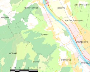
Noyarey
- commune in Isère, France
Noyarey is a charming commune located in the Auvergne-Rhône-Alpes region of France, near the city of Saint-Egrève and the beautiful landscape of the Chartreuse Mountains. Hiking in Noyarey and its surrounding areas offers a variety of trails with stunning views of the mountains and valleys. Here are some key points to consider when hiking in Noyarey:...
- Country:

- Postal Code: 38360
- Coordinates: 45° 14' 37" N, 5° 37' 53" E


- GPS tracks (wikiloc): [Link]
- Area: 16.86 sq km
- Population: 2257
- Web site: [Link]


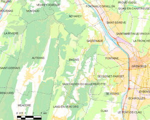
Engins
- commune in Isère, France
Hiking in the Écrins National Park, located in the French Alps, offers stunning landscapes, diverse wildlife, and a variety of trails suitable for all levels of hikers. The park features high alpine peaks, glaciers, valleys, and lush meadows, making it a paradise for outdoor enthusiasts....
- Country:

- Postal Code: 38360
- Coordinates: 45° 10' 52" N, 5° 37' 0" E


- GPS tracks (wikiloc): [Link]
- Area: 20.64 sq km
- Population: 473
- Web site: [Link]


Grenoble
- commune in Isère, France
Grenoble, situated at the foot of the French Alps, is an excellent base for hiking enthusiasts. The surrounding mountains and natural landscapes offer a diverse range of trails suitable for all experience levels, from leisurely walks to challenging hikes. Here are some key highlights and recommendations for hiking in the Grenoble area:...
- Country:

- Postal Code: 38100; 38000
- Local Dialing Code: 476
- Coordinates: 45° 11' 13" N, 5° 43' 35" E


- GPS tracks (wikiloc): [Link]
- AboveSeaLevel: 212 м m
- Area: 18.13 sq km
- Population: 160649
- Web site: [Link]


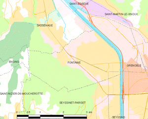
Fontaine
- commune in Isère, France
Fontaine, located in the Isère department in southeastern France, is a great starting point for various hiking adventures, especially for those who enjoy the natural beauty of the Grenoble area. Here are some key highlights and tips for hiking in Fontaine:...
- Country:

- Postal Code: 38600
- Coordinates: 45° 11' 35" N, 5° 41' 5" E


- GPS tracks (wikiloc): [Link]
- AboveSeaLevel: 210 м m
- Area: 6.74 sq km
- Population: 22516
- Web site: [Link]

