Saint-Anthème (Saint-Anthème)
- commune in Puy-de-Dôme, France
- Country:

- Postal Code: 63660
- Coordinates: 45° 31' 40" N, 3° 55' 2" E


- GPS tracks (wikiloc): [Link]
- Area: 68.89 sq km
- Population: 703
- Wikipedia en: wiki(en)
- Wikipedia: wiki(fr)
- Wikidata storage: Wikidata: Q268786
- Wikipedia Commons Category: [Link]
- Freebase ID: [/m/03ql1vh]
- SIREN number: [216303198]
- BnF ID: [152696697]
- VIAF ID: Alt: [236026462]
- INSEE municipality code: 63319
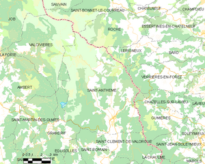
Shares border with regions:


Grandrif
- commune in Puy-de-Dôme, France
- Country:

- Postal Code: 63600
- Coordinates: 45° 30' 18" N, 3° 49' 2" E


- GPS tracks (wikiloc): [Link]
- Area: 22.15 sq km
- Population: 178


Bard
- commune in Loire, France
- Country:

- Postal Code: 42600
- Coordinates: 45° 35' 15" N, 4° 0' 41" E


- GPS tracks (wikiloc): [Link]
- Area: 13.78 sq km
- Population: 654


Lérigneux
- commune in Loire, France
- Country:

- Postal Code: 42600
- Coordinates: 45° 36' 3" N, 3° 57' 54" E


- GPS tracks (wikiloc): [Link]
- Area: 9.76 sq km
- Population: 147


Saint-Bonnet-le-Courreau
- commune in Loire, France
- Country:

- Postal Code: 42940
- Coordinates: 45° 39' 37" N, 3° 56' 38" E


- GPS tracks (wikiloc): [Link]
- Area: 50.18 sq km
- Population: 699
- Web site: [Link]


Gumières
- commune in Loire, France
- Country:

- Postal Code: 42560
- Coordinates: 45° 31' 52" N, 3° 59' 14" E


- GPS tracks (wikiloc): [Link]
- Area: 16.12 sq km
- Population: 323


Verrières-en-Forez
- commune in Loire, France
- Country:

- Postal Code: 42600
- Coordinates: 45° 34' 15" N, 3° 59' 48" E


- GPS tracks (wikiloc): [Link]
- Area: 21.17 sq km
- Population: 683
Saint-Clément-de-Valorgue
- commune in Puy-de-Dôme, France
- Country:

- Postal Code: 63660
- Coordinates: 45° 30' 1" N, 3° 55' 19" E


- GPS tracks (wikiloc): [Link]
- AboveSeaLevel: 919 м m
- Area: 13.37 sq km
- Population: 229
- Web site: [Link]


Roche
- commune in Loire, France
- Country:

- Postal Code: 42600
- Coordinates: 45° 36' 52" N, 3° 56' 43" E


- GPS tracks (wikiloc): [Link]
- Area: 23.33 sq km
- Population: 263
- Web site: [Link]
Saint-Romain
- commune in Puy-de-Dôme, France
- Country:

- Postal Code: 63660
- Coordinates: 45° 29' 23" N, 3° 53' 43" E


- GPS tracks (wikiloc): [Link]
- Area: 16.05 sq km
- Population: 216


Valcivières
- commune in Puy-de-Dôme, France
- Country:

- Postal Code: 63600
- Coordinates: 45° 35' 32" N, 3° 47' 44" E


- GPS tracks (wikiloc): [Link]
- Area: 32.96 sq km
- Population: 209
