Saint-Bernard (Saint-Bernard)

- commune in Isère, France
 Hiking in Saint-Bernard
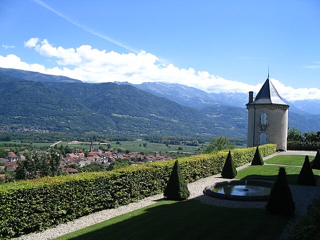
Hiking in Saint-Bernard, Isère, offers numerous trails and breathtaking views that showcase the stunning landscape of the French Alps. The region is characterized by its diverse terrain, which includes mountains, forests, and valleys that provide a variety of hiking experiences for all skill levels.
Notable Trails and Areas
-
Col de Saint-Bernard: This is a beautiful area with various paths that lead to panoramic viewpoints. The route can vary in difficulty, providing options for both easier walks and more challenging hikes.
-
La Chartreuse Regional Nature Park: Located near Saint-Bernard, this park is home to numerous well-maintained trails that are suitable for hiking. The park has marked paths that guide hikers through lush forests and up to high-altitude vistas.
-
Merchants' Pathways: Explore historic pathways used by local merchants. These trails often lead to stunning viewpoints and provide a glimpse into the region's cultural heritage.
-
Lac de la Frette: This scenic lake can be reached via several hiking paths, making it a great destination for a day hike. The area around the lake is perfect for picnicking and enjoying nature.
Tips for Hiking in Saint-Bernard
-
Season Considerations: Spring and summer are the most popular seasons for hiking. In the winter, the area may have snow, which can make trails more challenging and require additional gear.
-
Gear Up: Always wear proper hiking boots and carry enough water, snacks, a first aid kit, and navigation tools (map or GPS).
-
Mark your trails: Trails are marked with signs and can vary from easy to difficult, so be sure to choose a trail that matches your experience level.
-
Respect Nature: Stay on marked paths, pack out what you pack in, and protect the natural beauty of the area.
-
Local Regulations: Familiarize yourself with any local regulations or restrictions, especially if you're hiking through protected areas.
Accommodations and Accessibility
Saint-Bernard and its surrounding areas offer a range of accommodations, from campsites to hotels, making it easy to find a place to stay after a day of hiking. The region is also accessible by public transport, especially from nearby towns within the Isère region.
Whether you are an experienced hiker or a beginner looking to enjoy the natural beauty of the Alps, Saint-Bernard has something to offer for everyone. Just remember to plan your hikes according to your ability and the weather conditions!
- Country:

- Postal Code: 38660
- Coordinates: 45° 19' 46" N, 5° 54' 12" E


- GPS tracks (wikiloc): [Link]
- Area: 21.59 sq km
- Population: 623
- Web site: http://www.petites-roches.org
- Wikipedia en: wiki(en)
- Wikipedia: wiki(fr)
- Wikidata storage: Wikidata: Q652260
- Wikipedia Commons Category: [Link]
- Freebase ID: [/m/03nw7m3]
- GeoNames ID: Alt: [2981388]
- SIREN number: [213803679]
- BnF ID: [15258178c]
- INSEE municipality code: 38367
Shares border with regions:


Saint-Pierre-d'Entremont
- commune in Isère, France
Hiking in Saint-Pierre-d'Entremont
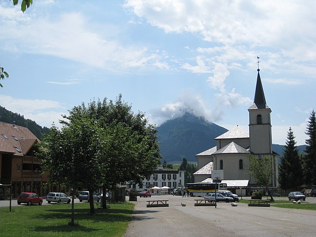
Saint-Pierre-d'Entremont, located in the Isère department of the Auvergne-Rhône-Alpes region in France, is a picturesque village surrounded by the Chartreuse mountains. It offers a variety of hiking opportunities that cater to different skill levels and preferences. Here are some highlights of hiking in this beautiful area:...
- Country:
- Postal Code: 73670
- Coordinates: 45° 24' 55" N, 5° 51' 14" E
- GPS tracks (wikiloc): [Link]
- Area: 32.31 sq km
- Population: 557
- Web site: [Link]

Le Touvet
- commune in Isère, France
Hiking in Le Touvet
Le Touvet is a charming village located in the French Alps, near the Belledonne mountain range, making it an excellent destination for hiking enthusiasts. The area offers a variety of trails that cater to different skill levels, from easy walks suitable for families to more challenging treks for experienced hikers....
- Country:
- Postal Code: 38660
- Coordinates: 45° 21' 27" N, 5° 56' 53" E
- GPS tracks (wikiloc): [Link]
- Area: 11.56 sq km
- Population: 3231
- Web site: [Link]

Saint-Pierre-de-Chartreuse
- commune in Isère, France
Hiking in Saint-Pierre-de-Chartreuse
Saint-Pierre-de-Chartreuse is a picturesque village located in the Chartreuse Mountains, in the Auvergne-Rhône-Alpes region of France. It's a popular destination for outdoor enthusiasts, particularly hikers, due to its stunning landscapes, diverse trails, and rich natural heritage. Here are some highlights and tips for hiking in this beautiful area:...
- Country:
- Postal Code: 38380
- Coordinates: 45° 20' 33" N, 5° 48' 56" E
- GPS tracks (wikiloc): [Link]
- Area: 80.12 sq km
- Population: 1028
- Web site: [Link]


Saint-Hilaire
- commune in Isère, France
Hiking in Saint-Hilaire
Saint-Hilaire, located in the Isère department of the Auvergne-Rhône-Alpes region in southeastern France, is a popular destination for hiking and outdoor activities. The area is renowned for its stunning landscapes, featuring a mix of mountains, forests, and scenic viewpoints, making it a fantastic spot for all levels of hikers....
- Country:
- Postal Code: 38660
- Coordinates: 45° 18' 34" N, 5° 53' 14" E
- GPS tracks (wikiloc): [Link]
- Area: 8.61 sq km
- Population: 1348
- Web site: [Link]


Sainte-Marie-du-Mont
- commune in Isère, France
Hiking in Sainte-Marie-du-Mont
Sainte-Marie-du-Mont is a charming village located in the Isère department of the Auvergne-Rhône-Alpes region in southeastern France. This area is known for its stunning natural landscapes and variety of outdoor activities, making it a great destination for hiking enthusiasts....
- Country:
- Postal Code: 38660
- Coordinates: 45° 24' 22" N, 5° 56' 44" E
- GPS tracks (wikiloc): [Link]
- Area: 23.87 sq km
- Population: 237
- Web site: [Link]


La Terrasse
- commune in Isère, France
Hiking in La Terrasse
La Terrasse is a charming town in the Auvergne-Rhône-Alpes region of France, known for its picturesque landscapes and access to various hiking trails. Here are some aspects to consider if you're planning to hike in La Terrasse:...
- Country:
- Postal Code: 38660
- Coordinates: 45° 19' 25" N, 5° 55' 52" E
- GPS tracks (wikiloc): [Link]
- Area: 9.47 sq km
- Population: 2567
- Web site: [Link]