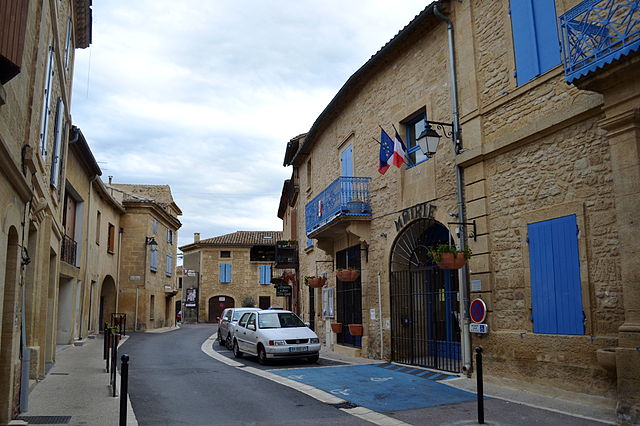
Saint-Bonnet-du-Gard (Saint-Bonnet-du-Gard)

- commune in Gard, France
- Country:

- Postal Code: 30210
- Coordinates: 43° 55' 37" N, 4° 32' 43" E


- GPS tracks (wikiloc): [Link]
- Area: 6.84 sq km
- Population: 852
- Web site: http://www.saintbonnetdugard.fr
- Wikipedia en: wiki(en)
- Wikipedia: wiki(fr)
- Wikidata storage: Wikidata: Q377042
- Wikipedia Commons Category: [Link]
- Freebase ID: [/m/03c7x1z]
- GeoNames ID: Alt: [6431387]
- SIREN number: [213002355]
- BnF ID: [152548759]
- VIAF ID: Alt: [158524226]
- PACTOLS thesaurus ID: [pcrtZmT0qPubl3]
- SUDOC authorities ID: [086213636]
- INSEE municipality code: 30235
Shares border with regions:


Remoulins
- commune in Gard, France
- Country:
- Postal Code: 30210
- Coordinates: 43° 56' 22" N, 4° 33' 50" E
- GPS tracks (wikiloc): [Link]
- AboveSeaLevel: 6 м m
- Area: 8.24 sq km
- Population: 2325
- Web site: [Link]

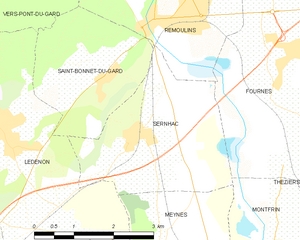
Sernhac
- commune in Gard, France
- Country:
- Postal Code: 30210
- Coordinates: 43° 54' 41" N, 4° 33' 7" E
- GPS tracks (wikiloc): [Link]
- Area: 8.93 sq km
- Population: 1718
- Web site: [Link]


Lédenon
- commune in Gard, France
- Country:
- Postal Code: 30210
- Coordinates: 43° 54' 55" N, 4° 30' 33" E
- GPS tracks (wikiloc): [Link]
- Area: 19.44 sq km
- Population: 1514
- Web site: [Link]

Vers-Pont-du-Gard
- commune in Gard, France
- Country:
- Postal Code: 30210
- Coordinates: 43° 58' 7" N, 4° 31' 28" E
- GPS tracks (wikiloc): [Link]
- AboveSeaLevel: 52 м m
- Area: 19.14 sq km
- Population: 1871
- Web site: [Link]