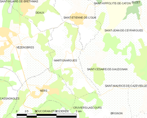
Saint-Césaire-de-Gauzignan (Saint-Césaire-de-Gauzignan)

- commune in Gard, France
- Country:

- Postal Code: 30360
- Coordinates: 44° 1' 47" N, 4° 12' 18" E


- GPS tracks (wikiloc): [Link]
- Area: 6.84 sq km
- Population: 377
- Wikipedia en: wiki(en)
- Wikipedia: wiki(fr)
- Wikidata storage: Wikidata: Q243908
- Wikipedia Commons Category: [Link]
- Freebase ID: [/m/03c7x19]
- GeoNames ID: Alt: [6431390]
- SIREN number: [213002405]
- BnF ID: [15254880w]
- INSEE municipality code: 30240
Shares border with regions:

Martignargues
- commune in Gard, France
- Country:
- Postal Code: 30360
- Coordinates: 44° 2' 41" N, 4° 10' 41" E
- GPS tracks (wikiloc): [Link]
- Area: 4.93 sq km
- Population: 419
Brignon
- commune in Gard, France
- Country:
- Postal Code: 30190
- Coordinates: 43° 59' 19" N, 4° 12' 50" E
- GPS tracks (wikiloc): [Link]
- Area: 6.67 sq km
- Population: 785
- Web site: [Link]
Saint-Jean-de-Ceyrargues
- commune in Gard, France
- Country:
- Postal Code: 30360
- Coordinates: 44° 3' 5" N, 4° 13' 37" E
- GPS tracks (wikiloc): [Link]
- Area: 6.65 sq km
- Population: 157


Saint-Maurice-de-Cazevieille
- commune in Gard, France
- Country:
- Postal Code: 30360
- Coordinates: 44° 1' 55" N, 4° 13' 58" E
- GPS tracks (wikiloc): [Link]
- Area: 13.15 sq km
- Population: 706


Castelnau-Valence
- commune in Gard, France
- Country:
- Postal Code: 30190
- Coordinates: 44° 0' 32" N, 4° 15' 7" E
- GPS tracks (wikiloc): [Link]
- AboveSeaLevel: 150 м m
- Area: 10.27 sq km
- Population: 440


Cruviers-Lascours
- commune in Gard, France
- Country:
- Postal Code: 30360
- Coordinates: 44° 0' 14" N, 4° 12' 16" E
- GPS tracks (wikiloc): [Link]
- Area: 5.51 sq km
- Population: 700
- Web site: [Link]
Saint-Étienne-de-l'Olm
- commune in Gard, France
- Country:
- Postal Code: 30360
- Coordinates: 44° 3' 31" N, 4° 11' 4" E
- GPS tracks (wikiloc): [Link]
- AboveSeaLevel: 120 м m
- Area: 4.18 sq km
- Population: 362