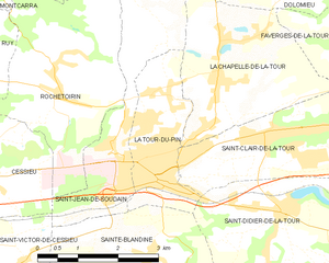
Saint-Clair-de-la-Tour (Saint-Clair-de-la-Tour)

- commune in Isère, France
 Hiking in Saint-Clair-de-la-Tour
Saint-Clair-de-la-Tour, located in the Auvergne-Rhône-Alpes region of France, offers some beautiful hiking opportunities amid its scenic landscapes. Here are some highlights if you're considering hiking in the area:
Trails and Terrain
-
Variety of Trails: The region offers a mix of trails suitable for all levels, from gentle walks to more challenging hikes. You'll find well-marked paths that navigate through forests, fields, and hills.
-
Natural Beauty: The trails often feature beautiful views of the surrounding countryside, including rolling hills and lush greenery, especially in the spring and summer months.
Notable Hikes
-
Plaines and Woodlands: Explore trails that wind through the diverse ecosystem of forests and open fields. Keep an eye out for local wildlife and unique plant species.
-
Mont Pilat: While a bit further afield, Mont Pilat is accessible and offers more demanding hikes for those seeking an adventure. The panoramic views from the summit are stunning, making it well worth the effort.
Accessibility and Facilities
-
Trailheads: Most trailheads are easily accessible from the village, and some may have parking available.
-
Information: Look for local maps or signage that provide details about the trails, including difficulty levels and estimated times.
Tips for Hiking in Saint-Clair-de-la-Tour
-
Dress Appropriately: Weather can change quickly, so wear layers and appropriate footwear.
-
Stay Hydrated and Energized: Bring water and snacks, especially for longer hikes.
-
Respect Nature: Follow Leave No Trace principles, and stay on marked paths to preserve the natural environment.
-
Local Wildlife: Be aware of the local wildlife, and maintain a respectful distance if you encounter any animals.
Best Time to Go
The best time for hiking in the area is generally from late spring to early autumn, when the weather is mild, and the scenery is at its most vibrant. Autumn can also be a beautiful time to hike, with the changing colors of the leaves.
Overall, Saint-Clair-de-la-Tour offers a great mix of natural beauty and accessible trails for hikers of all skill levels. Whether you're looking for a leisurely walk or a more challenging trek, you'll find enjoyable options in this charming region of France.
- Country:

- Postal Code: 38110
- Coordinates: 45° 34' 26" N, 5° 28' 55" E


- GPS tracks (wikiloc): [Link]
- Area: 9.24 sq km
- Population: 3365
- Web site: http://www.stclairdelatour.com
- Wikipedia en: wiki(en)
- Wikipedia: wiki(fr)
- Wikidata storage: Wikidata: Q1068148
- Wikipedia Commons Category: [Link]
- Freebase ID: [/m/03nvh_n]
- GeoNames ID: Alt: [6433334]
- SIREN number: [213803778]
- BnF ID: [15258187b]
- INSEE municipality code: 38377
Shares border with regions:


La Chapelle-de-la-Tour
- commune in Isère, France
Hiking in La Chapelle-de-la-Tour
La Chapelle-de-la-Tour is a charming commune located in the Isère department in the Auvergne-Rhône-Alpes region of southeastern France. The area is known for its beautiful landscapes, making it an excellent spot for hiking enthusiasts. Here are some highlights to consider when hiking in and around La Chapelle-de-la-Tour:...
- Country:
- Postal Code: 38110
- Coordinates: 45° 35' 7" N, 5° 27' 47" E
- GPS tracks (wikiloc): [Link]
- Area: 9.04 sq km
- Population: 1757
- Web site: [Link]


Saint-Didier-de-la-Tour
- commune in Isère, France
Hiking in Saint-Didier-de-la-Tour
Saint-Didier-de-la-Tour is a charming commune located in the Isère department of the Auvergne-Rhône-Alpes region in southeastern France. The area is characterized by its natural beauty, including rolling hills, lush greenery, and proximity to the mountains, making it a great spot for hiking enthusiasts....
- Country:
- Postal Code: 38110
- Coordinates: 45° 33' 19" N, 5° 28' 59" E
- GPS tracks (wikiloc): [Link]
- Area: 14.63 sq km
- Population: 2003
- Web site: [Link]


La Bâtie-Montgascon
- commune in Isère, France
Hiking in La Bâtie-Montgascon
La Bâtie-Montgascon is a charming village located in the Auvergne-Rhône-Alpes region of France, near the foothills of the Alps. The area is rich with natural beauty and offers various hiking opportunities for outdoor enthusiasts....
- Country:
- Postal Code: 38110
- Coordinates: 45° 34' 45" N, 5° 31' 41" E
- GPS tracks (wikiloc): [Link]
- Area: 8.43 sq km
- Population: 1890
- Web site: [Link]

La Tour-du-Pin
- commune in Isère, France
Hiking in La Tour-du-Pin
La Tour-du-Pin is a charming town located in the Isère department of the Auvergne-Rhône-Alpes region in southeastern France. Its proximity to the French Alps and various natural parks makes it an excellent spot for hiking enthusiasts....
- Country:
- Postal Code: 38110
- Coordinates: 45° 33' 57" N, 5° 26' 42" E
- GPS tracks (wikiloc): [Link]
- Area: 4.77 sq km
- Population: 7970
- Web site: [Link]