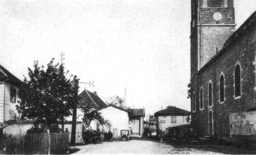
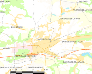
La Tour-du-Pin (La Tour-du-Pin)
- commune in Isère, France
La Tour-du-Pin is a charming town located in the Isère department of the Auvergne-Rhône-Alpes region in southeastern France. Its proximity to the French Alps and various natural parks makes it an excellent spot for hiking enthusiasts.
Hiking Opportunities
-
Surrounding Natural Areas:
- The area around La Tour-du-Pin offers a variety of trails suitable for different skill levels. The Chartreuse Mountains and the Vercors Regional Natural Park are not far away and feature stunning landscapes, diverse flora, and fauna, and well-marked hiking paths.
-
Popular Trails:
- Tour de la Chartreuse: This trail offers stunning views and covers a variety of terrains. It's a multi-day trek that can give you an immersive experience of the Chartreuse Mountains.
- Vercors Trails: The Vercors offers numerous options, from easier walks to more challenging hikes that often include dramatic cliffs and panoramic views.
-
Local Trails:
- There are several local paths around La Tour-du-Pin that can be explored, perfect for a day hike. These often meander through the countryside, allowing hikers to enjoy the scenic beauty of the region.
Practical Information
-
Best Time to Hike: Generally, spring (April to June) and fall (September to October) are the best times to hike in this region, as temperatures are mild and the landscape is vibrant.
-
Hiking Gear: Proper hiking gear is essential. Make sure to wear sturdy hiking boots, bring a map or GPS device, and pack enough water and snacks. Depending on the season, layers to adapt to changing weather are advisable.
-
Local Guides and Tours: If you're unfamiliar with the area or trail conditions, consider hiring a local guide or joining a guided tour. They can provide insights into the terrain and the local ecology.
Cultural Aspects
- Aside from the hikes, La Tour-du-Pin itself has a rich cultural heritage, including historical architecture and local cuisine. Don't miss the chance to explore the town's markets and eateries after a long day of hiking.
Safety Tips
- Always check the weather before heading out and inform someone about your hiking plans.
- Stay on marked trails and respect local wildlife.
- Carry a first aid kit and know basic safety protocols for hiking.
Hiking around La Tour-du-Pin can be a rewarding experience for nature lovers and adventurers, offering a mix of challenging trails and relaxing walks amid beautiful scenery. Enjoy your hikes!
- Country:

- Postal Code: 38110
- Coordinates: 45° 33' 57" N, 5° 26' 42" E


- GPS tracks (wikiloc): [Link]
- Area: 4.77 sq km
- Population: 7970
- Web site: http://www.latourdupin.fr
- Wikipedia en: wiki(en)
- Wikipedia: wiki(fr)
- Wikidata storage: Wikidata: Q217591
- Wikipedia Commons Category: [Link]
- Freebase ID: [/m/08sgms]
- GeoNames ID: Alt: [6455957]
- SIREN number: [213805096]
- BnF ID: [152583109]
- VIAF ID: Alt: [143227605]
- Library of Congress authority ID: Alt: [n95061211]
- MusicBrainz area ID: [0f0736ad-b59f-41bc-9c62-941b26886732]
- INSEE municipality code: 38509
Shares border with regions:


La Chapelle-de-la-Tour
- commune in Isère, France
 Hiking in La Chapelle-de-la-Tour
La Chapelle-de-la-Tour is a charming commune located in the Isère department in the Auvergne-Rhône-Alpes region of southeastern France. The area is known for its beautiful landscapes, making it an excellent spot for hiking enthusiasts. Here are some highlights to consider when hiking in and around La Chapelle-de-la-Tour:...
- Country:

- Postal Code: 38110
- Coordinates: 45° 35' 7" N, 5° 27' 47" E


- GPS tracks (wikiloc): [Link]
- Area: 9.04 sq km
- Population: 1757
- Web site: [Link]


Saint-Didier-de-la-Tour
- commune in Isère, France
 Hiking in Saint-Didier-de-la-Tour
Saint-Didier-de-la-Tour is a charming commune located in the Isère department of the Auvergne-Rhône-Alpes region in southeastern France. The area is characterized by its natural beauty, including rolling hills, lush greenery, and proximity to the mountains, making it a great spot for hiking enthusiasts....
- Country:

- Postal Code: 38110
- Coordinates: 45° 33' 19" N, 5° 28' 59" E


- GPS tracks (wikiloc): [Link]
- Area: 14.63 sq km
- Population: 2003
- Web site: [Link]


Saint-Clair-de-la-Tour
- commune in Isère, France
 Hiking in Saint-Clair-de-la-Tour
Saint-Clair-de-la-Tour, located in the Auvergne-Rhône-Alpes region of France, offers some beautiful hiking opportunities amid its scenic landscapes. Here are some highlights if you're considering hiking in the area:...
- Country:

- Postal Code: 38110
- Coordinates: 45° 34' 26" N, 5° 28' 55" E


- GPS tracks (wikiloc): [Link]
- Area: 9.24 sq km
- Population: 3365
- Web site: [Link]


Sainte-Blandine
- commune in Isère, France
Sainte-Blandine, located in the Isère department of the Auvergne-Rhône-Alpes region in southeastern France, is a charming village surrounded by beautiful natural landscapes ideal for hiking enthusiasts. Here are some highlights and tips for hiking in the area:...
- Country:

- Postal Code: 38110
- Coordinates: 45° 32' 48" N, 5° 26' 26" E


- GPS tracks (wikiloc): [Link]
- Area: 9.21 sq km
- Population: 963


Saint-Jean-de-Soudain
- commune in Isère, France
 Hiking in Saint-Jean-de-Soudain
Saint-Jean-de-Soudain is a picturesque village located in the Isère department of the Auvergne-Rhône-Alpes region in southeastern France. It's an excellent base for hikers looking to explore the natural landscapes and mountainous terrain nearby....
- Country:

- Postal Code: 38110
- Coordinates: 45° 34' 21" N, 5° 25' 44" E


- GPS tracks (wikiloc): [Link]
- Area: 7.48 sq km
- Population: 1572
- Web site: [Link]
