canton of La Tour-du-Pin (canton de La Tour-du-Pin)

- canton of France
 Hiking in canton of La Tour-du-Pin
The Canton of La Tour-du-Pin, located in the Isère department of the Auvergne-Rhône-Alpes region in southeastern France, is a beautiful area for hiking enthusiasts. The region features a mix of varied landscapes, including rolling hills, forests, and the foothills of the Alps, making it suitable for hikers of all levels.
Hiking Opportunities:
-
Scenic Trails: There are numerous marked trails in and around La Tour-du-Pin that offer varying levels of difficulty. The paths are often well-maintained, and you can experience stunning views of the surrounding countryside and the nearby mountains.
-
Natural Parks: The nearby Chartreuse and Vercors Regional Natural Parks provide excellent hiking opportunities. These parks boast a more rugged terrain and offer trails that lead you through pristine nature.
-
Historical Sites: Hiking through the Canton also allows you to discover historical landmarks and charming villages. The area is rich in culture and history, with many trails leading to ancient ruins and local architecture.
-
The Balconies of the Rhône: A popular hiking spot in this region provides breathtaking views of the Rhône Valley. It's a great choice for both day hikes and longer treks.
Tips for Hiking in La Tour-du-Pin:
-
Check Trail Conditions: It’s wise to check local maps, guides, and trail conditions before setting out, especially in varying weather conditions.
-
Pack Essentials: Always bring plenty of water, snacks, appropriate clothing, and hiking boots to ensure a comfortable and safe experience.
-
Wildlife Awareness: Be cautious of wildlife and respect the natural habitat. This region is home to various plants and animals that should be preserved.
-
Local Resources: The local tourist office can provide information about organized hikes, guided tours, and detailed maps of the trails. They can be great resources for discovering new routes.
-
Seasonal Considerations: Spring and autumn are generally the best seasons for hiking in this region, as the temperatures are mild and the landscapes are particularly beautiful.
Whether you are looking for a leisurely walk through the countryside or a challenging trek in the mountains, the Canton of La Tour-du-Pin has something to offer every hiker. Enjoy your adventure!
- Country:

- Capital: La Tour-du-Pin
- Coordinates: 45° 34' 18" N, 5° 26' 30" E


- GPS tracks (wikiloc): [Link]
- Population: 35955
- Wikipedia en: wiki(en)
- Wikipedia: wiki(fr)
- Wikidata storage: Wikidata: Q590027
- INSEE canton code: [3824]
Includes regions:


Cessieu
- commune in Isère, France
Hiking in Cessieu
Cessieu is a charming commune located in the Auvergne-Rhône-Alpes region of France, nestled between the Rhône River and the foothills of the Alps. Although it may not be as widely recognized as some other hiking destinations, it offers various opportunities for outdoor enthusiasts....
- Country:
- Postal Code: 38110
- Coordinates: 45° 34' 0" N, 5° 22' 36" E
- GPS tracks (wikiloc): [Link]
- Area: 14.35 sq km
- Population: 2886
- Web site: [Link]


La Chapelle-de-la-Tour
- commune in Isère, France
Hiking in La Chapelle-de-la-Tour
La Chapelle-de-la-Tour is a charming commune located in the Isère department in the Auvergne-Rhône-Alpes region of southeastern France. The area is known for its beautiful landscapes, making it an excellent spot for hiking enthusiasts. Here are some highlights to consider when hiking in and around La Chapelle-de-la-Tour:...
- Country:
- Postal Code: 38110
- Coordinates: 45° 35' 7" N, 5° 27' 47" E
- GPS tracks (wikiloc): [Link]
- Area: 9.04 sq km
- Population: 1757
- Web site: [Link]

Vignieu
- commune in Isère, France
Hiking in Vignieu
Vignieu is a charming commune located in the Isère department in the Auvergne-Rhône-Alpes region of southeastern France. While it might not be as well-known as some other hiking destinations in France, it offers picturesque landscapes and a range of outdoor activities that can cater to hikers of various skill levels....
- Country:
- Postal Code: 38890
- Coordinates: 45° 37' 41" N, 5° 25' 29" E
- GPS tracks (wikiloc): [Link]
- Area: 9.4 sq km
- Population: 1033
- Web site: [Link]


Saint-Didier-de-la-Tour
- commune in Isère, France
Hiking in Saint-Didier-de-la-Tour
Saint-Didier-de-la-Tour is a charming commune located in the Isère department of the Auvergne-Rhône-Alpes region in southeastern France. The area is characterized by its natural beauty, including rolling hills, lush greenery, and proximity to the mountains, making it a great spot for hiking enthusiasts....
- Country:
- Postal Code: 38110
- Coordinates: 45° 33' 19" N, 5° 28' 59" E
- GPS tracks (wikiloc): [Link]
- Area: 14.63 sq km
- Population: 2003
- Web site: [Link]


Saint-Clair-de-la-Tour
- commune in Isère, France
Hiking in Saint-Clair-de-la-Tour
Saint-Clair-de-la-Tour, located in the Auvergne-Rhône-Alpes region of France, offers some beautiful hiking opportunities amid its scenic landscapes. Here are some highlights if you're considering hiking in the area:...
- Country:
- Postal Code: 38110
- Coordinates: 45° 34' 26" N, 5° 28' 55" E
- GPS tracks (wikiloc): [Link]
- Area: 9.24 sq km
- Population: 3365
- Web site: [Link]

Sainte-Blandine
- commune in Isère, France
Hiking in Sainte-Blandine
Sainte-Blandine, located in the Isère department of the Auvergne-Rhône-Alpes region in southeastern France, is a charming village surrounded by beautiful natural landscapes ideal for hiking enthusiasts. Here are some highlights and tips for hiking in the area:...
- Country:
- Postal Code: 38110
- Coordinates: 45° 32' 48" N, 5° 26' 26" E
- GPS tracks (wikiloc): [Link]
- Area: 9.21 sq km
- Population: 963

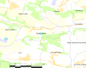
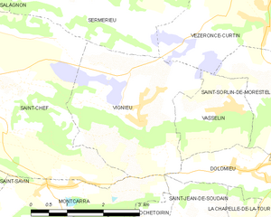
Montcarra
- commune in Isère, France
Hiking in Montcarra
Montcarra, located in the Isère department of southeastern France, is a beautiful area known for its scenic landscapes and outdoor activities. While it may not be as widely recognized as some of the larger national parks in the Alps, it offers a variety of hiking opportunities that can cater to different skill levels and preferences....
- Country:
- Postal Code: 38890
- Coordinates: 45° 36' 47" N, 5° 23' 29" E
- GPS tracks (wikiloc): [Link]
- Area: 4.9 sq km
- Population: 519
- Web site: [Link]


Faverges-de-la-Tour
- commune in Isère, France
Hiking in Faverges-de-la-Tour
Faverges-de-la-Tour, located in the Isère department in the Auvergne-Rhône-Alpes region of France, offers a range of hiking opportunities that showcase the natural beauty of the surrounding area. The region is characterized by its picturesque landscapes, including hills, woodlands, and stunning views of the nearby mountains....
- Country:
- Postal Code: 38110
- Coordinates: 45° 35' 28" N, 5° 31' 25" E
- GPS tracks (wikiloc): [Link]
- Area: 7.67 sq km
- Population: 1330
- Web site: [Link]

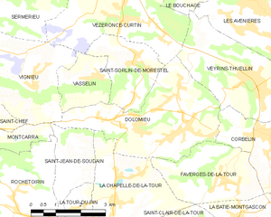
Dolomieu
- commune in Isère, France
Hiking in Dolomieu
Hiking in Dolomieu, Isère can be a wonderful experience, offering stunning landscapes and diverse trails. While Dolomieu is a small town, it is surrounded by natural beauty and is close to the Vercors and Chartreuse mountain ranges, which provide a variety of hiking opportunities....
- Country:
- Postal Code: 38110
- Coordinates: 45° 36' 39" N, 5° 29' 57" E
- GPS tracks (wikiloc): [Link]
- Area: 13.32 sq km
- Population: 3079
- Web site: [Link]

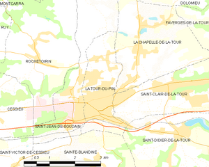
La Tour-du-Pin
- commune in Isère, France
Hiking in La Tour-du-Pin
La Tour-du-Pin is a charming town located in the Isère department of the Auvergne-Rhône-Alpes region in southeastern France. Its proximity to the French Alps and various natural parks makes it an excellent spot for hiking enthusiasts....
- Country:
- Postal Code: 38110
- Coordinates: 45° 33' 57" N, 5° 26' 42" E
- GPS tracks (wikiloc): [Link]
- Area: 4.77 sq km
- Population: 7970
- Web site: [Link]

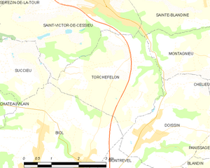
Torchefelon
- commune in Isère, France
Hiking in Torchefelon
Torchefelon is a beautiful destination for hiking, located in the Savoie region of the French Alps. The area is known for its stunning landscapes, with a mix of rugged mountain terrain, lush valleys, and alpine meadows. Here are some highlights and tips for hiking in Torchefelon:...
- Country:
- Postal Code: 38690
- Coordinates: 45° 31' 13" N, 5° 24' 1" E
- GPS tracks (wikiloc): [Link]
- Area: 8.68 sq km
- Population: 708
- Web site: [Link]


Montagnieu
- commune in Isère, France
Hiking in Montagnieu
Montagnieu, located in the department of Isère in the Auvergne-Rhône-Alpes region of France, offers a variety of hiking options that showcase the natural beauty of the surrounding landscapes. Here are some key points about hiking in this area:...
- Country:
- Postal Code: 38110
- Coordinates: 45° 31' 27" N, 5° 27' 9" E
- GPS tracks (wikiloc): [Link]
- Area: 8.83 sq km
- Population: 1023


Saint-Jean-de-Soudain
- commune in Isère, France
Hiking in Saint-Jean-de-Soudain
Saint-Jean-de-Soudain is a picturesque village located in the Isère department of the Auvergne-Rhône-Alpes region in southeastern France. It's an excellent base for hikers looking to explore the natural landscapes and mountainous terrain nearby....
- Country:
- Postal Code: 38110
- Coordinates: 45° 34' 21" N, 5° 25' 44" E
- GPS tracks (wikiloc): [Link]
- Area: 7.48 sq km
- Population: 1572
- Web site: [Link]

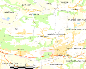
Rochetoirin
- commune in Isère, France
Hiking in Rochetoirin
Rochetoirin, located in the Auvergne-Rhône-Alpes region of France, is a charming destination for hiking enthusiasts. Nestled near the foothills of the Chartreuse Mountains, the area offers a variety of natural landscapes, from rolling hills to picturesque forests, and a glimpse of local flora and fauna....
- Country:
- Postal Code: 38110
- Coordinates: 45° 34' 54" N, 5° 25' 5" E
- GPS tracks (wikiloc): [Link]
- Area: 10.62 sq km
- Population: 1115
- Web site: [Link]

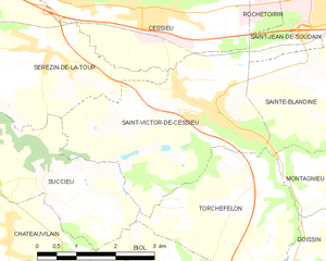
Saint-Victor-de-Cessieu
- commune in Isère, France
Hiking in Saint-Victor-de-Cessieu
Saint-Victor-de-Cessieu is a charming commune located in the Isère department of France, nestled near the beautiful landscape of the Rhône-Alpes region. The area is known for its picturesque views, rolling hills, and diverse flora and fauna, making it an appealing destination for hiking enthusiasts....
- Country:
- Postal Code: 38110
- Coordinates: 45° 32' 27" N, 5° 23' 29" E
- GPS tracks (wikiloc): [Link]
- Area: 12.22 sq km
- Population: 2209
- Web site: [Link]