Saint-Marcel (Saint-Marcel)

- commune in Indre, France
- Country:

- Postal Code: 36200
- Coordinates: 46° 36' 7" N, 1° 30' 50" E


- GPS tracks (wikiloc): [Link]
- Area: 17.84 sq km
- Population: 1583
- Web site: http://www.saint-marcel36.com/Agendasaintmarcel.html
- Wikipedia en: wiki(en)
- Wikipedia: wiki(fr)
- Wikidata storage: Wikidata: Q750517
- Wikipedia Commons Category: [Link]
- Freebase ID: [/m/03nvc1j]
- GeoNames ID: Alt: [6432978]
- SIREN number: [213602006]
- BnF ID: [15257504p]
- VIAF ID: Alt: [137650581]
- GND ID: Alt: [4324079-3]
- Library of Congress authority ID: Alt: [nr94012988]
- PACTOLS thesaurus ID: [pcrtftFSGkKPr9]
- SUDOC authorities ID: [086136518]
- INSEE municipality code: 36200
Shares border with regions:
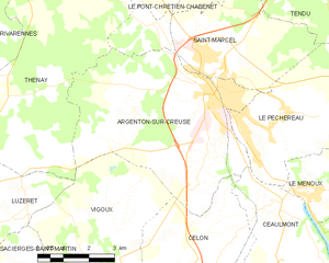
Argenton-sur-Creuse
- commune in Indre, France
- Country:
- Postal Code: 36200
- Coordinates: 46° 35' 20" N, 1° 31' 9" E
- GPS tracks (wikiloc): [Link]
- Area: 29.34 sq km
- Population: 4954
- Web site: [Link]


Thenay
- commune in Indre, France
- Country:
- Postal Code: 36800
- Coordinates: 46° 37' 48" N, 1° 25' 44" E
- GPS tracks (wikiloc): [Link]
- Area: 34.21 sq km
- Population: 874

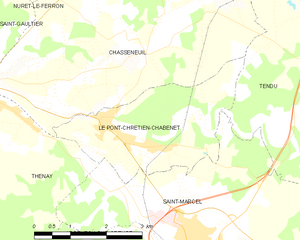
Le Pont-Chrétien-Chabenet
- commune in Indre, France
- Country:
- Postal Code: 36800
- Coordinates: 46° 37' 44" N, 1° 28' 49" E
- GPS tracks (wikiloc): [Link]
- Area: 9.03 sq km
- Population: 922
- Web site: [Link]


Le Pêchereau
- commune in Indre, France
- Country:
- Postal Code: 36200
- Coordinates: 46° 34' 41" N, 1° 32' 51" E
- GPS tracks (wikiloc): [Link]
- Area: 20.94 sq km
- Population: 1855
- Web site: [Link]


Tendu
- commune in Indre, France
- Country:
- Postal Code: 36200
- Coordinates: 46° 38' 39" N, 1° 33' 29" E
- GPS tracks (wikiloc): [Link]
- Area: 42.17 sq km
- Population: 648
- Web site: [Link]