canton of Argenton-sur-Creuse (canton d'Argenton-sur-Creuse)

- canton of France
- Country:

- Capital: Argenton-sur-Creuse
- Coordinates: 46° 35' 23" N, 1° 31' 12" E


- GPS tracks (wikiloc): [Link]
- Population: 18059
- Wikipedia en: wiki(en)
- Wikipedia: wiki(fr)
- Wikidata storage: Wikidata: Q890409
- Wikipedia Commons Category: [Link]
- INSEE canton code: [3602]
Includes regions:

Celon
- commune in Indre, France
- Country:
- Postal Code: 36200
- Coordinates: 46° 31' 7" N, 1° 29' 59" E
- GPS tracks (wikiloc): [Link]
- Area: 17.04 sq km
- Population: 408


Mosnay
- commune in Indre, France
- Country:
- Postal Code: 36200
- Coordinates: 46° 37' 19" N, 1° 37' 47" E
- GPS tracks (wikiloc): [Link]
- Area: 25.28 sq km
- Population: 481


Chavin
- commune in Indre, France
- Country:
- Postal Code: 36200
- Coordinates: 46° 33' 40" N, 1° 36' 39" E
- GPS tracks (wikiloc): [Link]
- Area: 14.01 sq km
- Population: 273
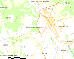
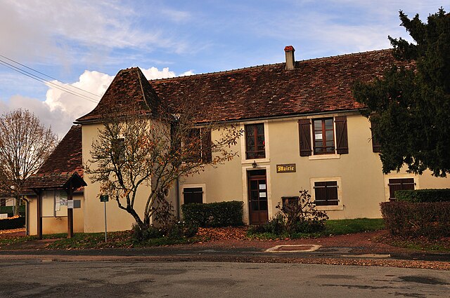
Argenton-sur-Creuse
- commune in Indre, France
- Country:
- Postal Code: 36200
- Coordinates: 46° 35' 20" N, 1° 31' 9" E
- GPS tracks (wikiloc): [Link]
- Area: 29.34 sq km
- Population: 4954
- Web site: [Link]


Chasseneuil
- commune in Indre, France
- Country:
- Postal Code: 36800
- Coordinates: 46° 38' 49" N, 1° 29' 46" E
- GPS tracks (wikiloc): [Link]
- Area: 29.85 sq km
- Population: 688

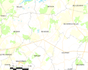
Bouesse
- commune in Indre, France
- Country:
- Postal Code: 36200
- Coordinates: 46° 36' 59" N, 1° 41' 16" E
- GPS tracks (wikiloc): [Link]
- Area: 24.19 sq km
- Population: 422

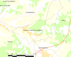
Le Pont-Chrétien-Chabenet
- commune in Indre, France
- Country:
- Postal Code: 36800
- Coordinates: 46° 37' 44" N, 1° 28' 49" E
- GPS tracks (wikiloc): [Link]
- Area: 9.03 sq km
- Population: 922
- Web site: [Link]


Le Pêchereau
- commune in Indre, France
- Country:
- Postal Code: 36200
- Coordinates: 46° 34' 41" N, 1° 32' 51" E
- GPS tracks (wikiloc): [Link]
- Area: 20.94 sq km
- Population: 1855
- Web site: [Link]


Tendu
- commune in Indre, France
- Country:
- Postal Code: 36200
- Coordinates: 46° 38' 39" N, 1° 33' 29" E
- GPS tracks (wikiloc): [Link]
- Area: 42.17 sq km
- Population: 648
- Web site: [Link]


Le Menoux
- commune in Indre, France
- Country:
- Postal Code: 36200
- Coordinates: 46° 33' 16" N, 1° 34' 11" E
- GPS tracks (wikiloc): [Link]
- Area: 5.58 sq km
- Population: 427


Saint-Marcel
- commune in Indre, France
- Country:
- Postal Code: 36200
- Coordinates: 46° 36' 7" N, 1° 30' 50" E
- GPS tracks (wikiloc): [Link]
- Area: 17.84 sq km
- Population: 1583
- Web site: [Link]