Saint-Marcellin (Saint-Marcellin)
- commune in Isère, France
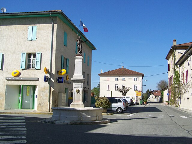
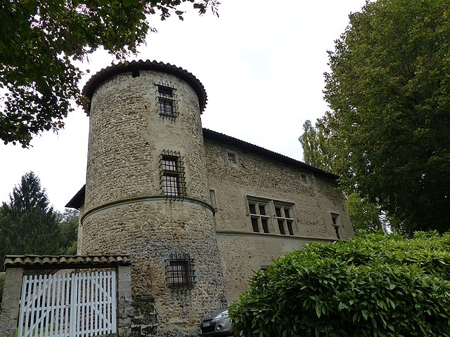
Saint-Marcellin, located in the Isère department of the Auvergne-Rhône-Alpes region in southeastern France, is surrounded by beautiful natural landscapes, making it an excellent destination for hiking enthusiasts. The area features a mix of rolling hills, lush forests, and stunning views of the Vercors and Chartreuse mountains.
Hiking Trails
Here are some popular hiking options surrounding Saint-Marcellin:
-
Vercors Regional Natural Park: Just a short drive away, this park offers a variety of trails ranging from easy walks to challenging hikes. Popular routes include those leading to the Grotte de la Borne, or up the Belvédère de l'Entreuve for panoramic views.
-
The Trail of Saint-Marcellin: This local trail takes you through the countryside, giving you a chance to explore the area’s vineyards and rural charm. It's suitable for families and less experienced hikers.
-
Col de la Machine: This hike offers stunning views and takes you through beautiful landscapes. The trail can be a bit challenging but rewards hikers with breathtaking panoramas of the surrounding mountain ranges.
-
Les Quatre Routes: A network of paths that connect various small villages in the area, offering a chance to experience the local culture and scenery.
Tips for Hiking in the Area
- Weather Considerations: The weather can change quickly in the mountains, so be sure to check the forecast and dress in layers. Even in summer, temperatures can drop in higher elevations.
- Navigation: It’s a good idea to have a map or a GPS device since some trails may not be well-marked.
- Equipment: Ensure you wear appropriate footwear and carry enough water and snacks. Some trails may be rugged, so good hiking boots are essential.
- Wildlife: Keep an eye out for local wildlife, including various bird species and possibly deer or chamois in the hills.
Local Culture
After a day of hiking, you can enjoy the local cuisine in Saint-Marcellin, which is known for its cheeses, particularly the Saint-Marcellin cheese. Don’t miss the chance to visit local markets for fresh produce and regional specialties.
Saint-Marcellin is a hidden gem for hikers, combining natural beauty with cultural experiences. Always make sure to respect nature and follow the Leave No Trace principles to preserve this beautiful area for future generations.
- Country:

- Postal Code: 38160
- Coordinates: 45° 9' 6" N, 5° 19' 11" E


- GPS tracks (wikiloc): [Link]
- AboveSeaLevel: 300 м m
- Area: 7.81 sq km
- Population: 8133
- Web site: http://www.saint-marcellin.fr
- Wikipedia en: wiki(en)
- Wikipedia: wiki(fr)
- Wikidata storage: Wikidata: Q521432
- Wikipedia Commons Category: [Link]
- Freebase ID: [/m/03g_5w1]
- GeoNames ID: Alt: [2978566]
- SIREN number: [213804164]
- BnF ID: [152582252]
- VIAF ID: Alt: [168764032]
- Library of Congress authority ID: Alt: [n81129745]
- SUDOC authorities ID: [035348860]
- YouTube channel ID: [UCaSFRYti6rAjV5Vmzjaib_A]
- INSEE municipality code: 38416
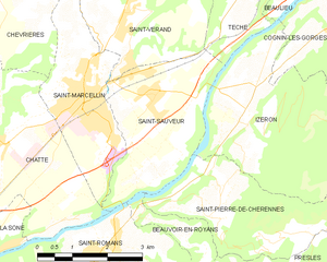
Shares border with regions:


Chevrières
- commune in Isère, France
Chevrières is a small village in the Isère department of the Auvergne-Rhône-Alpes region in southeastern France. While it may not be as well-known as some larger hiking destinations, it is surrounded by beautiful landscapes and offers opportunities for outdoor activities, including hiking....
- Country:

- Postal Code: 38160
- Coordinates: 45° 11' 15" N, 5° 17' 25" E


- GPS tracks (wikiloc): [Link]
- Area: 16.62 sq km
- Population: 710
- Web site: [Link]


Saint-Sauveur
- commune in Isère, France
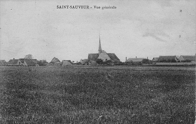
Saint-Sauveur is a charming village located in the Isère department of the Auvergne-Rhône-Alpes region in southeastern France. It's known for its beautiful natural landscapes, making it a great destination for hiking enthusiasts....
- Country:

- Postal Code: 38160
- Coordinates: 45° 9' 9" N, 5° 20' 31" E


- GPS tracks (wikiloc): [Link]
- Area: 9.42 sq km
- Population: 2100
- Web site: [Link]


Chatte
- commune in Isère, France
It seems like you might be referring to a location that could be spelled differently or may not be widely recognized as a hiking destination. If you meant "Chattahoochee" or other known areas, please clarify. However, if you are referring to a lesser-known area, here's a general guide on how to approach hiking in any location:...
- Country:

- Postal Code: 38160
- Coordinates: 45° 8' 37" N, 5° 16' 59" E


- GPS tracks (wikiloc): [Link]
- Area: 22.81 sq km
- Population: 2496
- Web site: [Link]


Saint-Vérand
- commune in Isère, France
Saint-Vérand is a charming village located in the Isère department of the Auvergne-Rhône-Alpes region in southeastern France. It is nestled in the foothills of the Alps and offers a variety of hiking opportunities that showcase the stunning natural landscapes of the area....
- Country:

- Postal Code: 38160
- Coordinates: 45° 10' 23" N, 5° 19' 54" E


- GPS tracks (wikiloc): [Link]
- AboveSeaLevel: 290 м m
- Area: 17.83 sq km
- Population: 1727
- Web site: [Link]

