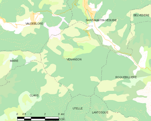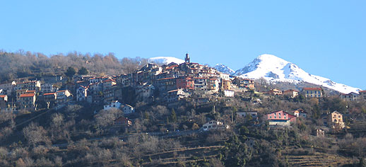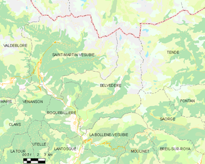
Saint-Martin-Vésubie (Saint-Martin-Vésubie)
- commune in Alpes-Maritimes, France
 Hiking in Saint-Martin-Vésubie
Saint-Martin-Vésubie is a picturesque village located in the Alpes-Maritimes department in the Provence-Alpes-Côte d'Azur region of France. It serves as an excellent base for hiking enthusiasts due to its proximity to the Mercantour National Park and stunning alpine landscapes. Here are some key highlights about hiking in this area:
1. :
Saint-Martin-Vésubie offers a variety of hiking trails that cater to all levels, from beginner-friendly walks to more challenging treks. The trails vary in length, difficulty, and scenery, making it an ideal spot for hikers of all abilities.
2. :
The park is renowned for its breathtaking landscapes, rich biodiversity, and stunning mountain views. Popular trails include:
- The Vallée des Merveilles: Known for its prehistoric rock engravings and unique rock formations, this area offers various routes that can lead you through dazzling natural settings.
- La Madone de Fenestre: A hike that takes you to a beautiful sanctuary with panoramic views of the surrounding peaks.
- The Mount Bounas Trail: A more strenuous hike that rewards you with spectacular vistas at the summit.
3. :
Hikers can expect to encounter diverse wildlife, including ibex, chamois, and numerous bird species. The region is also rich in flora, featuring alpine flowers, lush forests, and unique plant species.
4. :
While the summer months (June to September) are the most popular for hiking, early spring and late autumn can also provide excellent conditions, though winter hiking may require additional equipment like snowshoes for the snow-covered trails.
5. :
Before heading out, remember to:
- Check Trail Conditions: Always check the current trail conditions and weather forecasts.
- Wear Appropriate Gear: Strong hiking boots, weather-appropriate clothing, and carry plenty of water and snacks.
- Maps and Guides: It's advisable to carry a local hiking map or download a trail app to navigate the area effectively.
6. :
Saint-Martin-Vésubie has various accommodations, from hotels to campsites, as well as restaurants and shops where hikers can relax and replenish after a day of exploring.
7. :
For those who prefer guided experiences, several local companies offer hiking tours that can provide deeper insights into the area’s natural and cultural heritage.
Hiking in Saint-Martin-Vésubie can be a rewarding and exhilarating experience, promising breathtaking views and a connection with nature. Whether you're an experienced hiker or just starting, the area has something to offer to everyone.
- Country:

- Postal Code: 06450
- Coordinates: 44° 4' 6" N, 7° 15' 21" E


- GPS tracks (wikiloc): [Link]
- Area: 97.13 sq km
- Population: 1394
- Web site: http://www.saintmartinvesubie.fr
- Wikipedia en: wiki(en)
- Wikipedia: wiki(fr)
- Wikidata storage: Wikidata: Q375283
- Wikipedia Commons Category: [Link]
- SIREN number: [210601274]
- SIREN number: [210601274]
- VIAF ID: Alt: [264283506]
- VIAF ID: Alt: [264283506]
- OSM relation ID: [174523]
- OSM relation ID: [174523]
- archINFORM location ID: [4474]
- archINFORM location ID: [4474]
- Library of Congress authority ID: Alt: [n82130649]
- Library of Congress authority ID: Alt: [n82130649]
- PACTOLS thesaurus ID: [pcrtoIDzHK28MS]
- PACTOLS thesaurus ID: [pcrtoIDzHK28MS]
- INSEE municipality code: 06127
- INSEE municipality code: 06127
Shares border with regions:


Valdeblore
- commune in Alpes-Maritimes, France
Valdeblore is a beautiful valley located in the French Alps, in the Alpes-Maritimes department of the Provence-Alpes-Côte d'Azur region. It's known for its stunning landscapes, diverse flora and fauna, and excellent hiking opportunities. Here are some key points about hiking in Valdeblore:...
- Country:

- Postal Code: 06420
- Coordinates: 44° 4' 15" N, 7° 10' 16" E


- GPS tracks (wikiloc): [Link]
- AboveSeaLevel: 1050 м m
- Area: 94.16 sq km
- Population: 848
- Web site: [Link]


Venanson
- commune in Alpes-Maritimes, France
Venanson is a charming village located in the Alpes-Maritimes region of France, nestled in the heart of the Mercantour National Park. It offers breathtaking landscapes and a variety of hiking trails that cater to different skill levels. Here are some highlights for hiking in Venanson:...
- Country:

- Postal Code: 06450
- Coordinates: 44° 3' 11" N, 7° 15' 11" E


- GPS tracks (wikiloc): [Link]
- Area: 17.98 sq km
- Population: 155
- Web site: [Link]

Entracque
- Italian comune
Entracque is a picturesque village located in the Piedmont region of Italy, nestled in the stunning Maritime Alps. It's an excellent destination for hiking enthusiasts, offering a range of trails that cater to various skill levels, from beginners to advanced hikers. Here are some highlights of hiking in Entracque:...
- Country:

- Postal Code: 12010
- Local Dialing Code: 0171
- Licence Plate Code: CN
- Coordinates: 44° 14' 33" N, 7° 24' 0" E


- GPS tracks (wikiloc): [Link]
- AboveSeaLevel: 894 м m
- Area: 160.73 sq km
- Population: 848
- Web site: [Link]

Valdieri
- Italian comune
Valdieri is a picturesque town located in the Piedmont region of Italy, and it serves as an excellent gateway for hiking enthusiasts looking to explore the stunning landscapes of the Maritime Alps. Here are some highlights of hiking in Valdieri:...
- Country:

- Postal Code: 12010
- Local Dialing Code: 0171
- Licence Plate Code: CN
- Coordinates: 44° 17' 0" N, 7° 24' 0" E


- GPS tracks (wikiloc): [Link]
- AboveSeaLevel: 774 м m
- Area: 153.32 sq km
- Population: 932
- Web site: [Link]

Roquebillière
- commune in Alpes-Maritimes, France
Roquebillière is a charming village located in the Alpes-Maritimes department of the French Riviera, situated at the foot of the impressive Mercantour National Park. Hiking in and around Roquebillière offers a variety of trails with stunning views, diverse landscapes, and opportunities to encounter local flora and fauna....
- Country:

- Postal Code: 06450
- Coordinates: 44° 0' 40" N, 7° 18' 25" E


- GPS tracks (wikiloc): [Link]
- Area: 25.92 sq km
- Population: 1802
- Web site: [Link]


Belvédère
- commune in Alpes-Maritimes, France
Belvédère is a beautiful hiking destination that is often characterized by stunning views and diverse landscapes. Although the specifics can depend on which "Belvédère" you are referring to, as the name can be found in different locations around the world, I'll provide an overview of what you typically might expect when hiking in areas known by this name....
- Country:

- Postal Code: 06450
- Coordinates: 44° 0' 53" N, 7° 19' 16" E


- GPS tracks (wikiloc): [Link]
- Area: 75.41 sq km
- Population: 660
