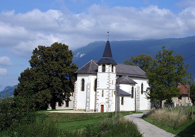
Saint-Maurice-de-Rotherens (Saint-Maurice-de-Rotherens)

- commune in Savoie, France
 Hiking in Saint-Maurice-de-Rotherens
Saint-Maurice-de-Rotherens is a lovely village located in the Savoie region of the French Alps. This area is rich in natural beauty, and it's an excellent destination for hiking enthusiasts. Here are some highlights and tips for hiking in and around Saint-Maurice-de-Rotherens:
Scenic Trails:
- Vineyards and Countryside: The region is known for its picturesque vineyards, and several trails meander through the countryside, offering stunning views of the rolling hills and grapevines.
- Alpine Trails: Close to the village, you can access trails that lead into the alpine regions. These trails often feature panoramic views of the surrounding mountains, including the Chartreuse and Bauges ranges.
- L’Espace Naturel Sensible des Gorges du Sierroz: This is a protected natural area nearby, offering trails that explore unique geological formations, diverse flora, and fauna.
Difficulty Levels:
- Beginner: Many gentle trails suitable for families and less experienced hikers can be found.
- Intermediate to Advanced: There are more challenging hikes that may require proper gear and experience, especially if you plan to venture into higher altitudes.
Best Times to Hike:
- Spring (April to June): The trails are less crowded, and wildflowers are in full bloom.
- Summer (July to August): Perfect for hiking, but expect more fellow hikers and tourists.
- Fall (September to October): The foliage displays stunning autumn colors, making for beautiful scenery.
- Winter: While hiking is possible, ensure you have the right winter gear, as snow can make trails challenging.
Preparation Tips:
- Check Weather Conditions: The weather can change rapidly in the Alps, so be prepared for unpredictable conditions.
- Hydration and Snacks: Always carry enough water and energy snacks.
- Maps and Navigation: While trails may be marked, it’s a good idea to have a map or a GPS device handy.
- Appropriate Gear: Sturdy hiking boots, comfortable clothing, and possibly trekking poles can enhance your hiking experience.
Local Amenities:
- The village may have small shops or cafes where you can purchase supplies or enjoy local delicacies post-hike. Check for any seasonal tourist information centers that can provide additional guidance on trails and current conditions.
Overall, hiking in and around Saint-Maurice-de-Rotherens promises to be a refreshing and scenic experience in the heart of the French Alps. Enjoy your outdoor adventure!
- Country:

- Postal Code: 73240
- Coordinates: 45° 37' 16" N, 5° 41' 55" E


- GPS tracks (wikiloc): [Link]
- Area: 8.17 sq km
- Population: 214
- Wikipedia en: wiki(en)
- Wikipedia: wiki(fr)
- Wikidata storage: Wikidata: Q746245
- Wikipedia Commons Category: [Link]
- Freebase ID: [/m/03qln16]
- GeoNames ID: Alt: [6442889]
- SIREN number: [217302603]
- BnF ID: [152741911]
- INSEE municipality code: 73260
Shares border with regions:

Saint-Pierre-d'Alvey
- commune in Savoie, France
Hiking in Saint-Pierre-d'Alvey
Saint-Pierre-d'Alvey is a picturesque commune located in the Savoie department in the Auvergne-Rhône-Alpes region of France. The area is characterized by its beautiful natural landscapes, making it a great destination for hiking enthusiasts....
- Country:
- Postal Code: 73170
- Coordinates: 45° 37' 48" N, 5° 44' 33" E
- GPS tracks (wikiloc): [Link]
- Area: 7.7 sq km
- Population: 273


Sainte-Marie-d'Alvey
- commune in Savoie, France
Hiking in Sainte-Marie-d'Alvey
Sainte-Marie-d'Alvey is a charming commune located in the Auvergne-Rhône-Alpes region of France. It’s not as well-known for hiking as some larger areas, but it offers beautiful landscapes and trails for those looking to enjoy nature. Here are some aspects to consider when hiking in Sainte-Marie-d'Alvey:...
- Country:
- Postal Code: 73240
- Coordinates: 45° 35' 36" N, 5° 43' 14" E
- GPS tracks (wikiloc): [Link]
- Area: 2.61 sq km
- Population: 120


Loisieux
- commune in Savoie, France
Hiking in Loisieux
Loisieux is a picturesque village located in the Auvergne-Rhône-Alpes region of France, surrounded by stunning natural landscapes that make it an excellent base for hiking enthusiasts. While specific trails in Loisieux may not be widely known, the general area offers a variety of hiking opportunities suited to different skill levels....
- Country:
- Postal Code: 73170
- Coordinates: 45° 39' 5" N, 5° 44' 6" E
- GPS tracks (wikiloc): [Link]
- Area: 9.33 sq km
- Population: 197


Gerbaix
- commune in Savoie, France
Hiking in Gerbaix
Gerbaix is a picturesque region located in the French Alps, known for its stunning landscapes and a variety of hiking trails that cater to different skill levels. Here are some key points regarding hiking in Gerbaix:...
- Country:
- Postal Code: 73470
- Coordinates: 45° 36' 35" N, 5° 44' 49" E
- GPS tracks (wikiloc): [Link]
- Area: 6.91 sq km
- Population: 370


Gresin
- commune in Savoie, France
Hiking in Gresin
Gresin, located in the Aosta Valley region of Italy, is a wonderful destination for hiking enthusiasts. The area offers stunning mountainous landscapes, lush valleys, and a plethora of trails suitable for various skill levels....
- Country:
- Postal Code: 73240
- Coordinates: 45° 36' 36" N, 5° 40' 57" E
- GPS tracks (wikiloc): [Link]
- Area: 5.01 sq km
- Population: 387


Champagneux
- commune in Savoie, France
Hiking in Champagneux
Champagneux is a charming village located in the Savoie region of the French Alps, offering stunning natural landscapes, rich biodiversity, and a variety of hiking trails suitable for different skill levels. Here are some highlights to consider when hiking in Champagneux:...
- Country:
- Postal Code: 73240
- Coordinates: 45° 37' 44" N, 5° 40' 26" E
- GPS tracks (wikiloc): [Link]
- Area: 10.68 sq km
- Population: 679