canton of Saint-Genix-sur-Guiers (canton de Saint-Genix-sur-Guiers)
- canton of France
 Hiking in canton of Saint-Genix-sur-Guiers
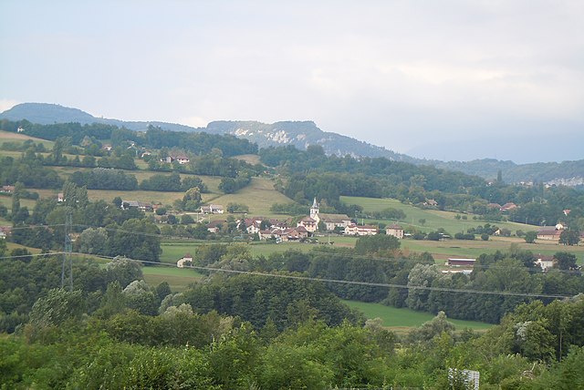
Canton de Saint-Genix-sur-Guiers is a picturesque region located in the Savoie department of France, nestled in the heart of the Chartreuse and Bauges mountain ranges. This area offers a variety of hiking opportunities, showcasing beautiful natural scenery, diverse landscapes, and rich cultural heritage.
Hiking Highlights in Canton de Saint-Genix-sur-Guiers:
-
Scenic Trails: The region is characterized by its varied terrain, including rolling hills, forested areas, and alpine meadows. Trails often feature stunning views of the surrounding mountains and valleys, making it a fantastic region for both casual walkers and more serious hikers.
-
Accessible Routes: Many trails are well-marked and cater to different skill levels, from easy walks suitable for families to challenging hikes for experienced trekkers. The nearby Mount Granier provides a moderate challenge with rewarding panoramas.
-
Flora and Fauna: Hikers can enjoy diverse flora and fauna, including wildflowers in the spring and various bird species throughout the year. Keep an eye out for local wildlife, which can include deer and other alpine animals.
-
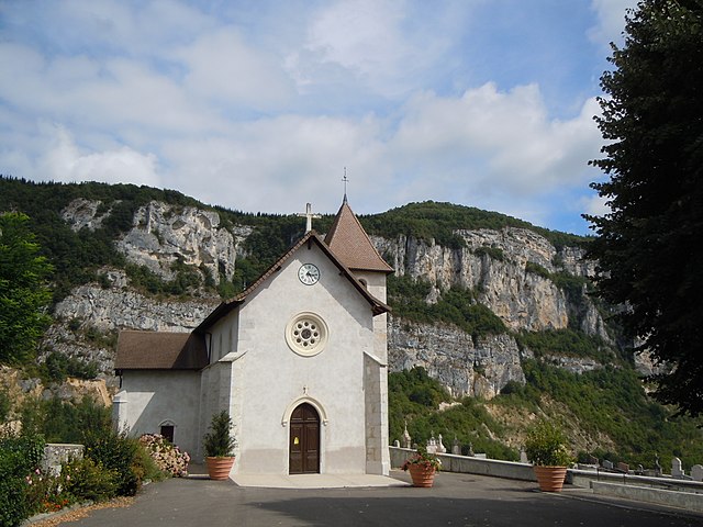
Cultural Experience: As you hike, you can explore charming villages and historic sites. Saint-Genix-sur-Guiers itself has a rich history, and you might discover local churches, traditional farms, and regional cuisine.
-
Access to Lakes: The nearby lakes, such as Lake Paladru and Lake Aiguebelette, offer opportunities for swimming, picnicking, and relaxing after a day of hiking.
-
Safety and Preparation: When hiking in this region, it's always a good idea to be prepared. Check local weather conditions, wear appropriate footwear, and carry enough water and snacks. It’s advisable to have a map or a GPS device since some trails might not have cell service.
Recommended Hiking Routes:
- Sentier des Caves: A relatively easy trail that allows you to discover local cave formations.
- Tour du Mont Granier: A more demanding hike that circles Mont Granier and provides breathtaking views from the summit.
- Les Balcons de Chartreuse: A scenic route that offers panoramic views across the Chartreuse mountains.
Best Time to Visit:
The best times for hiking in Canton de Saint-Genix-sur-Guiers are typically late spring through early fall (May to October) when the weather is mild, and the vegetation is at its most vibrant.
Always remember to respect nature by following Leave No Trace principles and enjoy your adventure in this beautiful region!
- Country:

- Capital: Saint-Genix-sur-Guiers
- Coordinates: 45° 36' 3" N, 5° 42' 36" E


- GPS tracks (wikiloc): [Link]
- Area: 80.0 sq km
- Wikidata storage: Wikidata: Q1785590
- INSEE canton code: [7324]
Includes regions:


Rochefort
- commune in Savoie, France
Rochefort is a charming village located in the Savoie region of the French Alps, which is known for its stunning alpine scenery, beautiful landscapes, and fantastic hiking opportunities. Here are some highlights and tips for hiking in and around Rochefort:...
- Country:

- Postal Code: 73240
- Coordinates: 45° 34' 56" N, 5° 43' 20" E


- GPS tracks (wikiloc): [Link]
- Area: 5.6 sq km
- Population: 216


Novalaise
- commune in Savoie, France
Novalaise is a charming commune located in the Savoie department of the Auvergne-Rhône-Alpes region in southeastern France. Nestled between the picturesque shores of Lake Aiguebelette and the surrounding mountains, it presents excellent opportunities for hiking enthusiasts....
- Country:

- Postal Code: 73470
- Coordinates: 45° 35' 40" N, 5° 46' 18" E


- GPS tracks (wikiloc): [Link]
- Area: 16.26 sq km
- Population: 2067


Marcieux
- commune in Savoie, France
Marcieux is a charming village located in the Savoie region of France, nestled near the beautiful lakes and mountains of the Rhône-Alpes. While it may not be as well-known as some larger hiking destinations, it offers various trails that cater to different skill levels and provide stunning views of the surrounding landscapes....
- Country:

- Postal Code: 73470
- Coordinates: 45° 36' 47" N, 5° 45' 45" E


- GPS tracks (wikiloc): [Link]
- Area: 4.4 sq km
- Population: 163


Sainte-Marie-d'Alvey
- commune in Savoie, France
 Hiking in Sainte-Marie-d'Alvey
Sainte-Marie-d'Alvey is a charming commune located in the Auvergne-Rhône-Alpes region of France. It’s not as well-known for hiking as some larger areas, but it offers beautiful landscapes and trails for those looking to enjoy nature. Here are some aspects to consider when hiking in Sainte-Marie-d'Alvey:...
- Country:

- Postal Code: 73240
- Coordinates: 45° 35' 36" N, 5° 43' 14" E


- GPS tracks (wikiloc): [Link]
- Area: 2.61 sq km
- Population: 120


Avressieux
- commune in Savoie, France
Avressieux is a charming village located in the Auvergne-Rhône-Alpes region of France, in the department of Savoie. It is situated at the edge of beautiful natural landscapes, making it an appealing destination for hiking enthusiasts....
- Country:

- Postal Code: 73240
- Coordinates: 45° 34' 20" N, 5° 41' 41" E


- GPS tracks (wikiloc): [Link]
- Area: 8.07 sq km
- Population: 517


Gerbaix
- commune in Savoie, France
Gerbaix is a picturesque region located in the French Alps, known for its stunning landscapes and a variety of hiking trails that cater to different skill levels. Here are some key points regarding hiking in Gerbaix:...
- Country:

- Postal Code: 73470
- Coordinates: 45° 36' 35" N, 5° 44' 49" E


- GPS tracks (wikiloc): [Link]
- Area: 6.91 sq km
- Population: 370


Gresin
- commune in Savoie, France
Gresin, located in the Aosta Valley region of Italy, is a wonderful destination for hiking enthusiasts. The area offers stunning mountainous landscapes, lush valleys, and a plethora of trails suitable for various skill levels....
- Country:

- Postal Code: 73240
- Coordinates: 45° 36' 36" N, 5° 40' 57" E


- GPS tracks (wikiloc): [Link]
- Area: 5.01 sq km
- Population: 387


Saint-Genix-sur-Guiers
- commune in Savoie, France
 Hiking in Saint-Genix-sur-Guiers
Saint-Genix-sur-Guiers is a charming commune located in the Rhône-Alpes region of France, known for its beautiful scenery and access to hiking trails. Nestled at the foot of the Chartreuse Mountains, it offers a variety of outdoor activities, including hiking, with trails that cater to different skill levels....
- Country:

- Postal Code: 73240
- Coordinates: 45° 36' 2" N, 5° 38' 4" E


- GPS tracks (wikiloc): [Link]
- Area: 12.27 sq km
- Population: 2384


Saint-Maurice-de-Rotherens
- commune in Savoie, France
 Hiking in Saint-Maurice-de-Rotherens
Saint-Maurice-de-Rotherens is a lovely village located in the Savoie region of the French Alps. This area is rich in natural beauty, and it's an excellent destination for hiking enthusiasts. Here are some highlights and tips for hiking in and around Saint-Maurice-de-Rotherens:...
- Country:

- Postal Code: 73240
- Coordinates: 45° 37' 16" N, 5° 41' 55" E


- GPS tracks (wikiloc): [Link]
- Area: 8.17 sq km
- Population: 214


Champagneux
- commune in Savoie, France
Champagneux is a charming village located in the Savoie region of the French Alps, offering stunning natural landscapes, rich biodiversity, and a variety of hiking trails suitable for different skill levels. Here are some highlights to consider when hiking in Champagneux:...
- Country:

- Postal Code: 73240
- Coordinates: 45° 37' 44" N, 5° 40' 26" E


- GPS tracks (wikiloc): [Link]
- Area: 10.68 sq km
- Population: 679