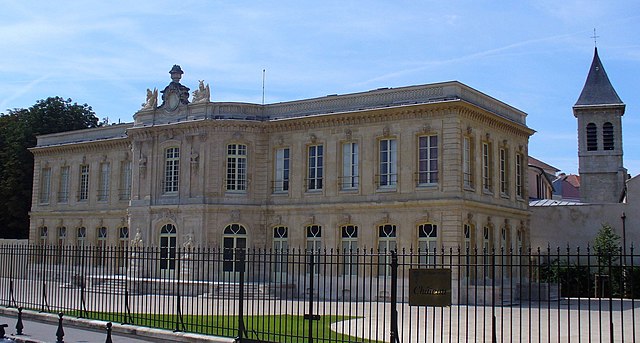
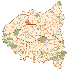
Saint-Ouen (Saint-Ouen-sur-Seine)
- human settlement in France
- Country:

- Postal Code: 93400
- Coordinates: 48° 54' 25" N, 2° 19' 59" E


- GPS tracks (wikiloc): [Link]
- AboveSeaLevel: 35 м m
- Area: 4.31 sq km
- Population: 48431
- Web site: http://www.saint-ouen.fr
- Wikipedia en: wiki(en)
- Wikipedia: wiki(fr)
- Wikidata storage: Wikidata: Q208889
- Wikipedia Commons Category: [Link]
- Freebase ID: [/m/02m2ck]
- Freebase ID: [/m/02m2ck]
- Freebase ID: [/m/02m2ck]
- GeoNames ID: Alt: [2977824]
- GeoNames ID: Alt: [2977824]
- GeoNames ID: Alt: [2977824]
- SIREN number: [219300704]
- SIREN number: [219300704]
- SIREN number: [219300704]
- BnF ID: [152803131]
- BnF ID: [152803131]
- BnF ID: [152803131]
- VIAF ID: Alt: [129122506]
- VIAF ID: Alt: [129122506]
- VIAF ID: Alt: [129122506]
- GND ID: Alt: [5351531-6]
- GND ID: Alt: [5351531-6]
- GND ID: Alt: [5351531-6]
- archINFORM location ID: [663]
- archINFORM location ID: [663]
- archINFORM location ID: [663]
- Library of Congress authority ID: Alt: [n88648004]
- Library of Congress authority ID: Alt: [n88648004]
- Library of Congress authority ID: Alt: [n88648004]
- PACTOLS thesaurus ID: [pcrtU3lREw1ByL]
- PACTOLS thesaurus ID: [pcrtU3lREw1ByL]
- PACTOLS thesaurus ID: [pcrtU3lREw1ByL]
- MusicBrainz area ID: [827a73b5-2be9-4e4a-b84a-9335bfc90a15]
- MusicBrainz area ID: [827a73b5-2be9-4e4a-b84a-9335bfc90a15]
- MusicBrainz area ID: [827a73b5-2be9-4e4a-b84a-9335bfc90a15]
- SUDOC authorities ID: [026628473]
- SUDOC authorities ID: [026628473]
- SUDOC authorities ID: [026628473]
- Twitter username: Alt: [villesaintouen]
- Twitter username: Alt: [villesaintouen]
- Twitter username: Alt: [villesaintouen]
- INSEE municipality code: 93070
- INSEE municipality code: 93070
- INSEE municipality code: 93070
Shares border with regions:


Saint-Denis
- commune in Seine-Saint-Denis, Paris agglomeration, France
- Country:

- Postal Code: 93210; 93200
- Coordinates: 48° 56' 8" N, 2° 21' 14" E


- GPS tracks (wikiloc): [Link]
- Area: 12.36 sq km
- Population: 111103
- Web site: [Link]


Asnières-sur-Seine
- commune in Hauts-de-Seine, France
- Country:

- Postal Code: 92600
- Coordinates: 48° 54' 40" N, 2° 17' 8" E


- GPS tracks (wikiloc): [Link]
- Area: 4.82 sq km
- Population: 86512
- Web site: [Link]


Clichy
- commune in Hauts-de-Seine, France
- Country:

- Postal Code: 92110
- Coordinates: 48° 54' 13" N, 2° 18' 20" E


- GPS tracks (wikiloc): [Link]
- AboveSeaLevel: 30 м m
- Area: 3.08 sq km
- Population: 60435
- Web site: [Link]


L'Île-Saint-Denis
- commune in Seine-Saint-Denis, France
- Country:

- Postal Code: 93450
- Coordinates: 48° 56' 9" N, 2° 20' 23" E


- GPS tracks (wikiloc): [Link]
- AboveSeaLevel: 30 м m
- Area: 1.77 sq km
- Population: 7539
- Web site: [Link]

Paris
- capital and largest city of France
- Country:

- Postal Code: 75020; 75019; 75018; 75017; 75016; 75015; 75014; 75013; 75012; 75011; 75010; 75009; 75008; 75007; 75006; 75005; 75004; 75003; 75002; 75001; 75116
- Local Dialing Code: 1
- Licence Plate Code: 75
- Coordinates: 48° 51' 24" N, 2° 21' 7" E


- GPS tracks (wikiloc): [Link]
- AboveSeaLevel: 28 м m
- Area: 105.4 sq km
- Population: 2206488
- Web site: [Link]
