.JPG)
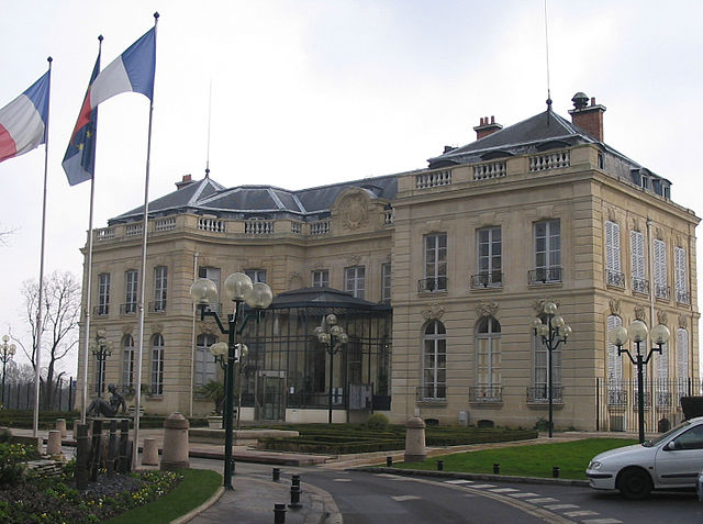
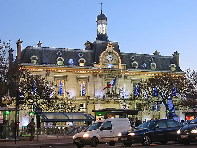
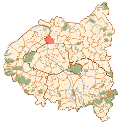
Saint-Denis (Saint-Denis)

- commune in Seine-Saint-Denis, Paris agglomeration, France
- Country:

- Postal Code: 93210; 93200
- Coordinates: 48° 56' 8" N, 2° 21' 14" E


- GPS tracks (wikiloc): [Link]
- Area: 12.36 sq km
- Population: 111103
- Web site: http://ville-saint-denis.fr
- Wikipedia en: wiki(en)
- Wikipedia: wiki(fr)
- Wikidata storage: Wikidata: Q160506
- Wikipedia Commons Gallery: [Link]
- Wikipedia Commons Category: [Link]
- Freebase ID: [/m/01ww5x]
- Freebase ID: [/m/01ww5x]
- Freebase ID: [/m/01ww5x]
- Freebase ID: [/m/01ww5x]
- Freebase ID: [/m/01ww5x]
- GeoNames ID: Alt: [6455341]
- GeoNames ID: Alt: [6455341]
- GeoNames ID: Alt: [6455341]
- GeoNames ID: Alt: [6455341]
- GeoNames ID: Alt: [6455341]
- SIREN number: [219740115]
- SIREN number: [219740115]
- SIREN number: [219740115]
- SIREN number: [219740115]
- SIREN number: [219740115]
- BnF ID: [15280312p]
- BnF ID: [15280312p]
- BnF ID: [15280312p]
- BnF ID: [15280312p]
- BnF ID: [15280312p]
- VIAF ID: Alt: [126179587]
- VIAF ID: Alt: [126179587]
- VIAF ID: Alt: [126179587]
- VIAF ID: Alt: [126179587]
- VIAF ID: Alt: [126179587]
- archINFORM location ID: [660]
- archINFORM location ID: [660]
- archINFORM location ID: [660]
- archINFORM location ID: [660]
- archINFORM location ID: [660]
- Library of Congress authority ID: Alt: [n84236807]
- Library of Congress authority ID: Alt: [n84236807]
- Library of Congress authority ID: Alt: [n84236807]
- Library of Congress authority ID: Alt: [n84236807]
- Library of Congress authority ID: Alt: [n84236807]
- PACTOLS thesaurus ID: [pcrtUqHKbclctW]
- PACTOLS thesaurus ID: [pcrtUqHKbclctW]
- PACTOLS thesaurus ID: [pcrtUqHKbclctW]
- PACTOLS thesaurus ID: [pcrtUqHKbclctW]
- PACTOLS thesaurus ID: [pcrtUqHKbclctW]
- MusicBrainz area ID: [d4ea3ccf-1b22-40cd-9ee5-c24ec7789e8a]
- MusicBrainz area ID: [d4ea3ccf-1b22-40cd-9ee5-c24ec7789e8a]
- MusicBrainz area ID: [d4ea3ccf-1b22-40cd-9ee5-c24ec7789e8a]
- MusicBrainz area ID: [d4ea3ccf-1b22-40cd-9ee5-c24ec7789e8a]
- MusicBrainz area ID: [d4ea3ccf-1b22-40cd-9ee5-c24ec7789e8a]
- Quora topic ID: [St-Denis-1]
- Quora topic ID: [St-Denis-1]
- Quora topic ID: [St-Denis-1]
- Quora topic ID: [St-Denis-1]
- Quora topic ID: [St-Denis-1]
- SUDOC authorities ID: [029738547]
- SUDOC authorities ID: [029738547]
- SUDOC authorities ID: [029738547]
- SUDOC authorities ID: [029738547]
- SUDOC authorities ID: [029738547]
- Encyclopædia Britannica Online ID: [place/Saint-Denis-France]
- Encyclopædia Britannica Online ID: [place/Saint-Denis-France]
- Encyclopædia Britannica Online ID: [place/Saint-Denis-France]
- Encyclopædia Britannica Online ID: [place/Saint-Denis-France]
- Encyclopædia Britannica Online ID: [place/Saint-Denis-France]
- Encyclopædia Universalis ID: [saint-denis]
- Encyclopædia Universalis ID: [saint-denis]
- Encyclopædia Universalis ID: [saint-denis]
- Encyclopædia Universalis ID: [saint-denis]
- Encyclopædia Universalis ID: [saint-denis]
- Twitter username: Alt: [VilleSaintDenis]
- Twitter username: Alt: [VilleSaintDenis]
- Twitter username: Alt: [VilleSaintDenis]
- Twitter username: Alt: [VilleSaintDenis]
- Twitter username: Alt: [VilleSaintDenis]
- Great Russian Encyclopedia Online ID: [3548308]
- Great Russian Encyclopedia Online ID: [3548308]
- Great Russian Encyclopedia Online ID: [3548308]
- Great Russian Encyclopedia Online ID: [3548308]
- Great Russian Encyclopedia Online ID: [3548308]
- ISNI: Alt: [0000 0001 2108 1709]
- ISNI: Alt: [0000 0001 2108 1709]
- ISNI: Alt: [0000 0001 2108 1709]
- ISNI: Alt: [0000 0001 2108 1709]
- ISNI: Alt: [0000 0001 2108 1709]
- NKCR AUT ID: [ko2003200161]
- NKCR AUT ID: [ko2003200161]
- NKCR AUT ID: [ko2003200161]
- NKCR AUT ID: [ko2003200161]
- NKCR AUT ID: [ko2003200161]
- Giant Bomb ID: [3035-3874]
- Giant Bomb ID: [3035-3874]
- Giant Bomb ID: [3035-3874]
- Giant Bomb ID: [3035-3874]
- Giant Bomb ID: [3035-3874]
- INSEE municipality code: 93066
- INSEE municipality code: 93066
- INSEE municipality code: 93066
- INSEE municipality code: 93066
- INSEE municipality code: 93066
Shares border with regions:


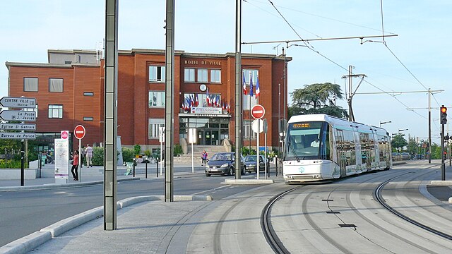
Aubervilliers
- commune in Seine-Saint-Denis, France
- Country:
- Postal Code: 93300
- Coordinates: 48° 54' 40" N, 2° 22' 57" E
- GPS tracks (wikiloc): [Link]
- Area: 5.76 sq km
- Population: 83782
- Web site: [Link]

Épinay-sur-Seine
- commune in Seine-Saint-Denis, France
- Country:
- Postal Code: 93800
- Coordinates: 48° 57' 17" N, 2° 18' 30" E
- GPS tracks (wikiloc): [Link]
- AboveSeaLevel: 56 м m
- Area: 4.57 sq km
- Population: 54840
- Web site: [Link]
Saint-Ouen
- human settlement in France
- Country:
- Postal Code: 93400
- Coordinates: 48° 54' 25" N, 2° 19' 59" E
- GPS tracks (wikiloc): [Link]
- AboveSeaLevel: 35 м m
- Area: 4.31 sq km
- Population: 48431
- Web site: [Link]

La Courneuve
- commune in Seine-Saint-Denis, France
- Country:
- Postal Code: 93120
- Coordinates: 48° 55' 53" N, 2° 23' 45" E
- GPS tracks (wikiloc): [Link]
- AboveSeaLevel: 40 м m
- Area: 7.52 sq km
- Population: 41733
- Web site: [Link]

Pierrefitte-sur-Seine
- commune in Seine-Saint-Denis, France
- Country:
- Postal Code: 93380
- Coordinates: 48° 57' 53" N, 2° 21' 39" E
- GPS tracks (wikiloc): [Link]
- AboveSeaLevel: 98 м m
- Area: 3.41 sq km
- Population: 29629
- Web site: [Link]


Stains
- commune in Seine-Saint-Denis, France
- Country:
- Postal Code: 93240
- Coordinates: 48° 57' 19" N, 2° 22' 56" E
- GPS tracks (wikiloc): [Link]
- AboveSeaLevel: 46 м m
- Area: 5.39 sq km
- Population: 39551
- Web site: [Link]


Villetaneuse
- commune in Seine-Saint-Denis, France
- Country:
- Postal Code: 93430
- Coordinates: 48° 57' 52" N, 2° 20' 39" E
- GPS tracks (wikiloc): [Link]
- AboveSeaLevel: 43 м m
- Area: 2.31 sq km
- Population: 12658
- Web site: [Link]


L'Île-Saint-Denis
- commune in Seine-Saint-Denis, France
- Country:
- Postal Code: 93450
- Coordinates: 48° 56' 9" N, 2° 20' 23" E
- GPS tracks (wikiloc): [Link]
- AboveSeaLevel: 30 м m
- Area: 1.77 sq km
- Population: 7539
- Web site: [Link]

Paris
- capital and largest city of France
- Country:
- Postal Code: 75020; 75019; 75018; 75017; 75016; 75015; 75014; 75013; 75012; 75011; 75010; 75009; 75008; 75007; 75006; 75005; 75004; 75003; 75002; 75001; 75116
- Local Dialing Code: 1
- Licence Plate Code: 75
- Coordinates: 48° 51' 24" N, 2° 21' 7" E
- GPS tracks (wikiloc): [Link]
- AboveSeaLevel: 28 м m
- Area: 105.4 sq km
- Population: 2206488
- Web site: [Link]