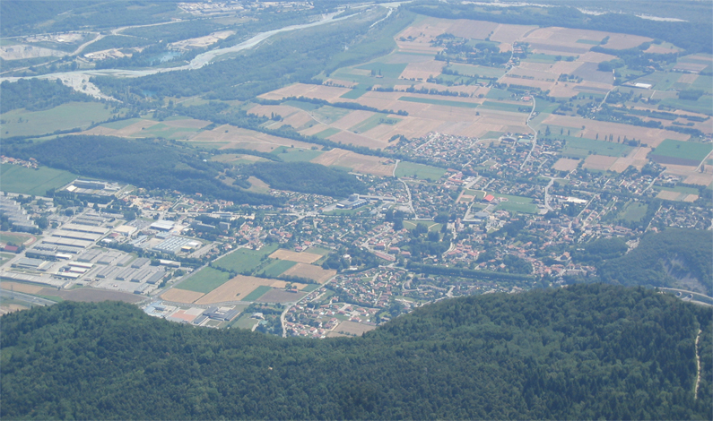
Saint-Paul-de-Varces (Saint-Paul-de-Varces)

- commune in Isère, France
 Hiking in Saint-Paul-de-Varces
Saint-Paul-de-Varces is a picturesque village located in the Isère department in the Auvergne-Rhône-Alpes region of France. It offers a variety of hiking opportunities suitable for different skill levels, surrounded by stunning mountainous landscapes and rich biodiversity.
Hiking Routes
-
Les Sentiers de la Varces: This network of trails around the village offers options for both casual walkers and experienced hikers. You can enjoy scenic views of the surrounding mountains and the valley below.
-
Le Mont Aiguille: A bit farther from Saint-Paul-de-Varces, this iconic mountain features challenging hikes with rewarding panoramic views. It’s a great option for experienced hikers looking for a bit more adventure.
-
Belledonne Range Trails: Located to the east of the village, the Belledonne mountains provide more strenuous hikes. The trails here can lead you to high-altitude lakes and mountain passes, with breathtaking scenery.
Hiking Tips
-
Maps and Guidance: Always take a detailed map or use a GPS-enabled device. Local tourism offices can provide information on marked trails.
-
Weather Preparedness: The weather can change rapidly in the mountains. Check forecasts before heading out, and dress in layers.
-
Hydration and Nutrition: Carry enough water and snacks, especially on longer hikes. There may be limited access to water sources on the trails.
-
Wildlife Awareness: Be mindful of the local wildlife. While encounters are rare, keeping a respectful distance from animals is vital.
Best Times to Hike
-
Spring (April to June): Wildflowers bloom, and the weather is mild, making it a beautiful time to hike.
-
Autumn (September to October): The fall foliage provides stunning views and cooler temperatures, perfect for hiking enthusiasts.
-
Summer (July to August): While popular, these months can get crowded. Start early in the day to avoid the heat and other hikers.
Local Amenities
- Accommodations: Saint-Paul-de-Varces has various lodging options, from hotels to guesthouses, catering to hikers.
- Local Cuisine: Enjoy traditional French cuisine in local restaurants, perfect for refueling after a long hike.
Saint-Paul-de-Varces offers a charming base for hiking adventures, with its excellent access to natural beauty, diverse trails, and local amenities. Be sure to plan accordingly, and enjoy the stunning landscapes that the region has to offer!
- Country:

- Postal Code: 38760
- Coordinates: 45° 4' 17" N, 5° 38' 26" E


- GPS tracks (wikiloc): [Link]
- Area: 19.69 sq km
- Population: 2191
- Web site: http://www.mairiesaintpauldevarces.fr
- Wikipedia en: wiki(en)
- Wikipedia: wiki(fr)
- Wikidata storage: Wikidata: Q733453
- Wikipedia Commons Category: [Link]
- Freebase ID: [/m/03g_54q]
- GeoNames ID: Alt: [6433381]
- SIREN number: [213804362]
- BnF ID: [15258245p]
- VIAF ID: Alt: [155886471]
- PACTOLS thesaurus ID: [pcrt1P0F1ShjEt]
- SUDOC authorities ID: [034636862]
- INSEE municipality code: 38436
Shares border with regions:


Le Gua
- commune in Isère, France
Hiking in Le Gua
Le Gua, located in the Isère department of the Auvergne-Rhône-Alpes region in France, offers a blend of picturesque landscapes and accessible hiking trails, making it a great destination for outdoor enthusiasts. Here are some highlights and tips for hiking in Le Gua:...
- Country:
- Postal Code: 38450
- Coordinates: 45° 1' 31" N, 5° 38' 52" E
- GPS tracks (wikiloc): [Link]
- Area: 28.48 sq km
- Population: 1812
- Web site: [Link]

Varces-Allières-et-Risset
- commune in Isère, France
Hiking in Varces-Allières-et-Risset
Varces-Allières-et-Risset is a picturesque commune located in the Isère department in southeastern France, near the city of Grenoble. The region is characterized by its stunning natural landscapes, making it an excellent destination for hiking enthusiasts....
- Country:
- Postal Code: 38760
- Coordinates: 45° 5' 12" N, 5° 40' 55" E
- GPS tracks (wikiloc): [Link]
- Area: 20.88 sq km
- Population: 8266
- Web site: [Link]


Villard-de-Lans
- commune in Isère, France
Hiking in Villard-de-Lans
Villard-de-Lans is a charming village located in the Vercors region of the French Alps, known for its stunning landscapes, diverse trails, and outdoor activities, making it a fantastic destination for hiking enthusiasts. Here are some key points about hiking in Villard-de-Lans:...
- Country:
- Postal Code: 38250
- Coordinates: 45° 4' 12" N, 5° 33' 2" E
- GPS tracks (wikiloc): [Link]
- Area: 67.2 sq km
- Population: 4175
- Web site: [Link]


Vif
- commune in Isère, France
Hiking in Vif
Vif is a charming commune located in the Isère department in the Auvergne-Rhône-Alpes region of southeastern France. Nestled at the foot of the Chartreuse Mountains and near the Écrins National Park, Vif offers a variety of hiking opportunities that cater to different skill levels. Here are some highlights of hiking in and around Vif:...
- Country:
- Postal Code: 38450
- Coordinates: 45° 3' 19" N, 5° 40' 12" E
- GPS tracks (wikiloc): [Link]
- Area: 28.3 sq km
- Population: 8212
- Web site: [Link]


Lans-en-Vercors
- commune in Isère, France
Hiking in Lans-en-Vercors
Lans-en-Vercors is a charming village located in the French Alps, within the Vercors Massif. It is well-known for its stunning natural scenery, offering a range of outdoor activities, particularly hiking. Here are some highlights and tips for hiking in Lans-en-Vercors:...
- Country:
- Postal Code: 38250
- Coordinates: 45° 7' 41" N, 5° 35' 19" E
- GPS tracks (wikiloc): [Link]
- Area: 38.67 sq km
- Population: 2649
- Web site: [Link]