Vif (Vif)
- commune in Isère, France
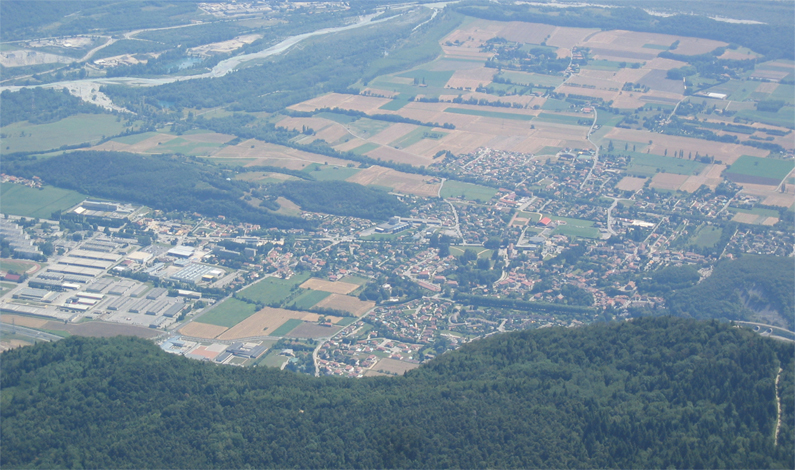
Vif is a charming commune located in the Isère department in the Auvergne-Rhône-Alpes region of southeastern France. Nestled at the foot of the Chartreuse Mountains and near the Écrins National Park, Vif offers a variety of hiking opportunities that cater to different skill levels. Here are some highlights of hiking in and around Vif:
Scenic Trails
- Local Trails: The area surrounding Vif features numerous marked hiking trails that provide stunning views of the surrounding landscape, including the mountains and valleys.
- Chartsruse Mountains: Just a short distance from Vif, the Chartreuse Mountains offer more rugged terrain and extensive marked trails, including routes that lead to panoramic viewpoints.
Popular Hikes
- Mont Trident: A popular hike that offers breathtaking views from the summit. It’s a moderate hike that is suitable for those with a bit of experience.
- Lac de Peclet: This trail leads to a picturesque lake nestled in the mountains, making it a great destination for a day hike.
Accessibility
- Vif is easily accessible from the city of Grenoble, making it a convenient destination for both locals and visitors. Public transportation options and nearby parking make it easier to reach the trailheads.
Nature and Wildlife
While hiking in Vif, you may encounter diverse flora and fauna, including endemic species. The region is home to various animals, and the rich biodiversity offers a rewarding experience for nature lovers.
Safety and Preparation
When hiking in the Vif area:
- Check Weather Conditions: Mountain weather can change rapidly, so it's important to be prepared.
- Gear Up: Ensure you have the right gear, including sturdy hiking boots, water, snacks, and a first aid kit.
- Stay on Marked Trails: To preserve the natural environment and for your safety, stick to the designated paths.
Conclusion
Vif is a wonderful base for exploring the natural beauty of the Isère region. Whether you are a seasoned hiker or a beginner, there are trails to suit your interests and abilities. Always remember to leave no trace and enjoy the breathtaking landscapes that the area offers!
- Country:

- Postal Code: 38450
- Coordinates: 45° 3' 19" N, 5° 40' 12" E


- GPS tracks (wikiloc): [Link]
- Area: 28.3 sq km
- Population: 8212
- Web site: http://www.ville-vif.fr
- Wikipedia en: wiki(en)
- Wikipedia: wiki(fr)
- Wikidata storage: Wikidata: Q776983
- Wikipedia Commons Category: [Link]
- Freebase ID: [/m/03g_52n]
- GeoNames ID: Alt: [6424474]
- SIREN number: [213805450]
- BnF ID: [15258345z]
- VIAF ID: Alt: [151851764]
- WOEID: [631302]
- INSEE municipality code: 38545
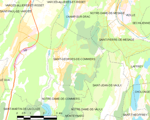
Shares border with regions:


Champ-sur-Drac
- commune in Isère, France
Champ-sur-Drac is a charming commune located in the Isère department of the Auvergne-Rhône-Alpes region in southeastern France. The area is surrounded by beautiful natural landscapes, making it a great destination for hiking enthusiasts....
- Country:

- Postal Code: 38560
- Coordinates: 45° 4' 58" N, 5° 44' 3" E


- GPS tracks (wikiloc): [Link]
- Area: 8.92 sq km
- Population: 3037
- Web site: [Link]


Le Gua
- commune in Isère, France
Le Gua, located in the Isère department of the Auvergne-Rhône-Alpes region in France, offers a blend of picturesque landscapes and accessible hiking trails, making it a great destination for outdoor enthusiasts. Here are some highlights and tips for hiking in Le Gua:...
- Country:

- Postal Code: 38450
- Coordinates: 45° 1' 31" N, 5° 38' 52" E


- GPS tracks (wikiloc): [Link]
- Area: 28.48 sq km
- Population: 1812
- Web site: [Link]


Notre-Dame-de-Commiers
- commune in Isère, France
 Hiking in Notre-Dame-de-Commiers
Notre-Dame-de-Commiers, located in the French Alps near Grenoble, is a beautiful destination for hiking enthusiasts. Nestled at the foot of the Chartreuse Mountains, the area offers a variety of trails that cater to different skill levels and preferences....
- Country:

- Postal Code: 38450
- Coordinates: 45° 0' 36" N, 5° 42' 0" E


- GPS tracks (wikiloc): [Link]
- Area: 4.79 sq km
- Population: 479
- Web site: [Link]


Varces-Allières-et-Risset
- commune in Isère, France
 Hiking in Varces-Allières-et-Risset
Varces-Allières-et-Risset is a picturesque commune located in the Isère department in southeastern France, near the city of Grenoble. The region is characterized by its stunning natural landscapes, making it an excellent destination for hiking enthusiasts....
- Country:

- Postal Code: 38760
- Coordinates: 45° 5' 12" N, 5° 40' 55" E


- GPS tracks (wikiloc): [Link]
- Area: 20.88 sq km
- Population: 8266
- Web site: [Link]


Saint-Martin-de-la-Cluze
- commune in Isère, France
 Hiking in Saint-Martin-de-la-Cluze
Saint-Martin-de-la-Cluze is a picturesque village located in the French Alps, specifically in the Isère department. Its stunning natural scenery and diverse topography make it a fantastic destination for hiking enthusiasts....
- Country:

- Postal Code: 38650
- Coordinates: 44° 58' 58" N, 5° 39' 31" E


- GPS tracks (wikiloc): [Link]
- AboveSeaLevel: 760 м m
- Area: 16.26 sq km
- Population: 705
- Web site: [Link]


Saint-Georges-de-Commiers
- commune in Isère, France
 Hiking in Saint-Georges-de-Commiers
Saint-Georges-de-Commiers is a picturesque commune located in the Isère department of the Auvergne-Rhône-Alpes region in southeastern France. Nestled at the foothills of the Vercors Massif, it offers a variety of hiking opportunities that cater to different experience levels and preferences....
- Country:

- Postal Code: 38450
- Coordinates: 45° 2' 17" N, 5° 42' 13" E


- GPS tracks (wikiloc): [Link]
- Area: 14.62 sq km
- Population: 2134
- Web site: [Link]


Saint-Paul-de-Varces
- commune in Isère, France
 Hiking in Saint-Paul-de-Varces
Saint-Paul-de-Varces is a picturesque village located in the Isère department in the Auvergne-Rhône-Alpes region of France. It offers a variety of hiking opportunities suitable for different skill levels, surrounded by stunning mountainous landscapes and rich biodiversity....
- Country:

- Postal Code: 38760
- Coordinates: 45° 4' 17" N, 5° 38' 26" E


- GPS tracks (wikiloc): [Link]
- Area: 19.69 sq km
- Population: 2191
- Web site: [Link]
