Villard-de-Lans (Villard-de-Lans)

- commune in Isère, France
 Hiking in Villard-de-Lans
Villard-de-Lans is a charming village located in the Vercors region of the French Alps, known for its stunning landscapes, diverse trails, and outdoor activities, making it a fantastic destination for hiking enthusiasts. Here are some key points about hiking in Villard-de-Lans:
Hiking Trails:
-
Diverse Terrain: The area offers a variety of trails that range from easy walks suitable for families to more challenging hikes for experienced trekkers.
-
Scenic Routes: Hike through picturesque landscapes, including forests, meadows, and rocky outcrops. The Vercors Regional Natural Park offers breathtaking views, particularly from higher elevations.
-
GR91 Trail: This long-distance trail crosses through the Vercors and is accessible from Villard-de-Lans. It's a great way to experience the natural beauty of the region.
-
Waterfalls and Caves: There are several routes leading to natural attractions like the Grotte de la Luire, waterfalls, and panoramic viewpoints.
-
Theme Trails: Some trails are designed around specific themes, such as local flora and fauna, which can enrich your hiking experience.
Seasonal Considerations:
- Summer: The summer months (June to September) offer the best hiking opportunities with warmer temperatures and fully accessible trails.
- Winter: In winter, the area transforms into a ski resort, but snowshoeing and winter hiking can still be enjoyed in certain areas.
Preparation Tips:
- Maps and Guides: It’s advisable to carry a detailed map of the trails or use hiking apps. The local tourist office can provide maps and help with route suggestions.
- Gear: Wear appropriate hiking boots and clothing, and always carry essentials like water, snacks, a first aid kit, and sun protection.
- Weather Awareness: Mountain weather can change quickly, so check conditions before heading out and be prepared for sudden changes.
Additional Activities:
- Besides hiking, Villard-de-Lans offers other outdoor activities such as mountain biking, paragliding, and via ferrata.
Local Culture:
- Embrace the local culture by sampling regional cuisine in the village's restaurants, which often feature local cheeses and specialties.
Safety:
- Stay on marked trails, respect wildlife, and notify someone of your hiking plans. It’s also advisable to hike with a partner, especially in remote areas.
Whether you’re looking for a leisurely stroll or an adventurous trek, Villard-de-Lans has something to offer for every level of hiker. Enjoy your trekking adventure in this beautiful Alpine environment!
- Country:

- Postal Code: 38250
- Coordinates: 45° 4' 12" N, 5° 33' 2" E


- GPS tracks (wikiloc): [Link]
- Area: 67.2 sq km
- Population: 4175
- Web site: http://www.villard-de-lans.fr
- Wikipedia en: wiki(en)
- Wikipedia: wiki(fr)
- Wikidata storage: Wikidata: Q696499
- Wikipedia Commons Gallery: [Link]
- Wikipedia Commons Category: [Link]
- Freebase ID: [/m/0893s3]
- GeoNames ID: Alt: [2968984]
- SIREN number: [213805484]
- BnF ID: [152583480]
- VIAF ID: Alt: [126159153]
- GND ID: Alt: [4333492-1]
- Library of Congress authority ID: Alt: [n82249917]
- PACTOLS thesaurus ID: [pcrtNKyvLUDIEj]
- WOEID: [12657246]
- INSEE municipality code: 38548
Shares border with regions:

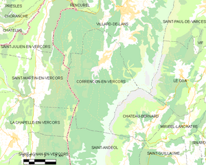
Corrençon-en-Vercors
- commune in Isère, France
Hiking in Corrençon-en-Vercors
Corrençon-en-Vercors is a charming alpine village located in the Vercors Regional Natural Park in the French Alps. It offers a variety of hiking opportunities that cater to different skill levels and preferences. Here are some highlights and tips for hiking in and around Corrençon-en-Vercors:...
- Country:
- Postal Code: 38250
- Coordinates: 45° 1' 53" N, 5° 31' 35" E
- GPS tracks (wikiloc): [Link]
- Area: 39.34 sq km
- Population: 353
- Web site: [Link]


Saint-Julien-en-Vercors
- commune in Drôme, France
Hiking in Saint-Julien-en-Vercors
Saint-Julien-en-Vercors is a beautiful destination in the Vercors Massif of the French Alps, known for its stunning scenery, rich biodiversity, and a variety of hiking trails suitable for all levels. Here are some highlights of hiking in this area:...
- Country:
- Postal Code: 26420
- Coordinates: 45° 3' 1" N, 5° 26' 58" E
- GPS tracks (wikiloc): [Link]
- Area: 18.47 sq km
- Population: 246


Le Gua
- commune in Isère, France
Hiking in Le Gua
Le Gua, located in the Isère department of the Auvergne-Rhône-Alpes region in France, offers a blend of picturesque landscapes and accessible hiking trails, making it a great destination for outdoor enthusiasts. Here are some highlights and tips for hiking in Le Gua:...
- Country:
- Postal Code: 38450
- Coordinates: 45° 1' 31" N, 5° 38' 52" E
- GPS tracks (wikiloc): [Link]
- Area: 28.48 sq km
- Population: 1812
- Web site: [Link]

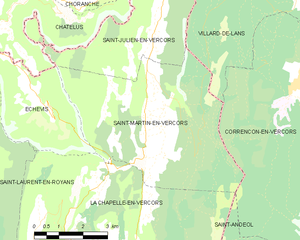
Saint-Martin-en-Vercors
- commune in Drôme, France
Hiking in Saint-Martin-en-Vercors
Saint-Martin-en-Vercors is a charming village located in the Vercors Regional Natural Park in the Auvergne-Rhône-Alpes region of France. The area is renowned for its stunning natural landscapes, ranging from limestone plateaus to dense forests, making it an excellent destination for hiking enthusiasts....
- Country:
- Postal Code: 26420
- Coordinates: 45° 1' 22" N, 5° 26' 35" E
- GPS tracks (wikiloc): [Link]
- Area: 27.13 sq km
- Population: 388


Château-Bernard
- commune in Isère, France
Hiking in Château-Bernard
Hiking in Château-Bernard offers a delightful opportunity to explore the natural beauty of the area, characterized by picturesque landscapes, diverse flora and fauna, and a rich cultural history. While Château-Bernard itself is a small commune in the Auvergne region of France, there are several hikes and trails in the surrounding areas that cater to various skill levels....
- Country:
- Postal Code: 38650
- Coordinates: 44° 58' 30" N, 5° 34' 35" E
- GPS tracks (wikiloc): [Link]
- Area: 18.27 sq km
- Population: 276
- Web site: [Link]

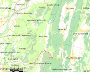
Rencurel
- commune in Isère, France
Hiking in Rencurel
Rencurel is a charming village located in the Vercors region of France, known for its stunning natural landscapes and excellent hiking opportunities. The Vercors is part of the larger Prealps, characterized by its dramatic cliffs, deep gorges, and lush forests, making it an ideal destination for outdoor enthusiasts....
- Country:
- Postal Code: 38680
- Coordinates: 45° 6' 9" N, 5° 28' 22" E
- GPS tracks (wikiloc): [Link]
- Area: 34.63 sq km
- Population: 304
- Web site: [Link]


Saint-Paul-de-Varces
- commune in Isère, France
Hiking in Saint-Paul-de-Varces
Saint-Paul-de-Varces is a picturesque village located in the Isère department in the Auvergne-Rhône-Alpes region of France. It offers a variety of hiking opportunities suitable for different skill levels, surrounded by stunning mountainous landscapes and rich biodiversity....
- Country:
- Postal Code: 38760
- Coordinates: 45° 4' 17" N, 5° 38' 26" E
- GPS tracks (wikiloc): [Link]
- Area: 19.69 sq km
- Population: 2191
- Web site: [Link]


Lans-en-Vercors
- commune in Isère, France
Hiking in Lans-en-Vercors
Lans-en-Vercors is a charming village located in the French Alps, within the Vercors Massif. It is well-known for its stunning natural scenery, offering a range of outdoor activities, particularly hiking. Here are some highlights and tips for hiking in Lans-en-Vercors:...
- Country:
- Postal Code: 38250
- Coordinates: 45° 7' 41" N, 5° 35' 19" E
- GPS tracks (wikiloc): [Link]
- Area: 38.67 sq km
- Population: 2649
- Web site: [Link]