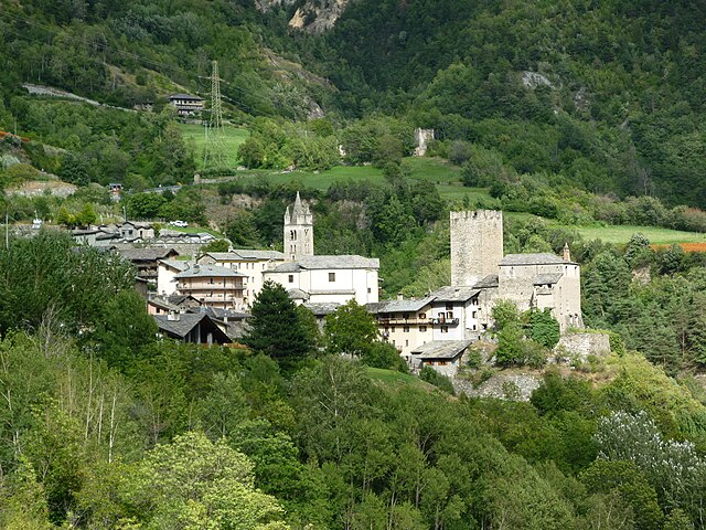
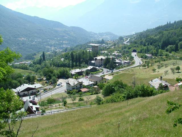
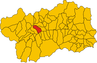
Saint-Pierre (Saint-Pierre)
.svg)
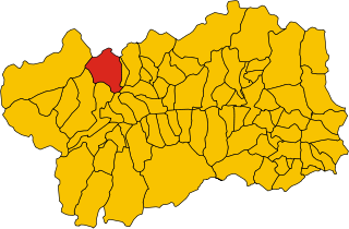
- comune in Aosta Valley, Italy
 Hiking in Saint-Pierre
Saint-Pierre, located in the Aosta Valley region of Italy, is a fantastic destination for hiking enthusiasts. The area is known for its stunning mountain scenery, rich history, and diverse trails that cater to a variety of skill levels. Here are some key points about hiking in this picturesque region:
Scenery and Environment
-
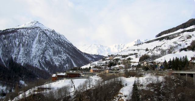
Alpine Landscapes: Surrounding Saint-Pierre are majestic peaks, lush valleys, and pristine forests. The views are particularly breathtaking, especially in clear weather when the peaks of the Gran Paradiso National Park can be seen.
-
Flora and Fauna: The region is rich in biodiversity. Hikers may encounter a variety of plant species and wildlife, including ibex, chamois, and numerous bird species.
Hiking Trails
-
Beginner Trails: There are relatively easy trails that are suitable for families and novice hikers. These often follow riverbanks or paths through the forest, providing a gentle introduction to the area's natural beauty.
-
Intermediate to Advanced Trails: For more experienced hikers, there are steeper and more challenging routes that offer rewarding views and a more immersive experience in the alpine environment. Notable trails could lead towards the surrounding mountains or connect with paths in the Gran Paradiso National Park.
-
Historical Routes: Some trails may also incorporate historical elements—hiking past ancient fortifications, castles, and traditional villages that provide insight into the local culture and history.
Practical Considerations
-
What to Bring: Essential gear includes sturdy hiking boots, weather-appropriate clothing, a map, plenty of water, and snacks. Sun protection is also advisable, as UV exposure can be high in the mountains.
-
Best Time to Visit: The hiking season typically runs from late spring to early autumn (May to September), with the best conditions usually found in late summer when the weather is more stable.
-
Accessibility: Saint-Pierre is well-connected by public transport, making it a convenient base for exploring the entire Aosta Valley region.
Local Tips
- Guided Tours: Consider joining a guided hiking tour to gain more insight into the natural and cultural history of the area.
- Stay Hydrated: Always carry enough water, as some trails may lack access to clean water sources.
- Respect Nature: Follow Leave No Trace principles to help preserve the beautiful landscapes for future hikers.
Additional Activities
When not hiking, you can enjoy the charming village of Saint-Pierre, with attractions such as the local castle, various restaurants serving regional cuisine, and opportunities to explore nearby towns like Aosta.
In summary, hiking in Saint-Pierre offers a wonderful mix of natural beauty, outdoor adventure, and cultural experiences. Whether you’re looking for a leisurely stroll or a challenging trek, this part of Aosta Valley has something to offer every outdoor enthusiast.
- Country:

- Postal Code: 11010
- Local Dialing Code: 0165
- Licence Plate Code: AO
- Coordinates: 45° 42' 36" N, 7° 13' 34" E


- GPS tracks (wikiloc): [Link]
- AboveSeaLevel: 731 м m
- Area: 26.18 sq km
- Population: 3213
- Web site: http://www.comune.saint-pierre.ao.it/
- Wikipedia en: wiki(en)
- Wikipedia: wiki(it)
- Wikidata storage: Wikidata: Q35418
- Wikipedia Commons Category: [Link]
- Wikipedia Commons Maps Category: [Link]
- Freebase ID: [/m/0fwzb5]
- GeoNames ID: Alt: [6535877]
- OSM relation ID: [45842]
- UN/LOCODE: [ITRRP]
- ISTAT ID: 007063
- Italian cadastre code: H674
Shares border with regions:

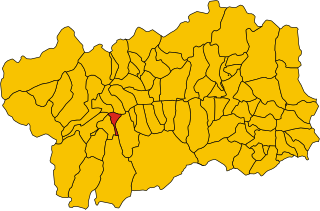
Avise
- Italian comune
Hiking in Avise
Avise is a charming commune in the Aosta Valley region of Italy, located in the picturesque Alpine area. It offers a variety of hiking opportunities that cater to different skill levels and preferences. Here are some highlights for those interested in hiking in Avise:...
- Country:
- Postal Code: 11010
- Local Dialing Code: 0165
- Licence Plate Code: AO
- Coordinates: 45° 42' 31" N, 7° 8' 26" E
- GPS tracks (wikiloc): [Link]
- AboveSeaLevel: 775 м m
- Area: 52.62 sq km
- Population: 298
- Web site: [Link]


Aymavilles
- Italian comune
Hiking in Aymavilles
Aymavilles is a picturesque village located in the Aosta Valley region of Italy, known for its stunning Alpine scenery and rich cultural heritage. Hiking in Aymavilles offers a mix of challenging trails, beautiful landscapes, and opportunities to experience the local flora and fauna....
- Country:
- Postal Code: 11010
- Local Dialing Code: 0165
- Licence Plate Code: AO
- Coordinates: 45° 42' 4" N, 7° 14' 25" E
- GPS tracks (wikiloc): [Link]
- AboveSeaLevel: 640 м m
- Area: 53.24 sq km
- Population: 2065
- Web site: [Link]

Gignod
- Italian comune
Hiking in Gignod
Gignod is a small municipality located in the Aosta Valley region of Italy, surrounded by stunning alpine scenery. It's an excellent destination for hiking enthusiasts of all levels, offering a variety of trails that showcase the natural beauty of the region, its rugged mountains, picturesque valleys, and rich biodiversity. Here are some highlights for hiking in Gignod:...
- Country:
- Postal Code: 11010
- Local Dialing Code: 0165
- Licence Plate Code: AO
- Coordinates: 45° 47' 0" N, 7° 18' 0" E
- GPS tracks (wikiloc): [Link]
- AboveSeaLevel: 988 м m
- Area: 25.98 sq km
- Population: 1727
- Web site: [Link]


Saint-Nicolas, Aosta Valley
- Italian comune
Hiking in Saint-Nicolas, Aosta Valley
Saint-Nicolas, located in the Aosta Valley region of Italy, offers a stunning backdrop for hikers with its beautiful alpine landscapes, charming villages, and rich cultural heritage. Here are some highlights and information about hiking in the area:...
- Country:
- Postal Code: 11010
- Local Dialing Code: 0165
- Licence Plate Code: AO
- Coordinates: 45° 43' 0" N, 7° 10' 0" E
- GPS tracks (wikiloc): [Link]
- AboveSeaLevel: 1200 м m
- Area: 15.46 sq km
- Population: 307
- Web site: [Link]
Saint-Rhémy-en-Bosses
- Italian comune
Hiking in Saint-Rhémy-en-Bosses
Saint-Rhémy-en-Bosses is a picturesque village located in the Aosta Valley region of Italy, nestled in the Italian Alps. The area is known for its stunning landscapes, charming architecture, and many outdoor activities, including hiking....
- Country:
- Postal Code: 11010
- Local Dialing Code: 0165
- Licence Plate Code: AO
- Coordinates: 45° 49' 19" N, 7° 10' 32" E
- GPS tracks (wikiloc): [Link]
- AboveSeaLevel: 1519 м m
- Area: 64.88 sq km
- Population: 335
- Web site: [Link]

Sarre, Aosta Valley
- Italian comune
Hiking in Sarre, Aosta Valley
Hiking in Sarre, located in the Aosta Valley of northern Italy, offers a fantastic outdoor experience surrounded by stunning mountain scenery. The Aosta Valley is known for its breathtaking landscapes, rich history, and numerous hiking trails suitable for all levels of experience....
- Country:
- Postal Code: 11010
- Local Dialing Code: 0165
- Licence Plate Code: AO
- Coordinates: 45° 43' 4" N, 7° 15' 27" E
- GPS tracks (wikiloc): [Link]
- AboveSeaLevel: 631 м m
- Area: 28.28 sq km
- Population: 4878
- Web site: [Link]

Villeneuve, Aosta Valley
- Italian comune
Hiking in Villeneuve, Aosta Valley
Villeneuve, located in the Aosta Valley of northwestern Italy, is a charming village surrounded by stunning alpine scenery. The area is notable for its outdoor adventure opportunities, particularly hiking....
- Country:
- Postal Code: 11018
- Local Dialing Code: 0165
- Licence Plate Code: AO
- Coordinates: 45° 42' 9" N, 7° 12' 27" E
- GPS tracks (wikiloc): [Link]
- AboveSeaLevel: 670 м m
- Area: 8.8 sq km
- Population: 1236
- Web site: [Link]