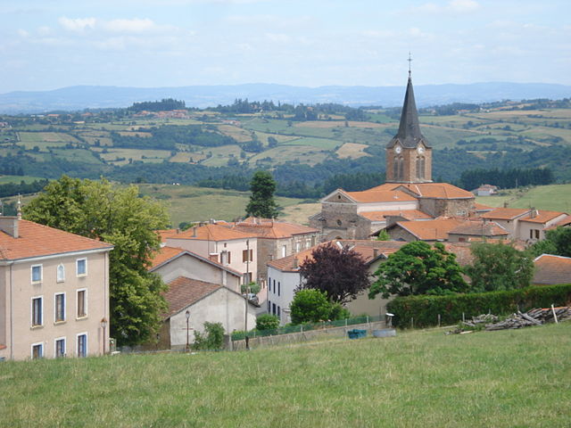
Saint-Polgues (Saint-Polgues)

- commune in Loire, France
- Country:

- Postal Code: 42260
- Coordinates: 45° 54' 44" N, 3° 58' 30" E


- GPS tracks (wikiloc): [Link]
- Area: 5.77 sq km
- Population: 256
- Wikipedia en: wiki(en)
- Wikipedia: wiki(fr)
- Wikidata storage: Wikidata: Q1105966
- Wikipedia Commons Category: [Link]
- Freebase ID: [/m/03nw93f]
- Freebase ID: [/m/03nw93f]
- GeoNames ID: Alt: [6434306]
- GeoNames ID: Alt: [6434306]
- SIREN number: [214202749]
- SIREN number: [214202749]
- BnF ID: [15259840v]
- BnF ID: [15259840v]
- INSEE municipality code: 42274
- INSEE municipality code: 42274
Shares border with regions:

Bully
- commune in Loire, France
- Country:
- Postal Code: 42260
- Coordinates: 45° 55' 39" N, 4° 0' 18" E
- GPS tracks (wikiloc): [Link]
- Area: 19.03 sq km
- Population: 415
Souternon
- commune in Loire, France
- Country:
- Postal Code: 42260
- Coordinates: 45° 52' 9" N, 3° 59' 16" E
- GPS tracks (wikiloc): [Link]
- Area: 17.05 sq km
- Population: 296


Dancé
- commune in Loire, France
- Country:
- Postal Code: 42260
- Coordinates: 45° 54' 8" N, 4° 1' 32" E
- GPS tracks (wikiloc): [Link]
- Area: 8.83 sq km
- Population: 170

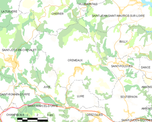
Cremeaux
- commune in Loire, France
- Country:
- Postal Code: 42260
- Coordinates: 45° 54' 28" N, 3° 55' 42" E
- GPS tracks (wikiloc): [Link]
- Area: 33.32 sq km
- Population: 911