Saint-Rambert-d'Albon (Saint-Rambert-d'Albon)

- commune in Drôme, France
- Country:

- Postal Code: 26140
- Coordinates: 45° 17' 38" N, 4° 49' 1" E


- GPS tracks (wikiloc): [Link]
- Area: 13.41 sq km
- Population: 6313
- Web site: http://www.ville-st-rambert.fr
- Wikipedia en: wiki(en)
- Wikipedia: wiki(fr)
- Wikidata storage: Wikidata: Q219310
- Wikipedia Commons Category: [Link]
- Freebase ID: [/m/0dt4dh]
- SIREN number: [212603252]
- BnF ID: [15253185f]
- VIAF ID: Alt: [144269137]
- Library of Congress authority ID: Alt: [n82086433]
- INSEE municipality code: 26325
Shares border with regions:


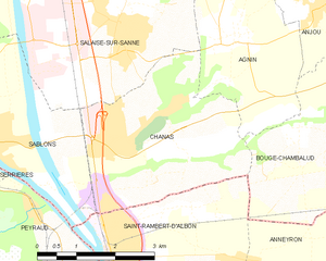
Bougé-Chambalud
- commune in Isère, France
 Hiking in Bougé-Chambalud
Bougé-Chambalud is a picturesque village located in the Auvergne-Rhône-Alpes region of France, specifically within the department of Drôme. Its setting offers several opportunities for hiking and enjoying the natural beauty of the area....
- Country:
- Postal Code: 38150
- Coordinates: 45° 19' 49" N, 4° 54' 5" E
- GPS tracks (wikiloc): [Link]
- Area: 15.85 sq km
- Population: 1395
- Web site: [Link]

Sablons
- commune in Isère, France
- Country:
- Postal Code: 38550
- Coordinates: 45° 19' 5" N, 4° 46' 23" E
- GPS tracks (wikiloc): [Link]
- Area: 10.23 sq km
- Population: 2244
- Web site: [Link]

Peyraud
- commune in Ardèche, France
- Country:
- Postal Code: 07340
- Coordinates: 45° 18' 11" N, 4° 47' 16" E
- GPS tracks (wikiloc): [Link]
- AboveSeaLevel: 141 м m
- Area: 5.96 sq km
- Population: 514
Champagne
- commune in Ardèche, France
- Country:
- Postal Code: 07340
- Coordinates: 45° 16' 23" N, 4° 48' 2" E
- GPS tracks (wikiloc): [Link]
- AboveSeaLevel: 145 м m
- Area: 4.1 sq km
- Population: 628

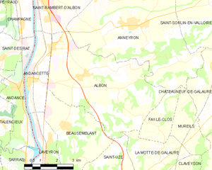
Albon
- commune in Drôme, France
- Country:
- Postal Code: 26140
- Coordinates: 45° 14' 44" N, 4° 50' 56" E
- GPS tracks (wikiloc): [Link]
- Area: 25.62 sq km
- Population: 1879


Andancette
- commune in Drôme, France
- Country:
- Postal Code: 26140
- Coordinates: 45° 14' 31" N, 4° 48' 25" E
- GPS tracks (wikiloc): [Link]
- Area: 5.98 sq km
- Population: 1344
- Web site: [Link]
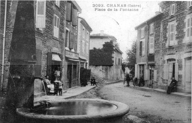
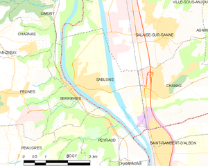
Chanas
- commune in Isère, France
- Country:
- Postal Code: 38150
- Coordinates: 45° 19' 6" N, 4° 49' 9" E
- GPS tracks (wikiloc): [Link]
- Area: 11.65 sq km
- Population: 2524
- Web site: [Link]

Anneyron
- commune in Drôme, France
Hiking in Anneyron
Anneyron is a charming town located in the Drôme department in southeastern France. Nestled in the Rhône Valley, it's a great starting point for exploring the surrounding natural landscapes. Here are some highlights and tips for hiking in and around Anneyron:...
- Country:
- Postal Code: 26140
- Coordinates: 45° 16' 16" N, 4° 53' 16" E
- GPS tracks (wikiloc): [Link]
- Area: 36.23 sq km
- Population: 3924
- Web site: [Link]