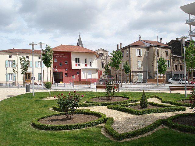
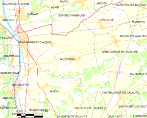
Albon (Albon)

- commune in Drôme, France
- Country:

- Postal Code: 26140
- Coordinates: 45° 14' 44" N, 4° 50' 56" E


- GPS tracks (wikiloc): [Link]
- Area: 25.62 sq km
- Population: 1879
- Wikipedia en: wiki(en)
- Wikipedia: wiki(fr)
- Wikidata storage: Wikidata: Q389248
- Wikipedia Commons Category: [Link]
- Freebase ID: [/m/03mgk8x]
- GeoNames ID: Alt: [6455355]
- SIREN number: [212600027]
- BnF ID: [15252863t]
- VIAF ID: Alt: [249300807]
- GND ID: Alt: [7752274-6]
- INSEE municipality code: 26002
Shares border with regions:


La Motte-de-Galaure
- commune in Drôme, France
 Hiking in La Motte-de-Galaure
La Motte-de-Galaure is a charming village located in the Drôme department in the Auvergne-Rhône-Alpes region of southeastern France. This area is characterized by its rolling hills, vineyards, and stunning countryside, making it a great location for hiking enthusiasts....
- Country:
- Postal Code: 26240
- Coordinates: 45° 11' 48" N, 4° 54' 20" E
- GPS tracks (wikiloc): [Link]
- Area: 7.73 sq km
- Population: 786

Saint-Rambert-d'Albon
- commune in Drôme, France
- Country:
- Postal Code: 26140
- Coordinates: 45° 17' 38" N, 4° 49' 1" E
- GPS tracks (wikiloc): [Link]
- Area: 13.41 sq km
- Population: 6313
- Web site: [Link]


Saint-Uze
- commune in Drôme, France
Hiking in Saint-Uze
Saint-Uze is a charming village located in the Auvergne-Rhône-Alpes region of France. While it may not be one of the most famous hiking destinations, it does offer opportunities for hiking and enjoying the surrounding natural beauty....
- Country:
- Postal Code: 26240
- Coordinates: 45° 11' 3" N, 4° 51' 40" E
- GPS tracks (wikiloc): [Link]
- Area: 10.1 sq km
- Population: 2025
- Web site: [Link]


Andancette
- commune in Drôme, France
- Country:
- Postal Code: 26140
- Coordinates: 45° 14' 31" N, 4° 48' 25" E
- GPS tracks (wikiloc): [Link]
- Area: 5.98 sq km
- Population: 1344
- Web site: [Link]

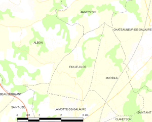
Fay-le-Clos
- commune in Drôme, France
Hiking in Fay-le-Clos
Fay-le-Clos is a charming destination situated in the scenic region of France, known for its natural beauty and peaceful landscapes. While it may not be as widely known as some other hiking spots, it offers a variety of opportunities for outdoor enthusiasts....
- Country:
- Postal Code: 26240
- Coordinates: 45° 12' 48" N, 4° 54' 21" E
- GPS tracks (wikiloc): [Link]
- Area: 4.56 sq km
- Population: 169


Beausemblant
- commune in Drôme, France
- Country:
- Postal Code: 26240
- Coordinates: 45° 13' 1" N, 4° 49' 49" E
- GPS tracks (wikiloc): [Link]
- Area: 11.67 sq km
- Population: 1416

Anneyron
- commune in Drôme, France
Hiking in Anneyron
Anneyron is a charming town located in the Drôme department in southeastern France. Nestled in the Rhône Valley, it's a great starting point for exploring the surrounding natural landscapes. Here are some highlights and tips for hiking in and around Anneyron:...
- Country:
- Postal Code: 26140
- Coordinates: 45° 16' 16" N, 4° 53' 16" E
- GPS tracks (wikiloc): [Link]
- Area: 36.23 sq km
- Population: 3924
- Web site: [Link]