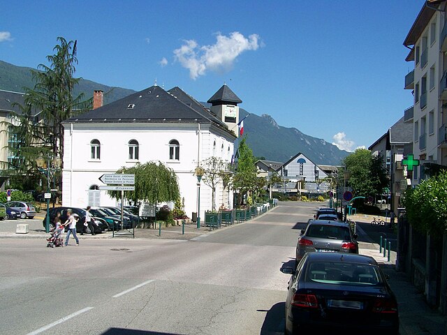
Saint-Sulpice, Savoie (Saint-Sulpice)

- commune in Savoie, France
 Hiking in Saint-Sulpice, Savoie
Saint-Sulpice in Savoie is a charming village located in the French Alps, offering beautiful hiking opportunities in a stunning natural setting. Here are some key points to consider when hiking in this area:
-
Scenic Trails: The region is characterized by its mountainous terrain, lush forests, and alpine meadows. There are various hiking trails suitable for different skill levels, ranging from easy walks to more challenging treks. You can explore paths that lead to breathtaking viewpoints, lakes, and waterfalls.
-
Flora and Fauna: As you hike, you may encounter a rich diversity of plant and animal life. The alpine environment supports unique species, and in the right season, wildflowers can create a vibrant landscape.
-
Access to Other Trails: Saint-Sulpice serves as a great starting point for exploring surrounding areas, including nearby valleys and peaks. You can easily connect to larger hiking networks in the Chartreuse Mountains or the Vanoise National Park, both popular for hiking enthusiasts.
-
Seasonal Considerations: The best times for hiking in this area are typically late spring through early autumn (from May to October). Snow may linger on higher trails well into the summer, so checking trail conditions and ensuring you have appropriate gear is essential.
-
Local Wildlife: Keep an eye out for wildlife such as chamois, ibex, and various bird species. Respecting their habitat is crucial, so stick to marked trails and observe from a distance.
-
Safety Tips: Always let someone know your hiking plans, carry enough water, snacks, a map or GPS device, and wear appropriate hiking gear. Weather conditions can change rapidly in the mountains, so be prepared for varying conditions.
-
Cultural Touches: As you explore the trails, take the time to appreciate the local culture, which includes traditional alpine architecture, mountain huts, and possibly local culinary specialties in the villages.
-
Guided Tours: If you're unfamiliar with the area or prefer to have local knowledge, consider joining a guided hiking tour. This can enhance your experience and ensure a safer adventure.
In summary, hiking in Saint-Sulpice, Savoie offers an enriching experience surrounded by the beauty of the French Alps. Whether you're looking for a leisurely hike or a more challenging trek, this area has something for everyone.
- Country:

- Postal Code: 73160
- Coordinates: 45° 34' 4" N, 5° 50' 42" E


- GPS tracks (wikiloc): [Link]
- Area: 8.82 sq km
- Population: 777
- Web site: http://www.saintsulpice73.fr
- Wikipedia en: wiki(en)
- Wikipedia: wiki(fr)
- Wikidata storage: Wikidata: Q261357
- Wikipedia Commons Category: [Link]
- Freebase ID: [/m/03qln38]
- GeoNames ID: Alt: [6617593]
- SIREN number: [217302819]
- BnF ID: [15274211t]
- INSEE municipality code: 73281
Shares border with regions:


Vimines
- commune in Savoie, France
Hiking in Vimines
It seems that Vimines might be a lesser-known location, as it doesn't appear in common hiking resources or databases. However, if you have a specific area in mind, such as a town or region near Vimines, I can offer general hiking advice or information on nearby hiking trails....
- Country:
- Postal Code: 73160
- Coordinates: 45° 32' 44" N, 5° 51' 54" E
- GPS tracks (wikiloc): [Link]
- Area: 14.23 sq km
- Population: 1965
- Web site: [Link]


Aiguebelette-le-Lac
- commune in Savoie, France
Hiking in Aiguebelette-le-Lac
Aiguebelette-le-Lac is a beautiful destination located in the Savoie region of France, known for its stunning lake—one of the cleanest in Europe—and surrounding natural landscapes, making it a fantastic spot for hiking enthusiasts....
- Country:
- Postal Code: 73610
- Coordinates: 45° 32' 16" N, 5° 48' 54" E
- GPS tracks (wikiloc): [Link]
- Area: 7.91 sq km
- Population: 243


Chambéry
- commune in Savoie, France
Hiking in Chambéry
Chambéry, located in the Auvergne-Rhône-Alpes region of France, is surrounded by stunning mountains and beautiful landscapes, making it an excellent destination for hiking enthusiasts. Here are some highlights about hiking in the area:...
- Country:
- Postal Code: 73000
- Coordinates: 45° 33' 59" N, 5° 55' 15" E
- GPS tracks (wikiloc): [Link]
- AboveSeaLevel: 270 м m
- Area: 20.99 sq km
- Population: 59697
- Web site: [Link]


Nances
- commune in Savoie, France
Hiking in Nances
Nances, often associated with scenic trails and beautiful landscapes, offers a variety of hiking opportunities for outdoor enthusiasts. Here’s a general guide to hiking in the Nances area, which you can adapt based on your specific location or preferences:...
- Country:
- Postal Code: 73470
- Coordinates: 45° 35' 25" N, 5° 47' 48" E
- GPS tracks (wikiloc): [Link]
- Area: 9.9 sq km
- Population: 451
- Web site: [Link]


Cognin
- commune in Savoie, France
Hiking in Cognin
Cognin is a charming town located in the Savoie region of France, close to the city of Chambéry. The region offers beautiful landscapes, including mountains, forests, and lakes, making it a great destination for hiking enthusiasts....
- Country:
- Postal Code: 73160
- Coordinates: 45° 33' 43" N, 5° 53' 50" E
- GPS tracks (wikiloc): [Link]
- Area: 4.48 sq km
- Population: 6097
- Web site: [Link]

La Motte-Servolex
- commune in Savoie, France
Hiking in La Motte-Servolex
La Motte-Servolex is a charming commune located in the Savoie department in the Auvergne-Rhône-Alpes region of southeastern France. Nestled near the foothills of the Chartreuse Mountains and close to the city of Chambéry, it offers a variety of hiking opportunities for all skill levels....
- Country:
- Postal Code: 73290
- Coordinates: 45° 35' 48" N, 5° 52' 39" E
- GPS tracks (wikiloc): [Link]
- Area: 29.85 sq km
- Population: 11731
- Web site: [Link]