
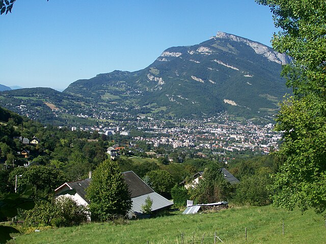
Chambéry (Chambéry)

- commune in Savoie, France
 Hiking in Chambéry
Chambéry, located in the Auvergne-Rhône-Alpes region of France, is surrounded by stunning mountains and beautiful landscapes, making it an excellent destination for hiking enthusiasts. Here are some highlights about hiking in the area:
Scenic Trails
- Massif des Bauges: This regional natural park offers a variety of trails that range from easy walks to more challenging hikes. The park is known for its diverse flora and fauna, as well as its breathtaking views of the Alps.
- Chartreuse Mountain Range: Just a short drive from Chambéry, the Chartreuse Mountains feature trails that often lead to stunning viewpoints and serene alpine lakes. The iconic Grand Som mountain is a popular destination for hikers seeking a rewarding challenge.
Popular Hikes
- Le Mont Granier: A hike that offers panoramic views of the surrounding valleys and beyond. It’s a moderate hike that provides a great opportunity to see the natural beauty of the region.
- Lac de la Thuile: A lovely hike that leads to a picturesque lake. The trail is family-friendly and suitable for hikers of all skill levels, making it a great spot for a relaxed day outdoors.
- Gorges du Sierroz: This trail takes you through impressive gorges and along rivers, offering a mix of stunning natural landscapes and interesting geological features.
Accessibility
Chambéry is well-connected by public transportation, making it easy to access trailheads in the surrounding mountains. Many trails can also be reached by car, providing flexibility for hikers.
Seasonal Considerations
- Spring and Summer: Ideal for wildflower sightings and clear views. These months typically offer warmer weather, making them perfect for hiking.
- Fall: The autumn foliage adds a beautiful backdrop to hikes, and the cooler temperatures can make for comfortable trekking.
- Winter: Some trails may be accessible for snowshoeing or winter hiking, but it's essential to check conditions and be prepared for snow and cold weather.
Safety and Preparation
- Always check trail conditions and weather forecasts before heading out.
- Wear appropriate clothing and sturdy footwear.
- Carry enough water and snacks, as amenities might be sparse on the trails.
- Inform someone about your planned route and expected return time, especially for more remote hikes.
Local Resources
- Consider visiting the local tourist office in Chambéry for maps, information on guided hikes, and recommendations tailored to your interests and abilities.
Overall, Chambéry and its surrounding areas offer a wealth of hiking opportunities that cater to various skill levels, ensuring a rewarding experience in nature. Enjoy your hikes!
- Country:

- Postal Code: 73000
- Coordinates: 45° 33' 59" N, 5° 55' 15" E


- GPS tracks (wikiloc): [Link]
- AboveSeaLevel: 270 м m
- Area: 20.99 sq km
- Population: 59697
- Web site: http://www.chambery.fr
- Wikipedia en: wiki(en)
- Wikipedia: wiki(fr)
- Wikidata storage: Wikidata: Q165090
- Wikipedia Commons Gallery: [Link]
- Wikipedia Commons Category: [Link]
- Wikipedia Commons Maps Category: [Link]
- Freebase ID: [/m/03lj05]
- Freebase ID: [/m/03lj05]
- GeoNames ID: Alt: [3027422]
- GeoNames ID: Alt: [3027422]
- SIREN number: [217300656]
- SIREN number: [217300656]
- BnF ID: [15274000m]
- BnF ID: [15274000m]
- VIAF ID: Alt: [167513303]
- VIAF ID: Alt: [167513303]
- GND ID: Alt: [4085206-4]
- GND ID: Alt: [4085206-4]
- archINFORM location ID: [639]
- archINFORM location ID: [639]
- Library of Congress authority ID: Alt: [n80087725]
- Library of Congress authority ID: Alt: [n80087725]
- MusicBrainz area ID: [369d731d-724f-49d2-bb7d-12e4af8a2dec]
- MusicBrainz area ID: [369d731d-724f-49d2-bb7d-12e4af8a2dec]
- Quora topic ID: [Chambéry]
- Quora topic ID: [Chambéry]
- UN/LOCODE: [FRCMF]
- UN/LOCODE: [FRCMF]
- SUDOC authorities ID: [026369311]
- SUDOC authorities ID: [026369311]
- Encyclopædia Britannica Online ID: [place/Chambery]
- Encyclopædia Britannica Online ID: [place/Chambery]
- Gran Enciclopèdia Catalana ID: [0017311]
- Gran Enciclopèdia Catalana ID: [0017311]
- Encyclopædia Universalis ID: [chambery]
- Encyclopædia Universalis ID: [chambery]
- INSEE municipality code: 73065
- INSEE municipality code: 73065
Shares border with regions:


Jacob-Bellecombette
- commune in Savoie, France
Hiking in Jacob-Bellecombette
Jacob-Bellecombette is a charming commune located in the Savoie department in the Auvergne-Rhône-Alpes region of southeastern France, near the city of Chambéry. The area is surrounded by beautiful natural scenery, making it an excellent destination for hiking enthusiasts....
- Country:
- Postal Code: 73000
- Coordinates: 45° 33' 20" N, 5° 54' 49" E
- GPS tracks (wikiloc): [Link]
- Area: 2.47 sq km
- Population: 3899
- Web site: [Link]

Saint-Sulpice, Savoie
- commune in Savoie, France
Hiking in Saint-Sulpice, Savoie
Saint-Sulpice in Savoie is a charming village located in the French Alps, offering beautiful hiking opportunities in a stunning natural setting. Here are some key points to consider when hiking in this area:...
- Country:
- Postal Code: 73160
- Coordinates: 45° 34' 4" N, 5° 50' 42" E
- GPS tracks (wikiloc): [Link]
- Area: 8.82 sq km
- Population: 777
- Web site: [Link]


Bassens
- commune in Savoie, France
Hiking in Bassens
Bassens, located in the Savoie department in the Auvergne-Rhône-Alpes region of France, is near the picturesque city of Chambéry and offers a variety of outdoor activities, including hiking. The area is characterized by its beautiful landscapes, a mix of mountains, valleys, and forests, making it an excellent destination for outdoor enthusiasts....
- Country:
- Postal Code: 73000
- Coordinates: 45° 34' 52" N, 5° 56' 27" E
- GPS tracks (wikiloc): [Link]
- Area: 3.11 sq km
- Population: 3998
- Web site: [Link]


Cognin
- commune in Savoie, France
Hiking in Cognin
Cognin is a charming town located in the Savoie region of France, close to the city of Chambéry. The region offers beautiful landscapes, including mountains, forests, and lakes, making it a great destination for hiking enthusiasts....
- Country:
- Postal Code: 73160
- Coordinates: 45° 33' 43" N, 5° 53' 50" E
- GPS tracks (wikiloc): [Link]
- Area: 4.48 sq km
- Population: 6097
- Web site: [Link]

Barberaz
- commune in Savoie, France
Hiking in Barberaz
Barberaz, located near Chambéry in the Savoie region of France, offers a variety of hiking opportunities, especially for those who enjoy beautiful alpine scenery and local nature. Here are some highlights and tips for hiking in and around Barberaz:...
- Country:
- Postal Code: 73000
- Coordinates: 45° 33' 48" N, 5° 56' 41" E
- GPS tracks (wikiloc): [Link]
- Area: 3.79 sq km
- Population: 4640
- Web site: [Link]


Saint-Alban-Leysse
- commune in Savoie, France
Hiking in Saint-Alban-Leysse
Saint-Alban-Leysse, located in the Savoie department in the Auvergne-Rhône-Alpes region of France, offers beautiful hiking opportunities amidst stunning natural landscapes. The area is characterized by its picturesque surroundings, with the Chartreuse and Bauges mountain ranges nearby, making it a great spot for outdoor enthusiasts....
- Country:
- Postal Code: 73230
- Coordinates: 45° 34' 48" N, 5° 57' 29" E
- GPS tracks (wikiloc): [Link]
- Area: 8.4 sq km
- Population: 5687
- Web site: [Link]

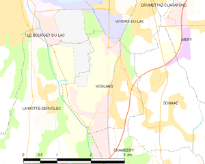
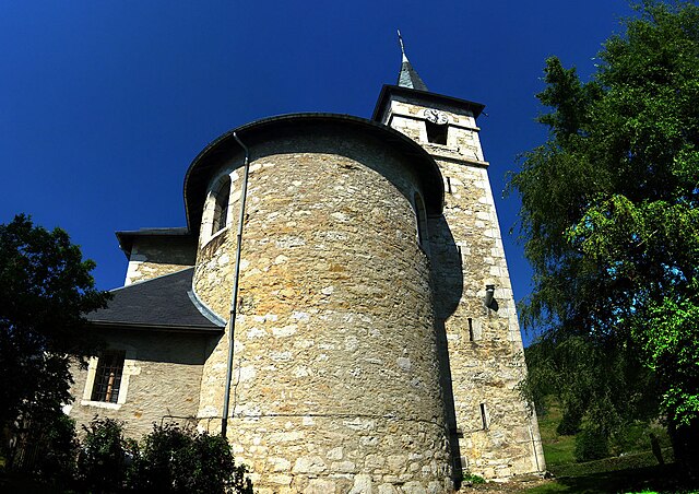
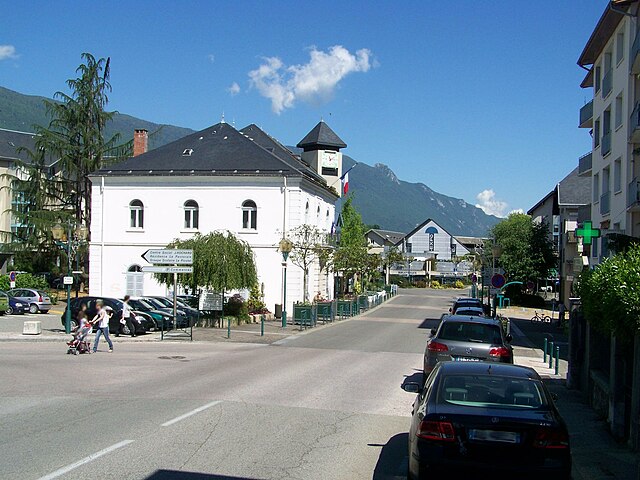
Voglans
- commune in Savoie, France
Hiking in Voglans
Voglans, located in the Savoie department in the Auvergne-Rhône-Alpes region of southeastern France, offers beautiful hiking opportunities, mainly due to its proximity to the majestic Bauges Massif and Lake Bourget. The region is characterized by stunning landscapes, diverse flora and fauna, and a mix of terrains suitable for various levels of hikers....
- Country:
- Postal Code: 73420
- Coordinates: 45° 37' 57" N, 5° 53' 45" E
- GPS tracks (wikiloc): [Link]
- Area: 4.62 sq km
- Population: 1852
- Web site: [Link]


Sonnaz
- commune in Savoie, France
Hiking in Sonnaz
Sonnaz, a charming village in the Auvergne-Rhône-Alpes region of France, offers a variety of hiking opportunities that showcase its natural beauty and scenic landscapes. Here are some key points to consider when planning your hiking adventures in and around Sonnaz:...
- Country:
- Postal Code: 73000
- Coordinates: 45° 37' 3" N, 5° 54' 52" E
- GPS tracks (wikiloc): [Link]
- Area: 6.79 sq km
- Population: 1795
- Web site: [Link]

La Motte-Servolex
- commune in Savoie, France
Hiking in La Motte-Servolex
La Motte-Servolex is a charming commune located in the Savoie department in the Auvergne-Rhône-Alpes region of southeastern France. Nestled near the foothills of the Chartreuse Mountains and close to the city of Chambéry, it offers a variety of hiking opportunities for all skill levels....
- Country:
- Postal Code: 73290
- Coordinates: 45° 35' 48" N, 5° 52' 39" E
- GPS tracks (wikiloc): [Link]
- Area: 29.85 sq km
- Population: 11731
- Web site: [Link]