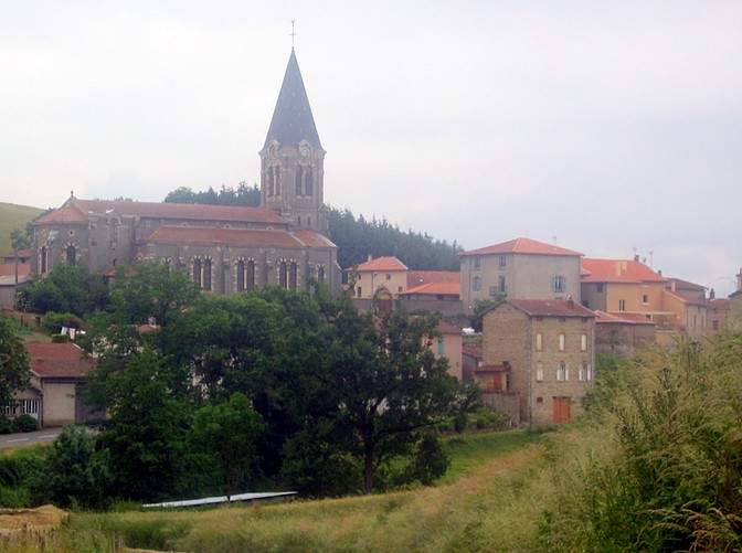
Sainte-Colombe-sur-Gand (Sainte-Colombe-sur-Gand)

- commune in Loire, France
- Country:

- Postal Code: 42540
- Coordinates: 45° 52' 44" N, 4° 16' 30" E


- GPS tracks (wikiloc): [Link]
- Area: 13.56 sq km
- Population: 427
- Web site: http://www.saintecolombesurgand.fr
- Wikipedia en: wiki(en)
- Wikipedia: wiki(fr)
- Wikidata storage: Wikidata: Q1107487
- Wikipedia Commons Category: [Link]
- Freebase ID: [/m/03nw8cp]
- Freebase ID: [/m/03nw8cp]
- GeoNames ID: Alt: [6434251]
- GeoNames ID: Alt: [6434251]
- SIREN number: [214202095]
- SIREN number: [214202095]
- BnF ID: [15259777x]
- BnF ID: [15259777x]
- INSEE municipality code: 42209
- INSEE municipality code: 42209
Shares border with regions:
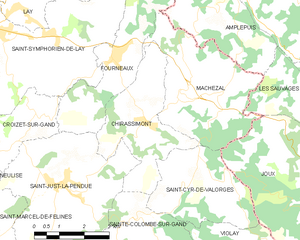
Chirassimont
- commune in Loire, France
- Country:
- Postal Code: 42114
- Coordinates: 45° 54' 49" N, 4° 17' 7" E
- GPS tracks (wikiloc): [Link]
- Area: 10.69 sq km
- Population: 405


Saint-Just-la-Pendue
- commune in Loire, France
- Country:
- Postal Code: 42540
- Coordinates: 45° 53' 39" N, 4° 14' 35" E
- GPS tracks (wikiloc): [Link]
- Area: 19.88 sq km
- Population: 1658
- Web site: [Link]

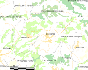
Bussières
- commune in Loire, France
- Country:
- Postal Code: 42510
- Coordinates: 45° 50' 15" N, 4° 16' 6" E
- GPS tracks (wikiloc): [Link]
- Area: 16.76 sq km
- Population: 1576
- Web site: [Link]


Violay
- commune in Loire, France
- Country:
- Postal Code: 42780
- Coordinates: 45° 51' 11" N, 4° 21' 29" E
- GPS tracks (wikiloc): [Link]
- Area: 27.07 sq km
- Population: 1238


Saint-Cyr-de-Valorges
- commune in Loire, France
- Country:
- Postal Code: 42114
- Coordinates: 45° 53' 29" N, 4° 18' 22" E
- GPS tracks (wikiloc): [Link]
- Area: 9.91 sq km
- Population: 306