
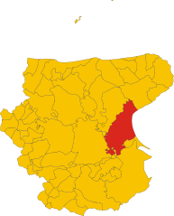
San Giovanni Rotondo (San Giovanni Rotondo)
.svg)
- Italian comune
 Hiking in San Giovanni Rotondo
San Giovanni Rotondo, located in the Apulia region of Italy, is not only famous for being the home of Padre Pio but also offers beautiful landscapes and hiking opportunities for outdoor enthusiasts. The area surrounding the town boasts picturesque scenery, with rolling hills, limestone cliffs, and a mix of Mediterranean vegetation.
Hiking Highlights:
-
Gargano National Park: Just a short distance from San Giovanni Rotondo, this park features diverse ecosystems, including forests, coastlines, and rocky cliffs. There are various trails that cater to different skill levels. You can explore trails through the Umbra Forest, which is rich in flora and fauna.
-
The Path of the Pilgrims: This historical route connects various religious sites in the area and offers scenic views as you hike. Along the way, you’ll encounter both natural beauty and cultural landmarks.
-
Monte Sant’Angelo: A nearby town accessible via hiking trails, it is famous for the Sanctuary of Monte Sant'Angelo, a UNESCO World Heritage site. The trails leading there reward hikers with stunning views of the Gargano coastline.
-
Caves of the Castellana: If you’re interested in a bit of adventure beyond hiking, you can explore the incredible caves located a bit further away, adding a geological twist to your visit.
Tips for Hiking in the Area:
- Trail Maps: Make sure to have a reliable trail map or GPS device, as some trails may not be well marked.
- Weather: The best time to hike in the region is during spring and fall when the weather is mild. Summers can be quite hot, especially during midday.
- Hydration and Snacks: Carry enough water and snacks, particularly if you plan to hike longer trails.
- Footwear: Wear sturdy hiking boots to handle the terrain properly, especially in more rugged areas.
- Wildlife Awareness: Be mindful of the local wildlife, and remember to respect nature by not disturbing animals or plants.
San Giovanni Rotondo is a fantastic place for hiking, blending stunning natural landscapes with a sense of spiritual history. Enjoy your hiking adventures!
- Country:

- Postal Code: 71013
- Local Dialing Code: 0882
- Licence Plate Code: FG
- Coordinates: 41° 42' 0" N, 15° 44' 0" E


- GPS tracks (wikiloc): [Link]
- AboveSeaLevel: 565 м m
- Area: 261.88 sq km
- Population: 27172
- Web site: http://www.sangiovannirotondo.it
- Wikipedia en: wiki(en)
- Wikipedia: wiki(it)
- Wikidata storage: Wikidata: Q51951
- Wikipedia Commons Gallery: [Link]
- Wikipedia Commons Category: [Link]
- Freebase ID: [/m/066z_5]
- GeoNames ID: Alt: [6540744]
- VIAF ID: Alt: [133405691]
- OSM relation ID: [41355]
- GND ID: Alt: [4218285-2]
- archINFORM location ID: [1063]
- MusicBrainz area ID: [77001af0-024d-4f2c-a2e4-cafb40459386]
- Quora topic ID: [San-Giovanni-Rotondo]
- TGN ID: [1046533]
- UN/LOCODE: [ITGBN]
- Gran Enciclopèdia Catalana ID: [0058703]
- DMOZ ID: Alt: [Regional/Europe/Italy/Puglia/Localities/San_Giovanni_Rotondo/]
- ISTAT ID: 071046
- Italian cadastre code: H926
Shares border with regions:


Foggia
- Italian comune
Hiking in Foggia
Foggia, located in the Apulia region of southeastern Italy, offers a diverse range of hiking opportunities that cater to various skill levels and preferences. The surrounding areas are known for their rich natural beauty, historical significance, and unique landscapes....
- Country:
- Postal Code: 71121–71122
- Local Dialing Code: 0881
- Licence Plate Code: FG
- Coordinates: 41° 28' 0" N, 15° 34' 0" E
- GPS tracks (wikiloc): [Link]
- AboveSeaLevel: 76 м m
- Area: 509.26 sq km
- Population: 151975
- Web site: [Link]

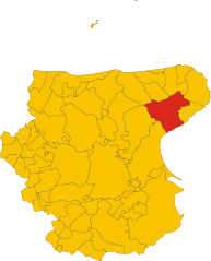
Manfredonia
- Italian comune
Hiking in Manfredonia
Manfredonia, located on the Adriatic coast of Italy in the Apulia region, offers a unique blend of natural beauty, cultural heritage, and hiking opportunities. The area is characterized by its stunning coastline, historical sites, and proximity to the Gargano National Park, which is a haven for outdoor enthusiasts....
- Country:
- Postal Code: 71043
- Local Dialing Code: 0884
- Licence Plate Code: FG
- Coordinates: 41° 38' 0" N, 15° 55' 0" E
- GPS tracks (wikiloc): [Link]
- AboveSeaLevel: 5 м m
- Area: 354.54 sq km
- Population: 56906
- Web site: [Link]

Monte Sant'Angelo
- Italian comune
Hiking in Monte Sant'Angelo
Monte Sant'Angelo is a scenic town located in the Apulia region of southern Italy, situated on the Gargano Peninsula. It offers a variety of hiking opportunities, characterized by stunning landscapes, rich historical sites, and diverse flora and fauna....
- Country:
- Postal Code: 71037
- Local Dialing Code: 0884
- Licence Plate Code: FG
- Coordinates: 41° 42' 0" N, 15° 58' 0" E
- GPS tracks (wikiloc): [Link]
- AboveSeaLevel: 796 м m
- Area: 245.13 sq km
- Population: 12342
- Web site: [Link]


Rignano Garganico
- Italian comune
Hiking in Rignano Garganico
Rignano Garganico is a charming village located in the Apulia region of Italy, nestled in the Gargano National Park. This area is known for its stunning natural landscapes, diverse ecosystems, and rich cultural heritage, making it an excellent destination for hiking enthusiasts....
- Country:
- Postal Code: 71010
- Local Dialing Code: 0882
- Licence Plate Code: FG
- Coordinates: 41° 41' 0" N, 15° 35' 0" E
- GPS tracks (wikiloc): [Link]
- AboveSeaLevel: 590 м m
- Area: 89.4 sq km
- Population: 2017
- Web site: [Link]


San Marco in Lamis
- Italian comune
Hiking in San Marco in Lamis
San Marco in Lamis, located in the Apulia region of Italy, offers a variety of hiking opportunities amidst beautiful natural landscapes and historical sites. Here are some key points about hiking in this area:...
- Country:
- Postal Code: 71014
- Local Dialing Code: 0882
- Licence Plate Code: FG
- Coordinates: 41° 42' 42" N, 15° 38' 6" E
- GPS tracks (wikiloc): [Link]
- AboveSeaLevel: 550 м m
- Area: 234.2 sq km
- Population: 13583
- Web site: [Link]