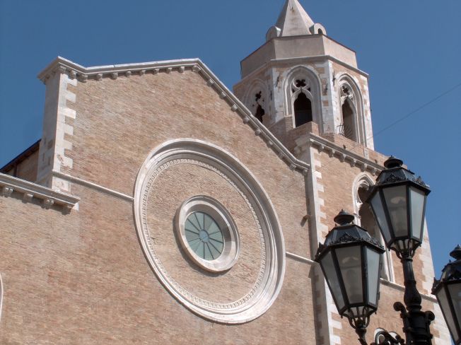
San Paolo di Civitate (San Paolo di Civitate)
.svg)
- Italian comune
 Hiking in San Paolo di Civitate
San Paolo di Civitate is a charming town located in the province of Foggia in the Apulia region of Italy. While it might not be as widely known for hiking as some other Italian destinations, there are opportunities to explore the picturesque landscapes and rural paths around the town.
Hiking Opportunities:
-
Countryside Trails: The area around San Paolo di Civitate is characterized by rolling hills, olive groves, and agricultural land, so you can find various trails that allow for leisurely hikes through scenic countryside. Look for local paths that connect nearby villages and take in the local flora and fauna.
-
Gargano National Park: A bit further afield, about an hour's drive from San Paolo di Civitate, is Gargano National Park. This park offers an array of hiking trails that range from easy walks to more challenging hikes. You can explore dramatic cliffs, lush forests, and stunning coastal views in this expansive natural reserve.
-
Local Guides: Engaging a local guide can enhance your hiking experience, offering insight into the area's history, culture, and natural environment. They can also help you find hidden gems and lesser-known trails.
-
Wildlife Watching: While hiking, you may encounter diverse wildlife, particularly bird species. Bring binoculars if you're interested in birdwatching along the trails.
-
Cultural Experiences: Combining your hikes with visits to historical sites, churches, and local farms can provide a richer experience. Take some time to sample the local cuisine, including fresh pasta and the region's excellent wines.
Tips for Hiking in San Paolo di Civitate:
- Best Time to Hike: Spring (April to June) and fall (September to October) are ideal times for hiking in this region, offering mild weather and beautiful scenery.
- Safety: Always let someone know your hiking plans, carry enough water, wear suitable footwear, and check local weather conditions before heading out.
- Map and Navigation: Make sure to have a physical or digital map of the area, as trails may not always be clearly marked.
In summary, while San Paolo di Civitate may not be a major hiking hub, its surrounding landscapes and proximity to national parks provide a variety of hiking opportunities that are worth exploring. Enjoy your adventure!
- Country:

- Postal Code: 71010
- Local Dialing Code: 0882
- Licence Plate Code: FG
- Coordinates: 41° 44' 0" N, 15° 16' 0" E


- GPS tracks (wikiloc): [Link]
- AboveSeaLevel: 215 м m
- Area: 91.16 sq km
- Population: 5740
- Web site: http://www.comune.sanpaolodicivitate.fg.it/
- Wikipedia en: wiki(en)
- Wikipedia: wiki(it)
- Wikidata storage: Wikidata: Q51956
- Wikipedia Commons Category: [Link]
- Freebase ID: [/m/0fz6j8]
- GeoNames ID: Alt: [6540745]
- VIAF ID: Alt: [238792630]
- OSM relation ID: [41515]
- archINFORM location ID: [45549]
- UN/LOCODE: [ITPD2]
- ISTAT ID: 071050
- Italian cadastre code: I072
Shares border with regions:


San Severo
- Italian comune
Hiking in San Severo
San Severo, located in the Apulia region of Italy, is known for its rich history, picturesque landscapes, and agricultural fields. While it may not be as famous as other Italian hiking destinations, it offers some charming opportunities for outdoor enthusiasts. Here are some aspects to consider for hiking in this area:...
- Country:
- Postal Code: 71016
- Local Dialing Code: 0882
- Licence Plate Code: FG
- Coordinates: 41° 41' 42" N, 15° 22' 45" E
- GPS tracks (wikiloc): [Link]
- AboveSeaLevel: 90 м m
- Area: 333 sq km
- Population: 53015
- Web site: [Link]


Apricena
- Italian comune
Hiking in Apricena
Apricena is a charming town located in the Apulia region of Italy, near the Adriatic coast and known for its beautiful limestone cliffs, olive groves, and scenic landscapes. Hiking in this region can offer a mix of coastal views, nature, and cultural experiences....
- Country:
- Postal Code: 71011
- Local Dialing Code: 0882
- Licence Plate Code: FG
- Coordinates: 41° 47' 5" N, 15° 26' 37" E
- GPS tracks (wikiloc): [Link]
- AboveSeaLevel: 73 м m
- Area: 172.51 sq km
- Population: 13174
- Web site: [Link]
Lesina
- Italian comune
Hiking in Lesina
Lesina, located in the Apulia region of Italy, is known for its scenic landscapes, charming coastal areas, and rich natural resources, making it an excellent destination for hiking enthusiasts. Here are some key points about hiking in and around Lesina:...
- Country:
- Postal Code: 71010
- Local Dialing Code: 0882
- Licence Plate Code: FG
- Coordinates: 41° 52' 0" N, 15° 21' 0" E
- GPS tracks (wikiloc): [Link]
- AboveSeaLevel: 5 м m
- Area: 160.16 sq km
- Population: 6347
- Web site: [Link]

Lucera
- Italian comune
Hiking in Lucera
Lucera, located in the Apulia region of southern Italy, offers a variety of hiking opportunities that allow you to experience the beautiful landscapes, historical sites, and unique flora and fauna of the area. Here are some key points to consider for hiking in and around Lucera:...
- Country:
- Postal Code: 71036
- Local Dialing Code: 0881
- Licence Plate Code: FG
- Coordinates: 41° 30' 0" N, 15° 20' 0" E
- GPS tracks (wikiloc): [Link]
- AboveSeaLevel: 50 м m
- Area: 339.79 sq km
- Population: 33085
- Web site: [Link]
Poggio Imperiale
- Italian comune
Hiking in Poggio Imperiale
Poggio Imperiale, located in the province of Livorno in Tuscany, Italy, is a beautiful area that offers a variety of hiking opportunities. The region is known for its stunning landscapes, dotted with rolling hills, vineyards, olive groves, and picturesque villages....
- Country:
- Postal Code: 71010
- Local Dialing Code: 0882
- Licence Plate Code: FG
- Coordinates: 41° 49' 0" N, 15° 22' 0" E
- GPS tracks (wikiloc): [Link]
- AboveSeaLevel: 75 м m
- Area: 52.88 sq km
- Population: 2697
- Web site: [Link]


Serracapriola
- Italian comune
Hiking in Serracapriola
Serracapriola is a charming town located in the province of Foggia in the Apulia (Puglia) region of Italy. It offers a picturesque backdrop for hiking enthusiasts, with its lush landscapes, rolling hills, and historical sites. Here are some highlights and suggestions for hiking in and around Serracapriola:...
- Country:
- Postal Code: 71010
- Local Dialing Code: 0882
- Licence Plate Code: FG
- Coordinates: 41° 48' 0" N, 15° 10' 0" E
- GPS tracks (wikiloc): [Link]
- AboveSeaLevel: 272 м m
- Area: 143.36 sq km
- Population: 3877
- Web site: [Link]


Torremaggiore
- Italian comune
Hiking in Torremaggiore
Torremaggiore, located in the Apulia region of southern Italy, offers a unique and scenic hiking experience. While it may not be as famous for hiking as some other regions of Italy, it still boasts beautiful landscapes, historical sites, and a rich cultural backdrop....
- Country:
- Postal Code: 71017
- Local Dialing Code: 0882
- Licence Plate Code: FG
- Coordinates: 41° 41' 0" N, 15° 17' 0" E
- GPS tracks (wikiloc): [Link]
- AboveSeaLevel: 169 м m
- Area: 208.57 sq km
- Population: 17069
- Web site: [Link]