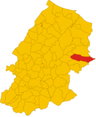
Torremaggiore (Torremaggiore)
.svg)
- Italian comune
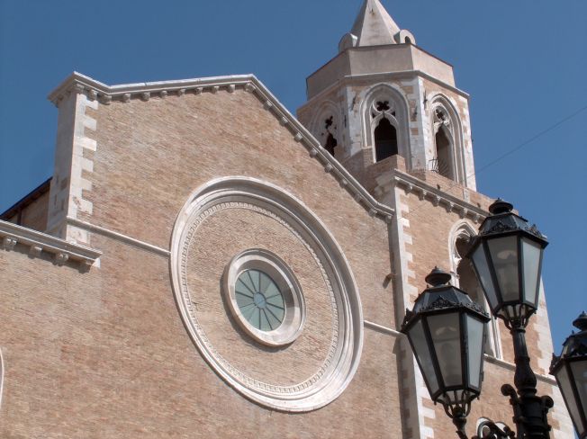
 Hiking in Torremaggiore
Torremaggiore, located in the Apulia region of southern Italy, offers a unique and scenic hiking experience. While it may not be as famous for hiking as some other regions of Italy, it still boasts beautiful landscapes, historical sites, and a rich cultural backdrop.
Hiking Opportunities
-
Natural Surroundings: The area around Torremaggiore is characterized by lush countryside, olive groves, and rolling hills. The terrain is relatively gentle, making it accessible for hikers of various skill levels.
-
Gargano National Park: While not directly in Torremaggiore, this national park is a short drive away and offers incredible hiking trails with stunning views of the Adriatic coastline, rugged cliffs, and diverse ecosystems. Popular trails include paths leading to the Umbra Forest and the coast at Vieste.
-
Historical Trails: Hiking in the area also allows you to explore ancient towns and historical ruins. You might find trails that lead from Torremaggiore to nearby villages, where you can discover charming streets, old churches, and local cuisine.
-
Guided Tours: Consider joining a guided hiking tour that can provide insights into the local flora, fauna, and history, enhancing your outdoor experience.
Considerations
-
Best Time to Hike: The ideal seasons for hiking in Torremaggiore are spring (April to June) and fall (September to October), when the weather is mild and the landscapes are at their most beautiful.
-
Gear and Preparation: Make sure to wear comfortable hiking shoes and bring plenty of water, snacks, and a map or GPS device. While some trails are well-marked, it's always best to be prepared.
-
Local Culture: Don’t miss the opportunity to enjoy local food and wine after a hike. The region is known for its olives and wines, so indulge in a well-deserved meal after a day on the trails.
Whether you're a seasoned hiker or a casual walker, the hiking opportunities in and around Torremaggiore can provide a rewarding way to experience the natural beauty and cultural richness of the Apulia region.
- Country:

- Postal Code: 71017
- Local Dialing Code: 0882
- Licence Plate Code: FG
- Coordinates: 41° 41' 0" N, 15° 17' 0" E


- GPS tracks (wikiloc): [Link]
- AboveSeaLevel: 169 м m
- Area: 208.57 sq km
- Population: 17069
- Web site: http://www.comune.torremaggiore.fg.it
- Wikipedia en: wiki(en)
- Wikipedia: wiki(it)
- Wikidata storage: Wikidata: Q51964
- Wikipedia Commons Category: [Link]
- Freebase ID: [/m/0fz6ks]
- GeoNames ID: Alt: [6542269]
- VIAF ID: Alt: [246945624]
- OSM relation ID: [41412]
- MusicBrainz area ID: [10fd4577-3e04-43a5-8859-456996ed71b1]
- Quora topic ID: [Torremaggiore]
- UN/LOCODE: [ITTFG]
- Gran Enciclopèdia Catalana ID: [0066786]
- ISTAT ID: 071056
- Italian cadastre code: L273
Shares border with regions:


San Severo
- Italian comune
Hiking in San Severo
San Severo, located in the Apulia region of Italy, is known for its rich history, picturesque landscapes, and agricultural fields. While it may not be as famous as other Italian hiking destinations, it offers some charming opportunities for outdoor enthusiasts. Here are some aspects to consider for hiking in this area:...
- Country:
- Postal Code: 71016
- Local Dialing Code: 0882
- Licence Plate Code: FG
- Coordinates: 41° 41' 42" N, 15° 22' 45" E
- GPS tracks (wikiloc): [Link]
- AboveSeaLevel: 90 м m
- Area: 333 sq km
- Population: 53015
- Web site: [Link]
Rotello
- Italian comune
Hiking in Rotello
Rotello is a charming village located in the Molise region of Italy, known for its beautiful landscapes and hiking opportunities. The surrounding area offers scenic trails that range from easy to more challenging routes, making it suitable for hikers of all skill levels. Here are some things to consider when hiking in Rotello:...
- Country:
- Postal Code: 86040
- Local Dialing Code: 0874
- Licence Plate Code: CB
- Coordinates: 41° 44' 51" N, 15° 0' 15" E
- GPS tracks (wikiloc): [Link]
- AboveSeaLevel: 360 м m
- Area: 70.75 sq km
- Population: 1191
- Web site: [Link]

Santa Croce di Magliano
- Italian comune
Hiking in Santa Croce di Magliano
Santa Croce di Magliano is a charming town located in the Molise region of Italy, known for its scenic landscapes and rich history. Hiking in this area offers a unique opportunity to explore the natural beauty and cultural heritage of the region....
- Country:
- Postal Code: 86047
- Local Dialing Code: 0874
- Licence Plate Code: CB
- Coordinates: 41° 43' 0" N, 14° 59' 0" E
- GPS tracks (wikiloc): [Link]
- AboveSeaLevel: 608 м m
- Area: 53.37 sq km
- Population: 4345
- Web site: [Link]


Casalvecchio di Puglia
- Italian comune
Hiking in Casalvecchio di Puglia
Casalvecchio di Puglia is a charming village located in the Apulia region of southern Italy, nestled in the northern part of the province of Foggia. While it's not as widely recognized for hiking as some other areas in Italy, the surrounding landscape offers beautiful opportunities for outdoor activities....
- Country:
- Postal Code: 71030
- Local Dialing Code: 0881
- Licence Plate Code: FG
- Coordinates: 41° 36' 0" N, 15° 7' 0" E
- GPS tracks (wikiloc): [Link]
- AboveSeaLevel: 465 м m
- Area: 31.93 sq km
- Population: 1838
- Web site: [Link]
Castelnuovo della Daunia
- Italian comune
Hiking in Castelnuovo della Daunia
Castelnuovo della Daunia is a charming town located in the Apennine Mountains of Italy, specifically in the region of Apulia (Puglia). It offers a mix of historical sites and natural beauty, making it an attractive destination for hiking enthusiasts. Here’s what you can expect when hiking in and around Castelnuovo della Daunia:...
- Country:
- Postal Code: 71034
- Local Dialing Code: 0881
- Licence Plate Code: FG
- Coordinates: 41° 35' 0" N, 15° 7' 0" E
- GPS tracks (wikiloc): [Link]
- AboveSeaLevel: 600 м m
- Area: 61.49 sq km
- Population: 1390
- Web site: [Link]

Lucera
- Italian comune
Hiking in Lucera
Lucera, located in the Apulia region of southern Italy, offers a variety of hiking opportunities that allow you to experience the beautiful landscapes, historical sites, and unique flora and fauna of the area. Here are some key points to consider for hiking in and around Lucera:...
- Country:
- Postal Code: 71036
- Local Dialing Code: 0881
- Licence Plate Code: FG
- Coordinates: 41° 30' 0" N, 15° 20' 0" E
- GPS tracks (wikiloc): [Link]
- AboveSeaLevel: 50 м m
- Area: 339.79 sq km
- Population: 33085
- Web site: [Link]


San Paolo di Civitate
- Italian comune
Hiking in San Paolo di Civitate
San Paolo di Civitate is a charming town located in the province of Foggia in the Apulia region of Italy. While it might not be as widely known for hiking as some other Italian destinations, there are opportunities to explore the picturesque landscapes and rural paths around the town....
- Country:
- Postal Code: 71010
- Local Dialing Code: 0882
- Licence Plate Code: FG
- Coordinates: 41° 44' 0" N, 15° 16' 0" E
- GPS tracks (wikiloc): [Link]
- AboveSeaLevel: 215 м m
- Area: 91.16 sq km
- Population: 5740
- Web site: [Link]


Serracapriola
- Italian comune
Hiking in Serracapriola
Serracapriola is a charming town located in the province of Foggia in the Apulia (Puglia) region of Italy. It offers a picturesque backdrop for hiking enthusiasts, with its lush landscapes, rolling hills, and historical sites. Here are some highlights and suggestions for hiking in and around Serracapriola:...
- Country:
- Postal Code: 71010
- Local Dialing Code: 0882
- Licence Plate Code: FG
- Coordinates: 41° 48' 0" N, 15° 10' 0" E
- GPS tracks (wikiloc): [Link]
- AboveSeaLevel: 272 м m
- Area: 143.36 sq km
- Population: 3877
- Web site: [Link]