San Pietro al Natisone (San Pietro al Natisone)
.svg)
- Italian comune
 Hiking in San Pietro al Natisone
San Pietro al Natisone, located in the northeastern part of Italy, near the border with Slovenia, is a beautiful area for hiking enthusiasts. The region features stunning natural landscapes, including rolling hills, dense forests, and the Natisone River. Here are some key highlights regarding hiking in this area:
-
Scenic Trails: The area is known for its diverse hiking trails that vary in difficulty, making it suitable for both beginners and experienced hikers. You can find paths that lead through picturesque landscapes, ancient villages, and offer panoramic views of the Julian Alps.
-
Natural Parks: Close to San Pietro al Natisone, you can explore the Natural Park of the Julian Pre-Alps. Hiking in this park allows you to discover unique flora and fauna, as well as striking geological formations. The park has well-marked trails that provide various exploration options, from leisurely walks to more challenging hikes.
-
Cultural Experience: Hiking in this region also offers the opportunity to experience the local culture. The area is rich in history, with ancient churches, traditional farmhouses, and small villages where you can immerse yourself in the local way of life. Don't miss trying local delicacies and engaging with the community.
-
Access to Slovenia: Given its proximity to Slovenia, hikers can also take advantage of trails that cross into the neighboring country, which has its own beautiful hiking routes in the Julian Alps and Triglav National Park.
-
Best Time to Hike: The ideal times for hiking in San Pietro al Natisone are during the spring and fall months, when the weather is mild and the landscapes are particularly beautiful with spring blooms or autumn foliage.
-
Equipment and Preparation: Depending on your chosen trail, it's important to wear appropriate hiking gear and carry essentials such as water, snacks, a first aid kit, and a map or GPS device. Always check the weather conditions before heading out.
-
Local Guides: If you're unfamiliar with the area or prefer a guided experience, consider hiring a local guide who knows the best trails and can share insights into the ecology and history of the region.
Overall, hiking in San Pietro al Natisone offers a perfect blend of natural beauty, cultural experiences, and outdoor adventure, making it a worthwhile destination for hikers.
- Country:

- Postal Code: 33049
- Local Dialing Code: 0432
- Licence Plate Code: UD
- Coordinates: 46° 7' 48" N, 13° 29' 14" E


- GPS tracks (wikiloc): [Link]
- AboveSeaLevel: 175 м m
- Area: 23.97 sq km
- Population: 2134
- Web site: http://www.comune.san-pietro-in-casale.bo.it
- Wikipedia en: wiki(en)
- Wikipedia: wiki(it)
- Wikidata storage: Wikidata: Q53358
- Wikipedia Commons Gallery: [Link]
- Wikipedia Commons Category: [Link]
- Freebase ID: [/m/0gkb53]
- GeoNames ID: Alt: [6541018]
- VIAF ID: Alt: [125590046]
- OSM relation ID: [79276]
- UN/LOCODE: [ITPNW]
- ISTAT ID: 030103
- Italian cadastre code: I092
- CONOR ID: 288766563
Shares border with regions:

Cividale del Friuli
- Italian comune
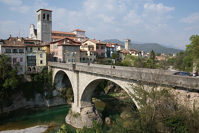
Hiking in Cividale del Friuli
Cividale del Friuli, located in the Friuli Venezia Giulia region of northeastern Italy, is not only a town rich in history and culture but also a great destination for hiking enthusiasts. The surrounding landscapes are diverse, featuring rolling hills, vineyards, and views of the nearby Julian Alps. Here are some of the highlights of hiking in this area:...
- Country:
- Postal Code: 33043
- Local Dialing Code: 0432
- Licence Plate Code: UD
- Coordinates: 46° 5' 26" N, 13° 26' 6" E
- GPS tracks (wikiloc): [Link]
- AboveSeaLevel: 135 м m
- Area: 50 sq km
- Population: 11292
- Web site: [Link]


Prepotto
- Italian comune
Hiking in Prepotto
Prepotto, located in the northeastern part of Italy, in the region of Friuli Venezia Giulia, is a beautiful destination for hiking enthusiasts. The area is known for its stunning landscapes, rolling hills, vineyards, and a rich cultural heritage....
- Country:
- Postal Code: 33040
- Local Dialing Code: 0432
- Licence Plate Code: UD
- Coordinates: 46° 2' 43" N, 13° 28' 45" E
- GPS tracks (wikiloc): [Link]
- AboveSeaLevel: 105 м m
- Area: 33.24 sq km
- Population: 753
- Web site: [Link]
Pulfero
- Italian comune
Hiking in Pulfero
Pulfero, located in the Friuli Venezia Giulia region of Italy, is a beautiful destination for hikers. Known for its stunning natural landscapes, the area offers a variety of trails that cater to different skill levels, from easy walks to challenging hikes....
- Country:
- Postal Code: 33046
- Local Dialing Code: 0432
- Licence Plate Code: UD
- Coordinates: 46° 10' 24" N, 13° 29' 4" E
- GPS tracks (wikiloc): [Link]
- AboveSeaLevel: 184 м m
- Area: 48.68 sq km
- Population: 923
- Web site: [Link]


San Leonardo
- Italian comune
Hiking in San Leonardo
San Leonardo is a charming village located in the Friuli-Venezia Giulia region of northeastern Italy. The area is known for its stunning natural landscapes, characterized by rolling hills, lush forests, and picturesque vineyards. Hiking in this region offers a variety of trails that cater to different skill levels and preferences, making it an excellent destination for outdoor enthusiasts....
- Country:
- Postal Code: 33040
- Local Dialing Code: 0432
- Licence Plate Code: UD
- Coordinates: 46° 7' 7" N, 13° 31' 53" E
- GPS tracks (wikiloc): [Link]
- AboveSeaLevel: 168 м m
- Area: 26.91 sq km
- Population: 1110
- Web site: [Link]
Savogna
- Italian comune
Hiking in Savogna
Savogna is a charming small village located in the region of Friuli Venezia Giulia in northeastern Italy. This area features beautiful natural landscapes, making it a great destination for hiking enthusiasts. Here are some highlights of hiking in Savogna:...
- Country:
- Postal Code: 33040
- Local Dialing Code: 0432
- Licence Plate Code: UD
- Coordinates: 46° 9' 34" N, 13° 32' 0" E
- GPS tracks (wikiloc): [Link]
- AboveSeaLevel: 235 м m
- Area: 22.17 sq km
- Population: 380
- Web site: [Link]
Torreano
- Italian comune
Hiking in Torreano
Torreano, located in the region of Friuli Venezia Giulia in Italy, offers a variety of hiking opportunities amidst beautiful natural landscapes. The area is characterized by rolling hills, vineyards, and charming villages, making it an excellent destination for outdoor enthusiasts....
- Country:
- Postal Code: 33040
- Local Dialing Code: 0432
- Licence Plate Code: UD
- Coordinates: 46° 8' 0" N, 13° 26' 0" E
- GPS tracks (wikiloc): [Link]
- AboveSeaLevel: 189 м m
- Area: 34.99 sq km
- Population: 2129
- Web site: [Link]