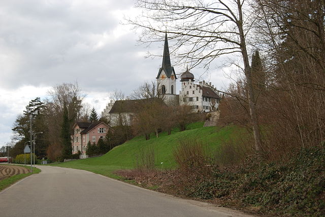
Schönholzerswilen (Schönholzerswilen)

- municipality in Switzerland
 Hiking in Schönholzerswilen
Schönholzerswilen is a small village located in the canton of Thurgau, Switzerland. It is surrounded by beautiful landscapes that offer various hiking opportunities for outdoor enthusiasts. Here are some highlights for hiking in and around Schönholzerswilen:
Scenic Trails
-
Local Trails: There are several well-marked local trails that allow you to explore the picturesque countryside. These trails often provide views of rolling hills, vineyards, and farmlands.
-
Thurgau Region: The entire Thurgau region is known for its scenic hiking paths, including vineyards and apple orchards. You can combine your hike with some local produce tasting if you visit during harvest seasons.
Natural Attractions
- Lake Constance: While not directly in Schönholzerswilen, the nearby Lake Constance offers great hiking paths along its shores, as well as opportunities for swimming and other water activities. There are several trails that lead to scenic overlooks of the lake.
Wildlife and Flora
- The area boasts a rich diversity of flora and fauna. Hikers may spot various bird species, deer, and other wildlife while traversing the paths, especially in more secluded areas.
Hiking Season
- Spring through fall are the best seasons for hiking, with beautiful wildflowers and warm weather. Winter hiking can also be enjoyable, but be prepared for cold temperatures and icy conditions.
Access to Other Trails
- Schönholzerswilen serves as a great starting point to access larger networks of trails in the Thurgau and neighboring cantons. Many hikers use public transport to reach more remote or elevated trailheads.
Important Tips
- Always check the weather before heading out.
- Wear sturdy hiking boots and bring plenty of water and snacks.
- Consider your skill level and choose trails that match your experience.
- Respect nature and follow Leave No Trace principles.
Exploring the beauty of Schönholzerswilen and its surrounding areas can provide a refreshing outdoor experience and an opportunity to connect with Switzerland's natural beauty. Enjoy your hiking adventures!
- Country:

- Postal Code: 8577
- Local Dialing Code: 071
- Licence Plate Code: TG
- Coordinates: 47° 30' 59" N, 9° 8' 25" E


- GPS tracks (wikiloc): [Link]
- AboveSeaLevel: 586 м m
- Area: 10.9 sq km
- Population: 845
- Web site: http://www.schoenholzerswilen.ch
- Wikipedia en: wiki(en)
- Wikipedia: wiki(de)
- Wikidata storage: Wikidata: Q68442
- Wikipedia Commons Category: [Link]
- Freebase ID: [/m/06_6kx]
- GeoNames ID: Alt: [7287112]
- VIAF ID: Alt: [234327254]
- OSM relation ID: [1684556]
- HDS ID: [1960]
- Swiss municipality code: [4756]
- Digital Atlas of the Roman Empire ID: [43203]
Shares border with regions:
Bürglen
- municipality in Switzerland
Hiking in Bürglen
Bürglen is a charming village located in the Thurgau canton of Switzerland, known for its picturesque landscapes and scenic views. Hiking in this area offers a wonderful opportunity to experience the natural beauty of the region, including rolling hills, vineyards, and lush forests....
- Country:
- Postal Code: 8575
- Local Dialing Code: 071
- Licence Plate Code: TG
- Coordinates: 47° 32' 59" N, 9° 8' 59" E
- GPS tracks (wikiloc): [Link]
- AboveSeaLevel: 441 м m
- Area: 11.7 sq km
- Population: 3788
- Web site: [Link]

Wuppenau
- municipality in Switzerland
Hiking in Wuppenau
Wuppenau is a relatively lesser-known area, which might not be as popular as some larger hiking destinations, but it can offer an enjoyable experience for those looking to explore its natural beauty. Here are some general tips and insights for hiking in the Wuppenau area:...
- Country:
- Postal Code: 9514
- Local Dialing Code: 071
- Licence Plate Code: TG
- Coordinates: 47° 29' 41" N, 9° 7' 10" E
- GPS tracks (wikiloc): [Link]
- AboveSeaLevel: 696 м m
- Area: 12.1 sq km
- Population: 1126
- Web site: [Link]

Kradolf-Schönenberg
- municipality in Switzerland
Hiking in Kradolf-Schönenberg
Kradolf-Schönenberg is a charming municipality located in the Canton of Thurgau in Switzerland. While it may not be as widely known as some of the larger Swiss hiking destinations, it offers beautiful landscapes and a peaceful hiking experience amidst nature, making it a great spot for outdoor enthusiasts....
- Country:
- Postal Code: 9214
- Local Dialing Code: 071
- Licence Plate Code: TG
- Coordinates: 47° 30' 59" N, 9° 10' 59" E
- GPS tracks (wikiloc): [Link]
- AboveSeaLevel: 455 м m
- Area: 10.9 sq km
- Population: 3570
- Web site: [Link]

Bussnang
- municipality in Switzerland
Hiking in Bussnang
Bussnang is a picturesque municipality located in the canton of Thurgau, Switzerland. It is surrounded by beautiful landscapes, making it an ideal destination for hiking enthusiasts. Here are some highlights of hiking in and around Bussnang:...
- Country:
- Postal Code: 9565
- Local Dialing Code: 071
- Licence Plate Code: TG
- Coordinates: 47° 33' 30" N, 9° 5' 2" E
- GPS tracks (wikiloc): [Link]
- AboveSeaLevel: 445 м m
- Area: 19.0 sq km
- Population: 2319
- Web site: [Link]


Braunau
- municipality in Switzerland
Hiking in Braunau
Braunau, while not a well-known hiking destination itself, is located in Switzerland near the borders of more prominent hiking areas, particularly in the region of the Swiss Alps. However, it provides access to various scenic trails and the surrounding natural beauty that the Swiss landscape offers....
- Country:
- Postal Code: 9502
- Local Dialing Code: 071
- Licence Plate Code: TG
- Coordinates: 47° 30' 16" N, 9° 4' 8" E
- GPS tracks (wikiloc): [Link]
- AboveSeaLevel: 693 м m
- Area: 9.2 sq km
- Population: 770
- Web site: [Link]