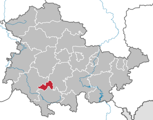
Schmalkalden-Meiningen (Landkreis Schmalkalden-Meiningen)

- district in Thuringia, Germany
 Hiking in Schmalkalden-Meiningen
Schmalkalden-Meiningen, located in the state of Thuringia, Germany, offers a variety of hiking opportunities that cater to both casual walkers and experienced hikers. The region is characterized by its picturesque landscapes, including forests, hills, and historical towns, making it an attractive destination for outdoor enthusiasts. Here are some key highlights:
Scenic Trails
-
Thuringian Forest: This extensive mountain range is ideal for hiking and features numerous trails. You can explore sections of the famous Rennsteig Trail, a long-distance hiking path that runs through the forest.
-
Alteburg Hill: Near Schmalkalden, this area offers trails that provide stunning views of the surrounding countryside and city. It's a relatively easy hike that can be enjoyed by families.
-
Nature Reserves: The region is home to several nature reserves where you can hike through diverse ecosystems, including beech forests and meadows. Look for trails in areas like the "Naturpark Thüringer Wald."
Historical Experience
Hiking in the Schmalkalden-Meiningen area also provides an opportunity to explore its rich history:
- Schmalkalden: The town has well-preserved medieval buildings and a charming old town. You can combine a hike with a visit to landmarks like the Lutherhaus and the impressive castles.
- Meiningen: Known for its cultural heritage, including the Meiningen Theatre, hiking in this area can also lead you to historical sites and parks.
Tips for Hiking
- Trail Markings: Pay attention to trail markers to ensure you stay on track. The trails in this area are typically well-marked.
- Weather Preparedness: Weather can change rapidly in the region, so check forecasts and dress in layers.
- Footwear: Ensure you wear sturdy hiking boots, as some trails can be rocky or uneven.
- Local Resources: Consider consulting local maps or guides for the best hiking routes and additional points of interest.
Accessibility
Most hiking trails in the Schmalkalden-Meiningen area are accessible for various fitness levels, making it a family-friendly destination. Whether you're looking for a leisurely stroll or a more challenging hike, there are options for everyone.
In summary, Schmalkalden-Meiningen is a great spot for hiking enthusiasts seeking a mix of natural beauty and historical charm in rural Germany. Remember to plan your trip according to the season, as some trails may be more challenging in winter conditions.
- Country:

- Licence Plate Code: SM
- Coordinates: 50° 40' 12" N, 10° 25' 12" E


- GPS tracks (wikiloc): [Link]
- AboveSeaLevel: 478 м m
- Area: 1210.73 sq km
- Population: 124623
- Web site: http://www.lk-sm.de/
- Wikipedia en: wiki(en)
- Wikipedia: wiki(de)
- Wikidata storage: Wikidata: Q7871
- Wikipedia Commons Category: [Link]
- Freebase ID: [/m/01zz27]
- GeoNames ID: Alt: [3302169]
- VIAF ID: Alt: [149744041]
- OSM relation ID: [62618]
- GND ID: Alt: [4409350-0]
- archINFORM location ID: [8891]
- TGN ID: [7076455]
- NUTS code: [DEG0B]
- German district key: 16066
Shares border with regions:

Rhön-Grabfeld
- district in Bavaria, Germany
Hiking in Rhön-Grabfeld
Rhön-Grabfeld is a picturesque region located in Bavaria, Germany, renowned for its scenic landscapes, rolling hills, and rich natural beauty. It comprises part of the UNESCO Biosphere Reserve Rhön, which is characterized by its unique geology, biodiversity, and well-maintained hiking trails....
- Country:
- Capital: Bad Neustadt an der Saale
- Licence Plate Code: MET; KÖN; NES
- Coordinates: 50° 19' 48" N, 10° 15' 0" E
- GPS tracks (wikiloc): [Link]
- AboveSeaLevel: 320 м m
- Area: 1022.00 sq km
- Population: 77197
- Web site: [Link]

Suhl
- town in Thuringia, Germany
Hiking in Suhl
Suhl, located in the Thuringia region of Germany, is surrounded by stunning natural landscapes, making it a wonderful destination for hiking enthusiasts. The area is characterized by diverse terrains, including forests, hills, and picturesque valleys, offering a range of trails suitable for all skill levels....
- Country:
- Postal Code: 98711; 98530; 98529; 98527
- Local Dialing Code: 036782; 036846; 03681
- Licence Plate Code: SHL
- Coordinates: 50° 36' 38" N, 10° 41' 35" E
- GPS tracks (wikiloc): [Link]
- AboveSeaLevel: 422 м m
- Area: 103.02 sq km
- Population: 36208
- Web site: [Link]


Fulda
- district in Hesse, Germany
Hiking in Fulda
Fulda is a beautiful district located in Hesse, Germany, known for its scenic landscapes, historical sites, and outdoor activities, including hiking. Here are some key aspects of hiking in Fulda:...
- Country:
- Capital: Fulda
- Licence Plate Code: FD
- Coordinates: 50° 33' 37" N, 9° 41' 10" E
- GPS tracks (wikiloc): [Link]
- AboveSeaLevel: 297 м m
- Area: 1380.40 sq km
- Population: 216093
- Web site: [Link]