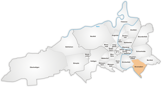
Schosshalde (Schosshalde)
- quarter/
 Hiking in Schosshalde
Schosshalde is a scenic area located in or near Bern, Switzerland, known for its beautiful views and tranquil hiking routes. When hiking in Schosshalde, you can expect a mix of lush greenery, charming landscapes, and pathways that may lead you through wooded areas or open meadows.
Key Aspects of Hiking in Schosshalde:
-
Scenic Views: The area often offers stunning views of the surrounding hills and the Aare River. Make sure to take time to appreciate the natural beauty.
-
Trail Options: There are various trails suitable for different skill levels, ranging from easy walks to more challenging hikes. Most trails are well-marked, and you can find routes that cater to families, casual hikers, and those looking for a vigorous workout.
-
Accessibility: Schosshalde is relatively accessible from Bern, making it a great choice for both locals and visitors. Public transport options may be available, allowing you to reach the starting points of the trails.
-
Flora and Fauna: As you hike, keep an eye out for diverse plant species and local wildlife. The area is often rich in biodiversity, providing opportunities for nature enthusiasts and photographers.
-
Seasonal Appeal: Each season offers a different experience. Spring and summer provide vibrant greenery, while fall showcases beautiful foliage. Winter hikes might reveal a serene, snow-covered landscape.
-
Safety Precautions: As with any hiking endeavor, it's essential to dress appropriately, bring enough water and snacks, and be aware of the trail conditions.
-
Local Attractions: After your hike, consider exploring nearby attractions or enjoying a meal in one of the local restaurants to complete your experience.
Before heading out, it's a good idea to check the local hiking maps and resources for any updates on trails, as well as to assess the weather conditions for a safe and enjoyable experience. Happy hiking!
- Country:

- Coordinates: 46° 56' 50" N, 7° 27' 52" E


- GPS tracks (wikiloc): [Link]
- Wikidata storage: Wikidata: Q55499127
- Wikipedia Commons Category: [Link]
- OSM relation ID: [6410315]
Shares border with regions:

Altenberg
- quarter/
Hiking in Altenberg
Altenberg, located in the Canton of Bern, Switzerland, offers a beautiful and diverse hiking experience surrounded by stunning natural landscapes, mountains, and picturesque villages. Here are some highlights and tips for hiking in the Altenberg area:...
- Country:
- Coordinates: 46° 57' 5" N, 7° 27' 8" E
- GPS tracks (wikiloc): [Link]

Gryphenhübeli
- quarter/
Hiking in Gryphenhübeli
Gryphenhübeli is a picturesque hiking destination located in Switzerland, known for its stunning landscapes, diverse flora, and fauna. The area offers a variety of trails suitable for hikers of all levels, from casual walkers to experienced trekkers....
- Country:
- Coordinates: 46° 56' 42" N, 7° 27' 21" E
- GPS tracks (wikiloc): [Link]

Murifeld
- quarter/
Hiking in Murifeld
Murifeld, located in Switzerland, is an area that provides beautiful hiking opportunities, especially for those who appreciate stunning landscapes and diverse natural settings. Here are some highlights and tips for hiking in Murifeld:...
- Country:
- Coordinates: 46° 56' 24" N, 7° 29' 0" E
- GPS tracks (wikiloc): [Link]
Brunnadern
- quarter/
Hiking in Brunnadern
Brunnadern is a charming village located in the canton of Appenzell Innerrhoden in Switzerland. It offers scenic landscapes, rich culture, and a variety of hiking trails that cater to different skill levels, making it an excellent destination for outdoor enthusiasts....
- Country:
- Coordinates: 46° 56' 2" N, 7° 28' 4" E
- GPS tracks (wikiloc): [Link]

Beundenfeld
- quarter/
Hiking in Beundenfeld
Beundenfeld appears to be a lesser-known location, and there may not be extensive resources or widely available information on hiking specifically in that area. However, I can help guide you on how to approach hiking in general and some tips on exploring lesser-known hiking areas....
- Country:
- Coordinates: 46° 57' 41" N, 7° 28' 22" E
- GPS tracks (wikiloc): [Link]
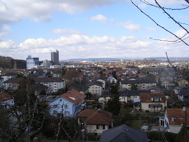
Ostermundigen
- municipality in Switzerland
Hiking in Ostermundigen
Ostermundigen, located near Bern, Switzerland, offers a variety of hiking opportunities that cater to different skill levels and preferences. Here are some highlights and tips for hiking in this beautiful area:...
- Country:
- Postal Code: 3072
- Local Dialing Code: 031
- Licence Plate Code: BE
- Coordinates: 46° 57' 21" N, 7° 29' 44" E
- GPS tracks (wikiloc): [Link]
- AboveSeaLevel: 570 м m
- Area: 5.96 sq km
- Population: 17546
- Web site: [Link]