Sergenaux (Sergenaux)

- commune in Jura, France
- Country:

- Postal Code: 39230
- Coordinates: 46° 53' 12" N, 5° 27' 27" E


- GPS tracks (wikiloc): [Link]
- Area: 3.24 sq km
- Population: 74
- Wikipedia en: wiki(en)
- Wikipedia: wiki(fr)
- Wikidata storage: Wikidata: Q614499
- Wikipedia Commons Category: [Link]
- Freebase ID: [/m/03nvv8p]
- Freebase ID: [/m/03nvv8p]
- GeoNames ID: Alt: [6433760]
- GeoNames ID: Alt: [6433760]
- SIREN number: [213905110]
- SIREN number: [213905110]
- BnF ID: [152588727]
- BnF ID: [152588727]
- INSEE municipality code: 39511
- INSEE municipality code: 39511
Shares border with regions:


La Chassagne
- commune in Jura, France
- Country:
- Postal Code: 39230
- Coordinates: 46° 51' 49" N, 5° 27' 7" E
- GPS tracks (wikiloc): [Link]
- Area: 5.67 sq km
- Population: 123

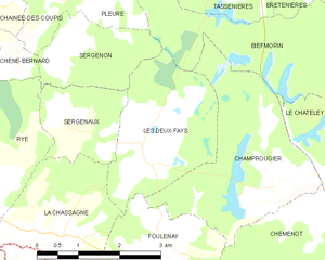
Les Deux-Fays
- commune in Jura, France
- Country:
- Postal Code: 39230
- Coordinates: 46° 52' 56" N, 5° 28' 56" E
- GPS tracks (wikiloc): [Link]
- Area: 6.77 sq km
- Population: 95


Rye
- commune in Jura, France
- Country:
- Postal Code: 39230
- Coordinates: 46° 52' 15" N, 5° 25' 45" E
- GPS tracks (wikiloc): [Link]
- Area: 11.84 sq km
- Population: 217


Sergenon
- commune in Jura, France
- Country:
- Postal Code: 39120
- Coordinates: 46° 54' 14" N, 5° 27' 23" E
- GPS tracks (wikiloc): [Link]
- Area: 3.88 sq km
- Population: 56