Sermersheim (Sermersheim)

- commune in Bas-Rhin, France
- Country:

- Postal Code: 67230
- Coordinates: 48° 20' 44" N, 7° 33' 6" E


- GPS tracks (wikiloc): [Link]
- Area: 10.12 sq km
- Population: 895
- Wikipedia en: wiki(en)
- Wikipedia: wiki(fr)
- Wikidata storage: Wikidata: Q21386
- Wikipedia Commons Category: [Link]
- Freebase ID: [/m/03m9c4f]
- Freebase ID: [/m/03m9c4f]
- GeoNames ID: Alt: [6441357]
- GeoNames ID: Alt: [6441357]
- SIREN number: [216704643]
- SIREN number: [216704643]
- BnF ID: [15271606m]
- BnF ID: [15271606m]
- INSEE municipality code: 67464
- INSEE municipality code: 67464
Shares border with regions:


Epfig
- commune in Bas-Rhin, France
- Country:
- Postal Code: 67680
- Coordinates: 48° 21' 32" N, 7° 27' 48" E
- GPS tracks (wikiloc): [Link]
- Area: 21.9 sq km
- Population: 2280


Hilsenheim
- commune in Bas-Rhin, France
- Country:
- Postal Code: 67600
- Coordinates: 48° 17' 20" N, 7° 33' 55" E
- GPS tracks (wikiloc): [Link]
- Area: 19.91 sq km
- Population: 2636
- Web site: [Link]

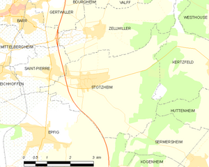
Stotzheim
- commune in Bas-Rhin, France
- Country:
- Postal Code: 67140
- Coordinates: 48° 22' 47" N, 7° 29' 29" E
- GPS tracks (wikiloc): [Link]
- Area: 13.61 sq km
- Population: 999


Kogenheim
- commune in Bas-Rhin, France
- Country:
- Postal Code: 67230
- Coordinates: 48° 20' 14" N, 7° 32' 29" E
- GPS tracks (wikiloc): [Link]
- Area: 11.77 sq km
- Population: 1217


Huttenheim
- commune in Bas-Rhin, France
- Country:
- Postal Code: 67230
- Coordinates: 48° 21' 32" N, 7° 34' 44" E
- GPS tracks (wikiloc): [Link]
- Area: 12.55 sq km
- Population: 2702