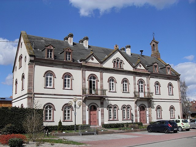
.jpg)
Stotzheim (Stotzheim)

- commune in Bas-Rhin, France
- Country:

- Postal Code: 67140
- Coordinates: 48° 22' 47" N, 7° 29' 29" E


- GPS tracks (wikiloc): [Link]
- Area: 13.61 sq km
- Population: 999
- Wikipedia en: wiki(en)
- Wikipedia: wiki(fr)
- Wikidata storage: Wikidata: Q21445
- Wikipedia Commons Category: [Link]
- Freebase ID: [/m/03m9cc9]
- Freebase ID: [/m/03m9cc9]
- GeoNames ID: Alt: [6441374]
- GeoNames ID: Alt: [6441374]
- SIREN number: [216704817]
- SIREN number: [216704817]
- BnF ID: [152716236]
- BnF ID: [152716236]
- INSEE municipality code: 67481
- INSEE municipality code: 67481
Shares border with regions:


Kertzfeld
- commune in Bas-Rhin, France
- Country:
- Postal Code: 67230
- Coordinates: 48° 22' 49" N, 7° 34' 4" E
- GPS tracks (wikiloc): [Link]
- Area: 9.43 sq km
- Population: 1250


Epfig
- commune in Bas-Rhin, France
- Country:
- Postal Code: 67680
- Coordinates: 48° 21' 32" N, 7° 27' 48" E
- GPS tracks (wikiloc): [Link]
- Area: 21.9 sq km
- Population: 2280
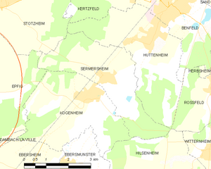
Sermersheim
- commune in Bas-Rhin, France
- Country:
- Postal Code: 67230
- Coordinates: 48° 20' 44" N, 7° 33' 6" E
- GPS tracks (wikiloc): [Link]
- Area: 10.12 sq km
- Population: 895

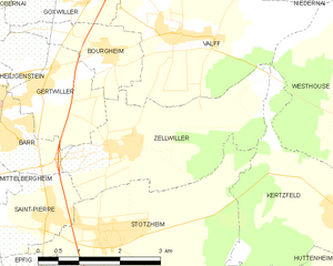
Zellwiller
- commune in Bas-Rhin, France
- Country:
- Postal Code: 67140
- Coordinates: 48° 23' 52" N, 7° 29' 52" E
- GPS tracks (wikiloc): [Link]
- Area: 8.79 sq km
- Population: 750


Saint-Pierre
- commune in Bas-Rhin, France
- Country:
- Postal Code: 67140
- Coordinates: 48° 23' 2" N, 7° 28' 15" E
- GPS tracks (wikiloc): [Link]
- Area: 3.21 sq km
- Population: 645


Huttenheim
- commune in Bas-Rhin, France
- Country:
- Postal Code: 67230
- Coordinates: 48° 21' 32" N, 7° 34' 44" E
- GPS tracks (wikiloc): [Link]
- Area: 12.55 sq km
- Population: 2702