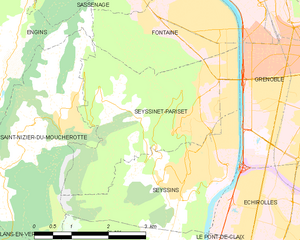
Seyssinet-Pariset (Seyssinet-Pariset)
- commune in Isère, France
Seyssinet-Pariset is a lovely commune in the Isère department, located near Grenoble in southeastern France. The region offers a variety of hiking opportunities, with beautiful landscapes that feature both mountainous terrain and lush valleys. Here are some highlights for hiking in Seyssinet-Pariset:
Trails and Routes
-
Local Trails: There are several marked trails in and around Seyssinet-Pariset, providing routes suitable for various skill levels. You can find paths that traverse forests, hills, and viewpoints overlooking the surrounding area.
-
Mont Rachais: A popular hike starting from Seyssinet-Pariset leads to Mont Rachais. The trail offers spectacular views of the city of Grenoble and the mountains beyond.
-
Parc Naturel Regional de Chartreuse: Although a bit further out, this regional park is accessible from Seyssinet-Pariset and offers numerous trails through stunning natural landscapes, with opportunities to explore diverse wildlife and flora.
Necessary Precautions
- Weather: Always check the weather conditions before heading out, as they can change rapidly in mountainous regions.
- Equipment: Wear appropriate hiking footwear and bring plenty of water, snacks, and a basic first-aid kit.
Accessibility
The proximity to Grenoble makes Seyssinet-Pariset easily accessible, and there are public transport options if you prefer to use them. This accessibility is ideal for newcomers looking to experience day hikes without extensive travel.
Local Tips
- Explore Vegetation: Take some time to appreciate the flora and fauna of the area, including diverse tree species and the chance to spot local wildlife.
- Cultural Sites: Incorporate cultural experiences, such as visiting local cafes or markets in Seyssinet-Pariset or nearby Grenoble, before or after your hike.
Conclusion
Overall, hiking in Seyssinet-Pariset provides a great opportunity to enjoy the outdoors and the beauty of the French Alps. Whether you're a seasoned hiker or a beginner, the trails in and around this charming commune cater to various skill levels and preferences. Enjoy your adventure!
- Country:

- Postal Code: 38170
- Coordinates: 45° 10' 53" N, 5° 41' 57" E


- GPS tracks (wikiloc): [Link]
- AboveSeaLevel: 262 м m
- Area: 10.65 sq km
- Population: 12264
- Web site: http://www.ville-seyssinet-pariset.fr
- Wikipedia en: wiki(en)
- Wikipedia: wiki(fr)
- Wikidata storage: Wikidata: Q1081604
- Wikipedia Commons Category: [Link]
- Freebase ID: [/m/03g_540]
- GeoNames ID: Alt: [6433416]
- SIREN number: [213804859]
- BnF ID: [152582899]
- PACTOLS thesaurus ID: [pcrtS28bmSGdKZ]
- Quora topic ID: [Seyssinet-Pariset]
- INSEE municipality code: 38485
Shares border with regions:
Engins
- commune in Isère, France
Hiking in the Écrins National Park, located in the French Alps, offers stunning landscapes, diverse wildlife, and a variety of trails suitable for all levels of hikers. The park features high alpine peaks, glaciers, valleys, and lush meadows, making it a paradise for outdoor enthusiasts....
- Country:

- Postal Code: 38360
- Coordinates: 45° 10' 52" N, 5° 37' 0" E


- GPS tracks (wikiloc): [Link]
- Area: 20.64 sq km
- Population: 473
- Web site: [Link]


Grenoble
- commune in Isère, France
Grenoble, situated at the foot of the French Alps, is an excellent base for hiking enthusiasts. The surrounding mountains and natural landscapes offer a diverse range of trails suitable for all experience levels, from leisurely walks to challenging hikes. Here are some key highlights and recommendations for hiking in the Grenoble area:...
- Country:

- Postal Code: 38100; 38000
- Local Dialing Code: 476
- Coordinates: 45° 11' 13" N, 5° 43' 35" E


- GPS tracks (wikiloc): [Link]
- AboveSeaLevel: 212 м m
- Area: 18.13 sq km
- Population: 160649
- Web site: [Link]


Seyssins
- commune in Isère, France
Seyssins is a picturesque town located near Grenoble in the Auvergne-Rhône-Alpes region of France. It serves as a great base for hiking enthusiasts, offering access to a variety of trails with stunning views of the surrounding mountains and valleys....
- Country:

- Postal Code: 38180
- Coordinates: 45° 9' 22" N, 5° 40' 47" E


- GPS tracks (wikiloc): [Link]
- Area: 8 sq km
- Population: 7213
- Web site: [Link]

Saint-Nizier-du-Moucherotte
- commune in Isère, France
 Hiking in Saint-Nizier-du-Moucherotte
Saint-Nizier-du-Moucherotte is a picturesque village located in the French Alps, near Grenoble. It serves as an excellent starting point for various hiking trails that offer stunning views of the surrounding mountains, particularly the iconic Moucherotte peak. Here’s what you need to know about hiking in this area:...
- Country:

- Postal Code: 38250
- Coordinates: 45° 10' 15" N, 5° 37' 49" E


- GPS tracks (wikiloc): [Link]
- Area: 11.26 sq km
- Population: 1112
- Web site: [Link]

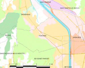
Fontaine
- commune in Isère, France
Fontaine, located in the Isère department in southeastern France, is a great starting point for various hiking adventures, especially for those who enjoy the natural beauty of the Grenoble area. Here are some key highlights and tips for hiking in Fontaine:...
- Country:

- Postal Code: 38600
- Coordinates: 45° 11' 35" N, 5° 41' 5" E


- GPS tracks (wikiloc): [Link]
- AboveSeaLevel: 210 м m
- Area: 6.74 sq km
- Population: 22516
- Web site: [Link]
