Soturac (Soturac)

- commune in Lot, France
- Country:

- Postal Code: 46700
- Coordinates: 44° 29' 19" N, 1° 1' 0" E


- GPS tracks (wikiloc): [Link]
- Area: 19.55 sq km
- Population: 627
- Wikipedia en: wiki(en)
- Wikipedia: wiki(fr)
- Wikidata storage: Wikidata: Q1329124
- Wikipedia Commons Category: [Link]
- Freebase ID: [/m/03nwpf3]
- GeoNames ID: Alt: [6434921]
- SIREN number: [214603078]
- BnF ID: [15261048p]
- VIAF ID: Alt: [248648813]
- INSEE municipality code: 46307
Shares border with regions:


Montayral
- commune in Lot-et-Garonne, France
- Country:
- Postal Code: 47500
- Coordinates: 44° 28' 46" N, 0° 59' 14" E
- GPS tracks (wikiloc): [Link]
- Area: 24.54 sq km
- Population: 2731


Saint-Front-sur-Lémance
- commune in Lot-et-Garonne, France
- Country:
- Postal Code: 47500
- Coordinates: 44° 34' 36" N, 0° 58' 18" E
- GPS tracks (wikiloc): [Link]
- Area: 19.58 sq km
- Population: 542

Mauroux
- commune in Lot, France
- Country:
- Postal Code: 46700
- Coordinates: 44° 27' 19" N, 1° 2' 47" E
- GPS tracks (wikiloc): [Link]
- AboveSeaLevel: 213 м m
- Area: 16.2 sq km
- Population: 518
- Web site: [Link]
Saint-Martin-le-Redon
- commune in Lot, France
- Country:
- Postal Code: 46700
- Coordinates: 44° 31' 50" N, 1° 2' 33" E
- GPS tracks (wikiloc): [Link]
- Area: 10.6 sq km
- Population: 211

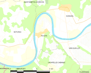
Touzac
- commune in Lot, France
- Country:
- Postal Code: 46700
- Coordinates: 44° 29' 50" N, 1° 3' 19" E
- GPS tracks (wikiloc): [Link]
- Area: 4.89 sq km
- Population: 376


Fumel
- commune in Lot-et-Garonne, France
- Country:
- Postal Code: 47500
- Coordinates: 44° 29' 55" N, 0° 58' 2" E
- GPS tracks (wikiloc): [Link]
- Area: 22.66 sq km
- Population: 4886
- Web site: [Link]

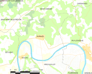
Duravel
- commune in Lot, France
- Country:
- Postal Code: 46700
- Coordinates: 44° 30' 59" N, 1° 4' 47" E
- GPS tracks (wikiloc): [Link]
- Area: 14.97 sq km
- Population: 974