Souday (Souday)

- former commune in Loir-et-Cher, France
- Country:

- Postal Code: 41170
- Coordinates: 48° 2' 12" N, 0° 51' 59" E


- GPS tracks (wikiloc): [Link]
- Area: 36.42 sq km
- Population: 510
- Wikipedia en: wiki(en)
- Wikipedia: wiki(fr)
- Wikidata storage: Wikidata: Q663156
- Wikipedia Commons Category: [Link]
- Freebase ID: [/m/03nw2r6]
- GeoNames ID: Alt: [2974105]
- SIREN number: [214102485]
- BnF ID: [152595223]
- INSEE municipality code: 41248
Shares border with regions:

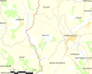
Baillou
- commune in Loir-et-Cher, France
- Country:
- Postal Code: 41170
- Coordinates: 47° 58' 5" N, 0° 50' 32" E
- GPS tracks (wikiloc): [Link]
- Area: 19.85 sq km
- Population: 252

Choue
- commune in Loir-et-Cher, France
- Country:
- Postal Code: 41170
- Coordinates: 47° 59' 55" N, 0° 55' 42" E
- GPS tracks (wikiloc): [Link]
- Area: 37.39 sq km
- Population: 529


Le Plessis-Dorin
- commune in Loir-et-Cher, France
- Country:
- Postal Code: 41170
- Coordinates: 48° 5' 22" N, 0° 51' 52" E
- GPS tracks (wikiloc): [Link]
- Area: 14.19 sq km
- Population: 172

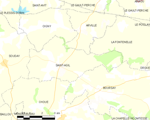
Saint-Agil
- former commune in Loir-et-Cher, France
- Country:
- Postal Code: 41170
- Coordinates: 48° 2' 9" N, 0° 55' 33" E
- GPS tracks (wikiloc): [Link]
- Area: 15.61 sq km
- Population: 270


Melleray
- commune in Sarthe, France
- Country:
- Postal Code: 72320
- Coordinates: 48° 5' 56" N, 0° 48' 1" E
- GPS tracks (wikiloc): [Link]
- Area: 25.9 sq km
- Population: 451


Valennes
- commune in Sarthe, France
- Country:
- Postal Code: 72320
- Coordinates: 47° 59' 47" N, 0° 48' 34" E
- GPS tracks (wikiloc): [Link]
- Area: 26.7 sq km
- Population: 319
Oigny
- former commune in Loir-et-Cher, France
- Country:
- Postal Code: 41170
- Coordinates: 48° 3' 48" N, 0° 55' 15" E
- GPS tracks (wikiloc): [Link]
- Area: 9.86 sq km
- Population: 91


Vibraye
- commune in Sarthe, France
- Country:
- Postal Code: 72320
- Coordinates: 48° 3' 32" N, 0° 44' 9" E
- GPS tracks (wikiloc): [Link]
- Area: 43.62 sq km
- Population: 2598
- Web site: [Link]