Saint-Agil (Saint-Agil)

- former commune in Loir-et-Cher, France
- Country:

- Postal Code: 41170
- Coordinates: 48° 2' 9" N, 0° 55' 33" E


- GPS tracks (wikiloc): [Link]
- Area: 15.61 sq km
- Population: 270
- Wikipedia en: wiki(en)
- Wikipedia: wiki(fr)
- Wikidata storage: Wikidata: Q1170217
- Wikipedia Commons Category: [Link]
- Freebase ID: [/m/03nw23v]
- GeoNames ID: Alt: [2981922]
- SIREN number: [214101974]
- BnF ID: [152594711]
- INSEE municipality code: 41197
Shares border with regions:


La Fontenelle
- commune in Loir-et-Cher, France
- Country:
- Postal Code: 41270
- Coordinates: 48° 3' 36" N, 1° 1' 28" E
- GPS tracks (wikiloc): [Link]
- Area: 20.1 sq km
- Population: 193

Choue
- commune in Loir-et-Cher, France
- Country:
- Postal Code: 41170
- Coordinates: 47° 59' 55" N, 0° 55' 42" E
- GPS tracks (wikiloc): [Link]
- Area: 37.39 sq km
- Population: 529

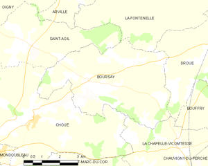
Boursay
- commune in Loir-et-Cher, France
- Country:
- Postal Code: 41270
- Coordinates: 48° 1' 9" N, 0° 58' 9" E
- GPS tracks (wikiloc): [Link]
- Area: 22.08 sq km
- Population: 173
Oigny
- former commune in Loir-et-Cher, France
- Country:
- Postal Code: 41170
- Coordinates: 48° 3' 48" N, 0° 55' 15" E
- GPS tracks (wikiloc): [Link]
- Area: 9.86 sq km
- Population: 91


Arville
- former commune in Loir-et-Cher, France
- Country:
- Postal Code: 41170
- Coordinates: 48° 3' 46" N, 0° 56' 50" E
- GPS tracks (wikiloc): [Link]
- Area: 9.75 sq km
- Population: 80


Souday
- former commune in Loir-et-Cher, France
- Country:
- Postal Code: 41170
- Coordinates: 48° 2' 12" N, 0° 51' 59" E
- GPS tracks (wikiloc): [Link]
- Area: 36.42 sq km
- Population: 510