Soulaines-Dhuys (Soulaines-Dhuys)

- commune in Aube, France
- Country:

- Postal Code: 10200
- Coordinates: 48° 22' 27" N, 4° 44' 0" E


- GPS tracks (wikiloc): [Link]
- Area: 20.06 sq km
- Population: 417
- Wikipedia en: wiki(en)
- Wikipedia: wiki(fr)
- Wikidata storage: Wikidata: Q1152885
- Wikipedia Commons Category: [Link]
- Freebase ID: [/m/03m8w1z]
- GeoNames ID: Alt: [6426581]
- SIREN number: [211003611]
- BnF ID: [15246464t]
- PACTOLS thesaurus ID: [pcrtNkPKlZcHUZ]
- INSEE municipality code: 10372
Shares border with regions:
Thil
- commune in Aube, France
- Country:
- Postal Code: 10200
- Coordinates: 48° 20' 51" N, 4° 47' 9" E
- GPS tracks (wikiloc): [Link]
- AboveSeaLevel: 185 м m
- Area: 19.42 sq km
- Population: 133


Ceffonds
- commune in Haute-Marne, France
- Country:
- Postal Code: 52220
- Coordinates: 48° 28' 12" N, 4° 45' 48" E
- GPS tracks (wikiloc): [Link]
- Area: 36.52 sq km
- Population: 632


Épothémont
- commune in Aube, France
- Country:
- Postal Code: 10500
- Coordinates: 48° 25' 4" N, 4° 39' 27" E
- GPS tracks (wikiloc): [Link]
- Area: 10.43 sq km
- Population: 183


Ville-sur-Terre
- commune in Aube, France
- Country:
- Postal Code: 10200
- Coordinates: 48° 19' 55" N, 4° 44' 52" E
- GPS tracks (wikiloc): [Link]
- Area: 16.1 sq km
- Population: 108


La Ville-aux-Bois
- commune in Aube, France
- Country:
- Postal Code: 10500
- Coordinates: 48° 24' 25" N, 4° 41' 25" E
- GPS tracks (wikiloc): [Link]
- Area: 5.56 sq km
- Population: 23


La Chaise
- commune in Aube, France
- Country:
- Postal Code: 10500
- Coordinates: 48° 21' 45" N, 4° 39' 35" E
- GPS tracks (wikiloc): [Link]
- Area: 8.81 sq km
- Population: 39

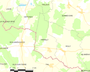
Trémilly
- commune in Haute-Marne, France
- Country:
- Postal Code: 52110
- Coordinates: 48° 21' 59" N, 4° 46' 55" E
- GPS tracks (wikiloc): [Link]
- Area: 10.72 sq km
- Population: 83

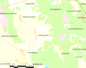
Morvilliers
- commune in Aube, France
- Country:
- Postal Code: 10500
- Coordinates: 48° 22' 50" N, 4° 37' 9" E
- GPS tracks (wikiloc): [Link]
- Area: 15.64 sq km
- Population: 309


Fuligny
- commune in Aube, France
- Country:
- Postal Code: 10200
- Coordinates: 48° 19' 55" N, 4° 42' 24" E
- GPS tracks (wikiloc): [Link]
- Area: 10.34 sq km
- Population: 52