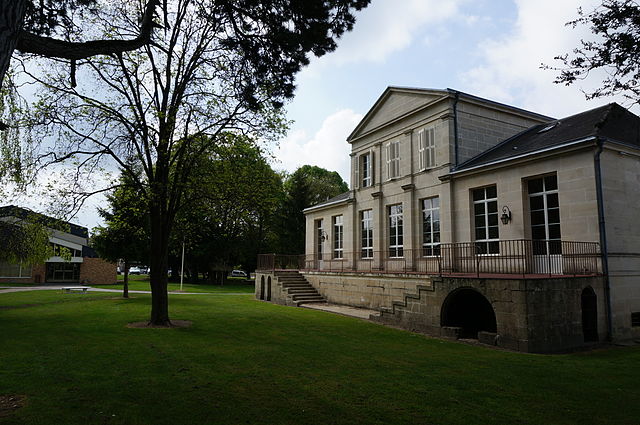
Soulanges (Soulanges)

- commune in Marne, France
- Country:

- Postal Code: 51300
- Coordinates: 48° 47' 26" N, 4° 32' 6" E


- GPS tracks (wikiloc): [Link]
- Area: 12.37 sq km
- Population: 485
- Wikipedia en: wiki(en)
- Wikipedia: wiki(fr)
- Wikidata storage: Wikidata: Q1103532
- Wikipedia Commons Category: [Link]
- Freebase ID: [/m/03qf9yg]
- GeoNames ID: Alt: [6436037]
- SIREN number: [215105172]
- BnF ID: [152631500]
- INSEE municipality code: 51557
Shares border with regions:
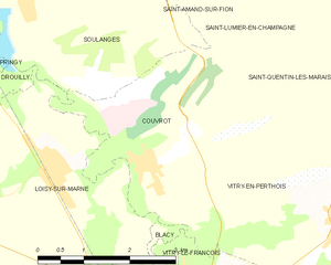
Couvrot
- commune in Marne, France
- Country:
- Postal Code: 51300
- Coordinates: 48° 45' 34" N, 4° 34' 18" E
- GPS tracks (wikiloc): [Link]
- Area: 8.05 sq km
- Population: 885
Aulnay-l'Aître
- commune in Marne, France
- Country:
- Postal Code: 51240
- Coordinates: 48° 49' 22" N, 4° 33' 36" E
- GPS tracks (wikiloc): [Link]
- Area: 8.36 sq km
- Population: 159


Pringy
- commune in Marne, France
- Country:
- Postal Code: 51300
- Coordinates: 48° 46' 50" N, 4° 31' 0" E
- GPS tracks (wikiloc): [Link]
- Area: 15.34 sq km
- Population: 411


Drouilly
- commune in Marne, France
- Country:
- Postal Code: 51300
- Coordinates: 48° 46' 19" N, 4° 31' 19" E
- GPS tracks (wikiloc): [Link]
- Area: 2.43 sq km
- Population: 137


Loisy-sur-Marne
- commune in Marne, France
- Country:
- Postal Code: 51300
- Coordinates: 48° 45' 30" N, 4° 32' 42" E
- GPS tracks (wikiloc): [Link]
- Area: 14.07 sq km
- Population: 1093
Saint-Lumier-en-Champagne
- commune in Marne, France
- Country:
- Postal Code: 51300
- Coordinates: 48° 47' 43" N, 4° 37' 38" E
- GPS tracks (wikiloc): [Link]
- Area: 8.56 sq km
- Population: 262


Saint-Amand-sur-Fion
- commune in Marne, France
- Country:
- Postal Code: 51300
- Coordinates: 48° 48' 38" N, 4° 36' 33" E
- GPS tracks (wikiloc): [Link]
- Area: 28.4 sq km
- Population: 1043
- Web site: [Link]

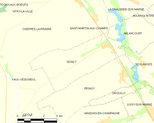
Songy
- commune in Marne, France
- Country:
- Postal Code: 51240
- Coordinates: 48° 48' 8" N, 4° 30' 1" E
- GPS tracks (wikiloc): [Link]
- Area: 15.06 sq km
- Population: 266
Ablancourt
- commune in Marne, France
- Country:
- Postal Code: 51240
- Coordinates: 48° 48' 49" N, 4° 31' 19" E
- GPS tracks (wikiloc): [Link]
- Area: 7.07 sq km
- Population: 157