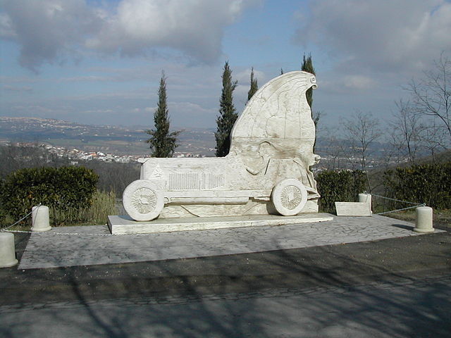
Spoltore (Spoltore)
.svg)
- Italian comune
 Hiking in Spoltore
Spoltore, located in the Abruzzo region of Italy, is a charming town that offers scenic hiking opportunities thanks to its proximity to both the mountains and the Adriatic coast. While it may not be as widely known as some other hiking destinations, the surrounding area provides a variety of trails suitable for different skill levels. Here are some highlights for hiking around Spoltore:
Trails and Areas
-
Monte Pagano: To the west of Spoltore, Monte Pagano offers several hiking routes with varying levels of difficulty. The trails here provide stunning views of the surrounding countryside and are popular among both locals and visitors.
-
Città Sant'Angelo and the Cerrano Park: Nearby, you can explore hiking trails within the Torre del Cerrano Natural Marine Reserve, which is about a 20-minute drive from Spoltore. The park features coastal paths and scenic views over the Adriatic Sea.
-
Gran Sasso and Monti della Laga National Park: Further inland (about an hour's drive), this national park offers some of the best hiking in the Abruzzo region. You can find a range of trails that take you through dramatic landscapes, including peaks, lakes, and rich biodiversity.
What to Bring
- Proper Footwear: Sturdy hiking boots or shoes are essential for comfort and safety on uneven terrain.
- Water and Snacks: Hydration is key. Carry enough water and some energy snacks.
- Navigation Tools: Maps, a compass, or a GPS device can help you stay on track, especially on lesser-known trails.
- Layered Clothing: Weather can change quickly, so dress in layers and be prepared for varying conditions.
Tips
- Start Early: If you're tackling longer trails, it's best to start early to give yourself plenty of time.
- Respect Nature: Stay on marked trails, carry out any trash, and be mindful of wildlife.
- Check Local Resources: Before heading out, check local hiking guides or the community for updates on trail conditions and recommendations.
Conclusion
Hiking around Spoltore can be a rewarding experience, offering the chance to explore the natural beauty of Abruzzo. Whether you're looking for a casual stroll or a challenging hike, there are options for every type of hiker. Enjoy your adventure!
- Country:

- Postal Code: 65010
- Local Dialing Code: 085
- Licence Plate Code: PE
- Coordinates: 42° 27' 18" N, 14° 8' 24" E


- GPS tracks (wikiloc): [Link]
- AboveSeaLevel: 185 м m
- Area: 37.01 sq km
- Population: 19378
- Web site: http://www.comune.spoltore.pe.it
- Wikipedia en: wiki(en)
- Wikipedia: wiki(it)
- Wikidata storage: Wikidata: Q51400
- Wikipedia Commons Gallery: [Link]
- Wikipedia Commons Category: [Link]
- Freebase ID: [/m/0fg8z1]
- GeoNames ID: Alt: [6538868]
- OSM relation ID: [42013]
- Quora topic ID: [Spoltore]
- UN/LOCODE: [ITSPR]
- DMOZ ID: Alt: [Regional/Europe/Italy/Abruzzo/Localities/Spoltore/]
- ISTAT ID: 068041
- Italian cadastre code: I922
Shares border with regions:


Pescara
- city in Abruzzo, Central Italy
Hiking in Pescara
Pescara, located on the Adriatic coast of Italy in the Abruzzo region, offers a variety of hiking opportunities, with scenic views of both the coastline and the surrounding mountains. Here are some key points to consider if you're planning a hiking trip in and around Pescara:...
- Country:
- Postal Code: 65121–65129
- Local Dialing Code: 085
- Licence Plate Code: PE
- Coordinates: 42° 27' 51" N, 14° 12' 51" E
- GPS tracks (wikiloc): [Link]
- AboveSeaLevel: 0 м m
- Area: 34.36 sq km
- Population: 120286
- Web site: [Link]


San Giovanni Teatino
- Italian comune
Hiking in San Giovanni Teatino
San Giovanni Teatino is a charming town located in the Abruzzo region of Italy, just outside of Chieti and near the Adriatic coast. While it’s not as famous for hiking as some of the bigger national parks in Italy, there are still some beautiful areas and tracks in and around the town that are worth exploring, especially for those looking for a more off-the-beaten-path experience....
- Country:
- Postal Code: 66020
- Local Dialing Code: 085
- Licence Plate Code: CH
- Coordinates: 42° 25' 20" N, 14° 11' 12" E
- GPS tracks (wikiloc): [Link]
- AboveSeaLevel: 145 м m
- Area: 18 sq km
- Population: 14380
- Web site: [Link]

Cappelle sul Tavo
- Italian comune
Hiking in Cappelle sul Tavo
Cappelle sul Tavo is a charming town located in the Abruzzo region of Italy, known for its beautiful landscapes and proximity to the Adriatic coast as well as the Apennine mountains. While Cappelle sul Tavo itself isn't a major hiking destination, it serves as a great base for exploring the surrounding natural areas that offer various hiking opportunities....
- Country:
- Postal Code: 65010
- Local Dialing Code: 085
- Licence Plate Code: PE
- Coordinates: 42° 28' 0" N, 14° 6' 0" E
- GPS tracks (wikiloc): [Link]
- AboveSeaLevel: 122 м m
- Area: 5.41 sq km
- Population: 4016
- Web site: [Link]
Cepagatti
- Italian comune
Hiking in Cepagatti
Cepagatti is a charming town located in the Abruzzo region of Italy, known for its picturesque landscapes and proximity to the Apennine Mountains. While it's not as famous as some other hiking destinations, it does offer opportunities for outdoor enthusiasts to explore the beautiful surrounding countryside. Here are some points to consider for hiking in and around Cepagatti:...
- Country:
- Postal Code: 65012
- Local Dialing Code: 085
- Licence Plate Code: PE
- Coordinates: 42° 21' 57" N, 14° 4' 36" E
- GPS tracks (wikiloc): [Link]
- AboveSeaLevel: 145 м m
- Area: 30.82 sq km
- Population: 11014
- Web site: [Link]


Montesilvano
- Italian comune
Hiking in Montesilvano
Montesilvano is a beautiful coastal town in the Abruzzo region of Italy, located near the Adriatic Sea. While it's primarily known for its beaches and vibrant seaside atmosphere, there are also some lovely hiking opportunities in the surrounding areas, particularly in the nearby mountainous regions....
- Country:
- Postal Code: 65015; 65015–65016
- Local Dialing Code: 085
- Licence Plate Code: PE
- Coordinates: 42° 30' 43" N, 14° 8' 14" E
- GPS tracks (wikiloc): [Link]
- AboveSeaLevel: 5 м m
- Area: 23.57 sq km
- Population: 54152
- Web site: [Link]

Moscufo
- Italian comune
Hiking in Moscufo
Moscufo is a picturesque village located in the Abruzzo region of Italy, near Pescara. While not as well-known for hiking as some other areas in Italy, it is surrounded by scenic landscapes, rolling hills, and natural beauty that can offer some interesting walking and hiking opportunities. Here are some aspects to consider if you’re planning to hike in or near Moscufo:...
- Country:
- Postal Code: 65010
- Local Dialing Code: 085
- Licence Plate Code: PE
- Coordinates: 42° 26' 0" N, 14° 3' 0" E
- GPS tracks (wikiloc): [Link]
- AboveSeaLevel: 246 м m
- Area: 20.26 sq km
- Population: 3168
- Web site: [Link]


Pianella
- Italian comune
Hiking in Pianella
Pianella, located in the province of Pescara in Italy, is surrounded by beautiful landscapes and offers several hiking opportunities. The region is characterized by its rolling hills, vineyards, and stunning views of the Adriatic Sea and the Apennine Mountains. Here are some considerations and recommendations for hiking in the area:...
- Country:
- Postal Code: 65019
- Local Dialing Code: 085
- Licence Plate Code: PE
- Coordinates: 42° 23' 57" N, 14° 2' 52" E
- GPS tracks (wikiloc): [Link]
- AboveSeaLevel: 236 м m
- Area: 47.05 sq km
- Population: 8652
- Web site: [Link]